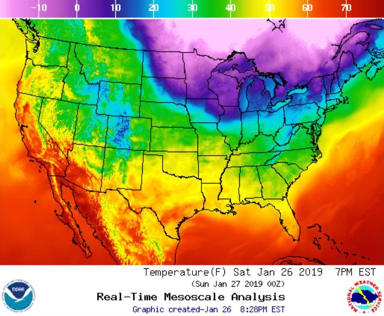
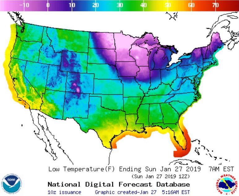
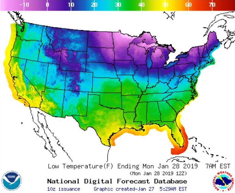
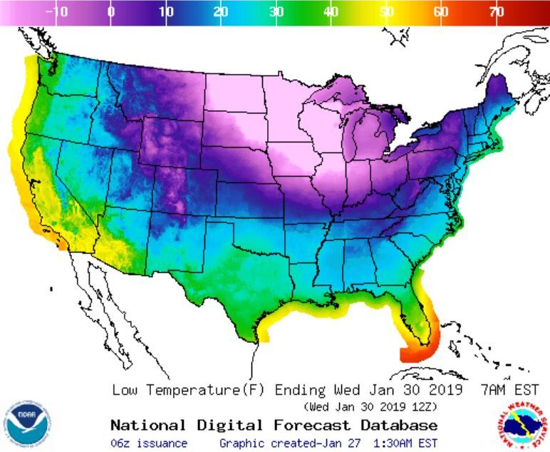
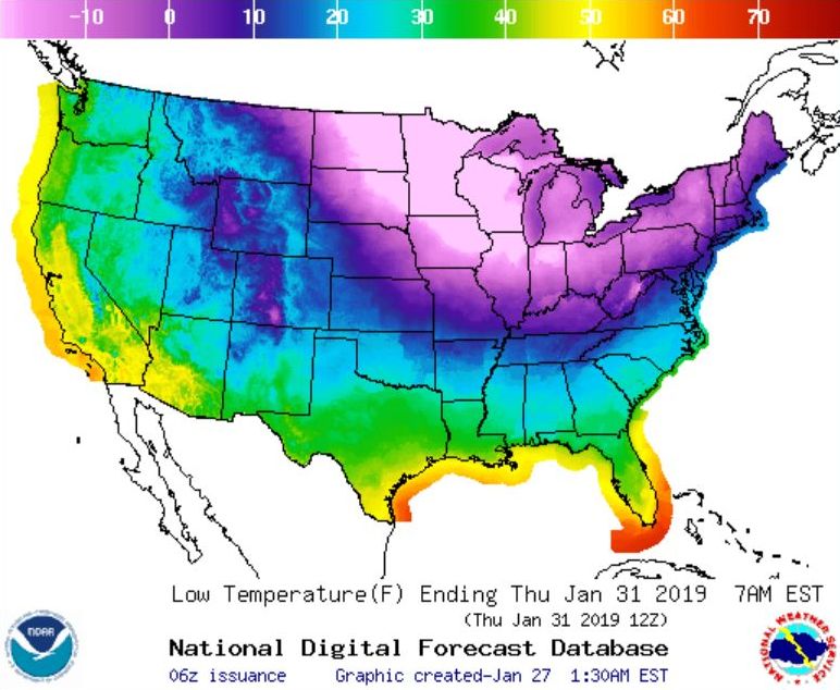
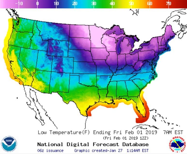
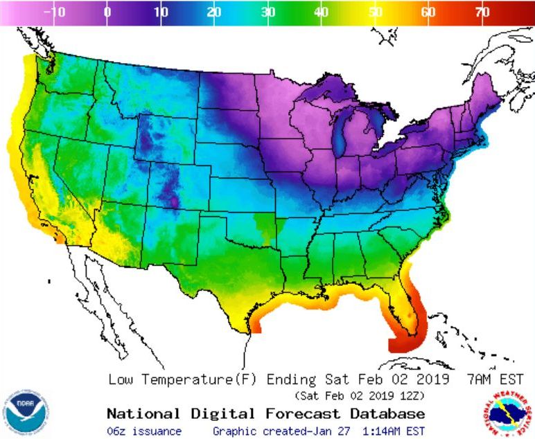
Remember how cold it was in January 2014? It’s been five years since we saw extremely cold weather but the jet stream is wobbling again and we’re going to see a smack of subzero temperatures this week. The maps show this week’s forecast lows described by the National Weather Service:
Bitter cold temperatures will give way to a potentially record breaking push of Arctic air this week. Wind chills as low as -40 or colder can be expected across the Northern Plains and Great Lakes. In addition, wide swaths of heavy snow can be expected across the area. This system will push east and south early this week with much below normal temperatures and wintry precipitation.
National Weather Service, 27 Jan 2019, 5am
Crazy as it seems, extreme cold is a sign of climate change. Here’s an explanation from my Polar Vortex article of January 2014:
“In the good old days before climate change, the winter polar vortex in the northern hemisphere was generally well behaved. It was a persistent, strong, cold, low pressure zone surrounding the polar high at roughly the same latitude around the globe. The strong winds kept the jet stream in line. Nobody got too hot or too cold.
“But now as the Earth gets hotter hot air from the troposphere is forced into the stratosphere and disrupts the polar vortex. The vortex weakens, becomes disorganized, and can collapse into smaller pieces. Its winds weaken and the jet stream flaps like a flag in the breeze, as shown in (c) below.”

- (a) Strong polar vortex (blue) keeps jet stream (pink) at same latitude.
- (b) Polar vortex weakens
- (c) Weak vortex lets the jet stream range widely north and south.
Get ready! Arctic air is on its way.
(forecast maps from the National Weather Service. jet stream diagram from Wikimedia Commons; click on the captions to see the originals)
