Yearly Archives: 2019

Danger! Space Junk

Last month I wrote about the damage that bad space weather can do to satellites, the electric grid, radio and TV transmissions, and GPS navigation. Though space weather can kill a satellite(*) bad weather is temporary. Not so with space junk.

Since 1957 when the Space Age began, our unused equipment has created a garbage patch in outer space. Over the years we’ve launched 5,000+ satellites though only 1,300 are operational today. There’s a lot of junk up there that’s out of control (can’t be navigated anymore) and potentially explosive.

screenshot of space junk explosion from PBS Be Smart

Even if it can’t explode, space junk is dangerous to active satellites because it travels so fast. In Low Earth Orbit, where the International Space Station lives, everything travels at 17,500 miles per hour (28,000 km/hour). A crash at that speed, even with a tiny object, can destroy a satellite. When a satellite dies something electronic fails here on Earth.

Meanwhile we’re launching more satellites every year at a faster pace than before. At the end of 2018 it had taken a decade to launch 1,000 CubeSat nano-satellites, only four-inches across, but there are plans to add 1,000 more by 2021. Outer space is so crowded that NASA and the European Space Agency (ESA) work every day to steer satellites away from dangerous space debris.

The 2016 video above describes space junk and how we’ve coped with it so far. Note that it doesn’t talk about CubeSats because the video predates those plans.

ESA’s 2017 video below describes the problem in technical terms with dramatic background music. I’ve cued the video to start at Low Earth Orbit. Watch for two minutes (beyond the first fade-to-black) and you’ll see lots of collisions.

Yow! It’s crowded up there.

(videos from PBS It’s OK To Be Smart and the European Space Agency (ESA) on YouTube)

(*) Space weather killed Telstar 401 in 1997.

Angry Storm On Saturn

Saturn’s north polar vortex storm (photo from Wikimedia Commons)

This month a KDKA viewer saw unusual clouds like breaking waves in the sky as he was traveling on the Turnpike to Philadelphia.

Our planet isn’t the only one that has these clouds. This photo of Saturn’s north polar vortex shows Kelvin-Helmholtz clouds on the spinning edge. Photographed by the Cassini spacecraft in April 2013 and colorized by NASA, this image is called The Rose but is actually a violent, relentless storm. And it’s big!

According to the Cassini Mission at NASA, “Measurements have sized the eye at a staggering 1,250 miles (2,000 kilometers) across with cloud speeds as fast as 330 miles per hour (150 meters per second).”

Our own polar vortex is mild by comparison.

(photo from NASA via Wikimedia Commons; click on the caption to see the original)

Oh! No! Snow!

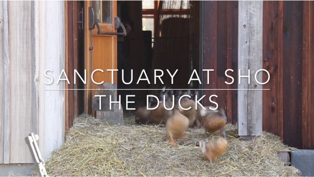
Ducks emerging from the barn at Sanctuary@SHO, Vermont (screenshot from video)

Every morning the ducks at Sanctuary@SHO in Huntington, Vermont burst out of the barn and run down to the orchard to feed. Their enthusiasm is infectious. It must be one of the favorite parts of their day (see video here).

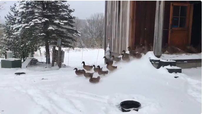
On a recent November morning they ran out of the barn as usual and into the first snowfall.

Here’s their reaction.

Oh! No! Snow!

(videos and screenshots from Sanctuary@SHO in Huntington, Vermont)

A Surprising Look at Robins

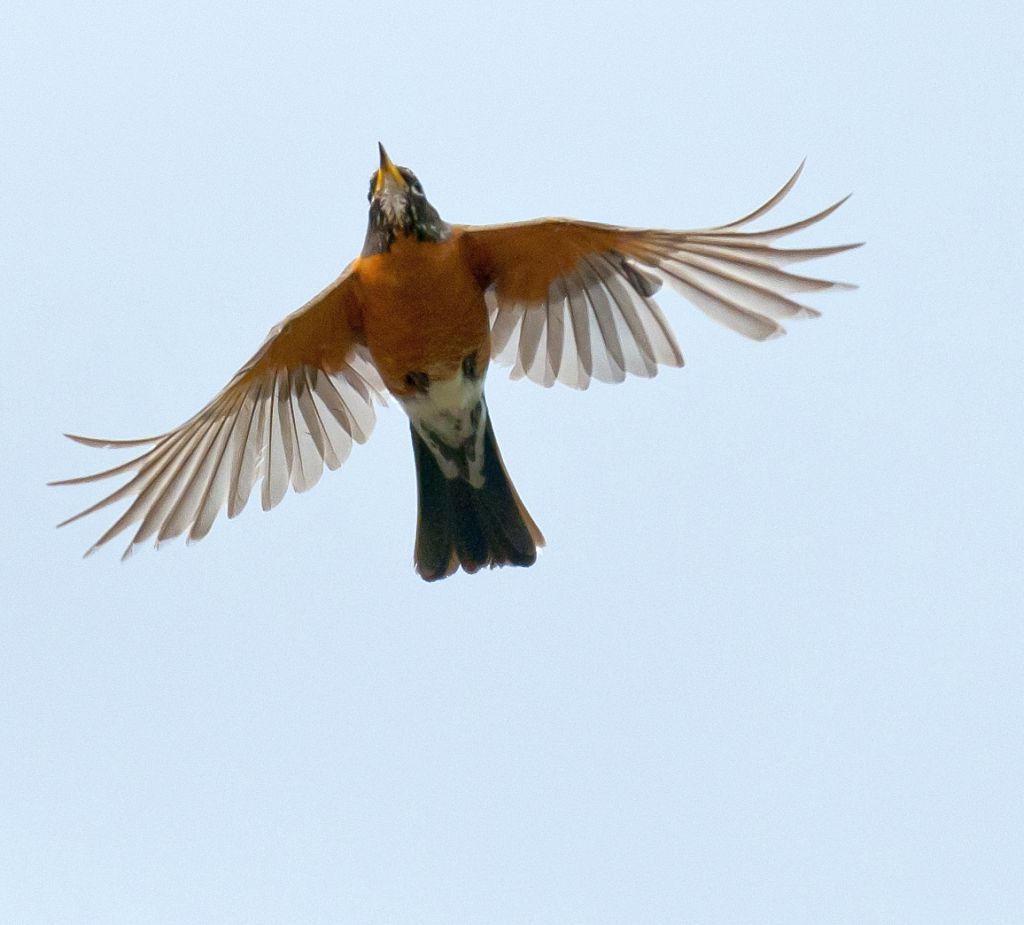
American robin in flight (photo from Wikimedia Commons)

We usually see American robins (Turdus migratorius) with their wings closed. They perch in a tree, sit on a nest, or walk with their classic 3-steps-and-stop gait. Even in flight robins close their wings, flapping and gliding in a pattern similar to their walk.

This view of a robin with open wings reveals a surprise. The robin’s armpits, called axillaries, match its belly.

Check out this vintage article on axillaries to see other birds with hidden surprises.

(photo from Wikimedia Commons; click on the caption to see the original)

A Murmuration Of Shorebirds

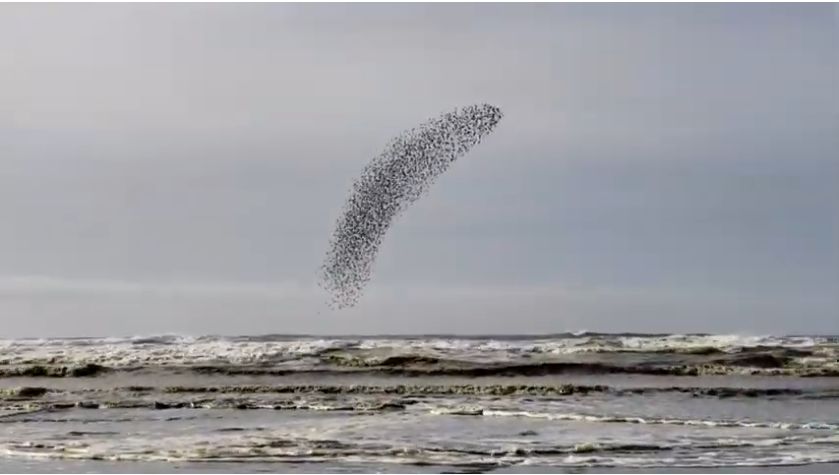
A murmuration of sandpipers, Washington state, Nov 2018 (screenshot from YouTube video)

When European starlings are frightened by an aerial predator they fly in tight formation in a giant shimmering blob called a murmuration. If you’ve never seen it, check out these two examples: Murmurations in Lorain by Chad+Chris Saladin and Murmuration a 2011 film on Vimeo.

Starlings aren’t the only ones who fly like this. Shorebirds are masters at staying in formation, flying high and low and sweeping between the waves when threatened from above.

In the video below, a shorebird flock flashes black and white at Ocean Shores, Washington in November 2018. Their backs are dark, their bellies are white, so they change color as they turn in the air.

video embedded from Peggy Dolane on YouTube

The flock is doing this for a reason.

Watch a predator dive in at the 0:13 time mark. It looks like a peregrine falcon to me. 🙂

(screenshot from video by Peggy Dolane on YouTube)

p.s. Starlings and sandpipers have other similarities. Back in 2008 I mused about starlings as “Land”pipers.

MOTUS Peregrines On The Move

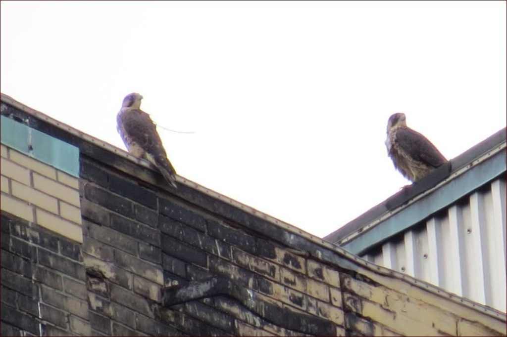
Downtown Pittsburgh juvenile peregrines. Bird on left has a MOTUS tag, 20 June 2019 (photo by Lori Maggio)

In June 2019 the Pennsylvania Game Commission fitted 10 of the state’s fledgling peregrines with MOTUS tracking devices to study where they go and how many survive their first year of life. Five months later the network has data locations for three (or maybe five) of them.

Keep in mind that only a few data points have been captured, the MOTUS data is still preliminary, and false positives sometimes occur. That said, here’s what we know so far.

Harrisburg female, Red, 46/BS (ID# 24660)

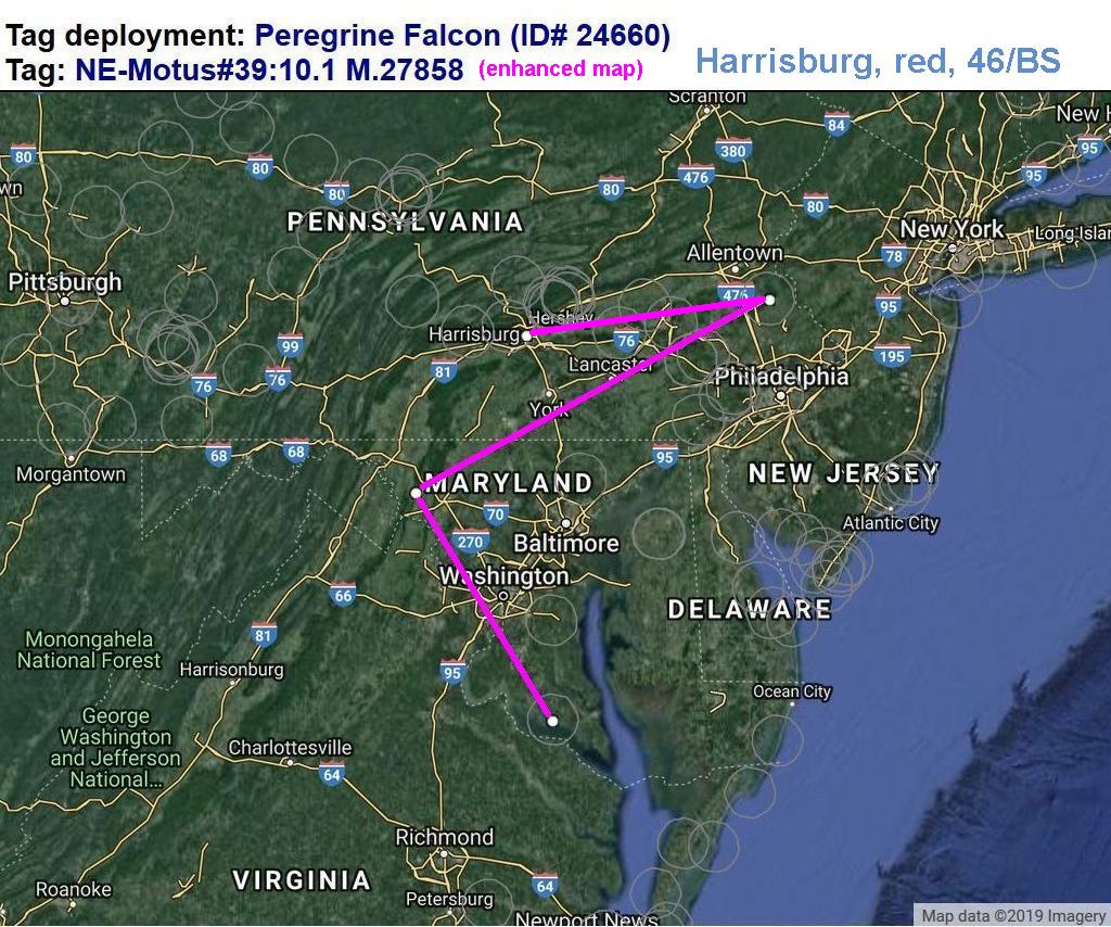
The path of the Harrisburg female peregrine (Red, 46/BS, ID#24660) looks quite promising. She flew first to Nockamixon (19 Sept), then west and south to Lamb’s Knoll (2 Oct) and Newtowne Neck near Compton, Maryland (4 Oct). The enhanced map below includes her banding location in Harrisburg. Click here for her path on the Motus website which does not include her banding location.

Map of Harrisburg Red peregrine, ID#24660, enhanced from MOTUS tracking map

Harrisburg male, White, 22/BZ (ID# 24662)

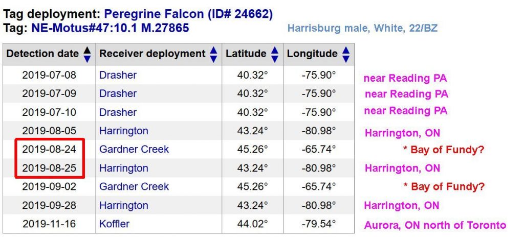
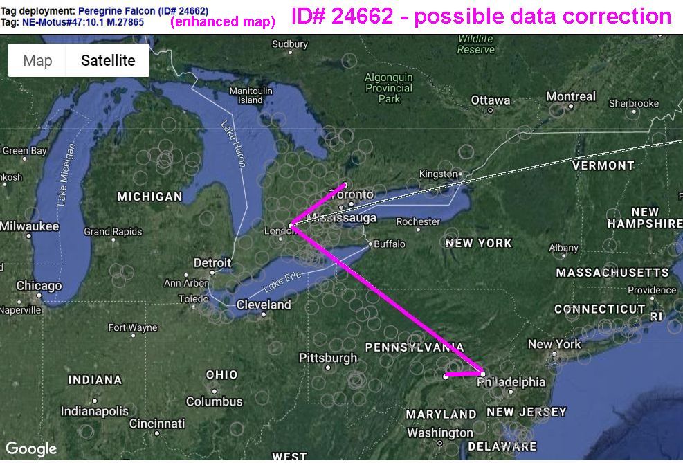
Initial data on the Harrisburg male (White, 22/BZ, ID#24662) were clouded by inaccuracies that placed him in both Reading, PA (Drasher) and Saskatchewan, Canada — 1,600 miles away — on the same day.

After removing the Saskachewan error there was still one more puzzle. The data table indicates that Harrisburg White flew 766 miles four times — from western Ontario (Harrington) to the Bay of Fundy (Gardner Creek) and back again. Would a bird have done this? And could he have made one of those trips in a single day, 24-25 August, in a head wind? Hmmm! Doubtful.

screenshot of Harrisburg White data table as of 25 Nov 2019

With those questions in mind I created the enhanced map below, adding his banding location and removing Gardner Creek (which may still be on his MOTUS map here). While his data is under review Harrisburg White is still on the move. He showed up near Aurora, Ontario on 16 November.

Map of Harrisburg White peregrine, ID#24662, enhanced from MOTUS tracking map

Nazareth, female, Red, 20/CA (ID# 24665)

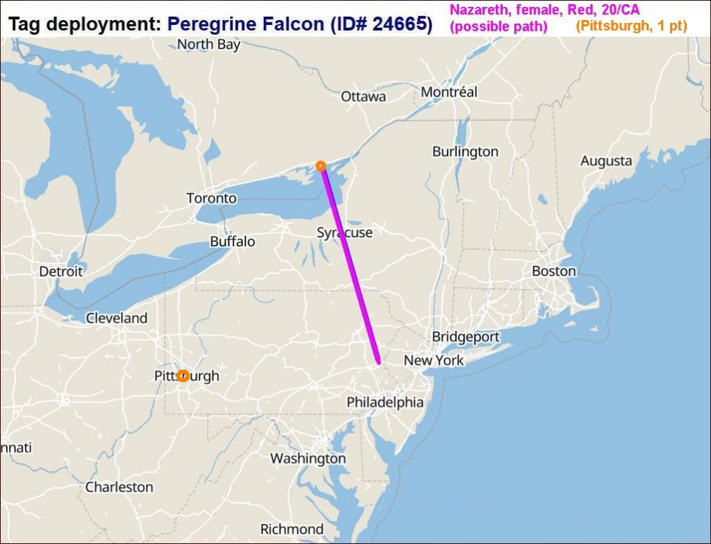
Hatched on a clinker silo at Lehigh Cement in Nazareth, Pennsylvania this female (Red, 20/CA, ID#24665) logged three data points on Amherst Island in Lake Ontario: 51 seconds on 17 and 19 July and three hours on 6 August. Without other locational data MOTUS cannot generate a map so I created one below with two points while her data is under review. Click here for her data table on the MOTUS website.

Proposed map of Nazareth Red peregrine, ID#24665, constructed by Kate St. John and enhanced MOTUS tracking data

Data uncertain: Pittsburgh, female, Blue, 19/CA (ID# 24664)

Interestingly there is a single 51-second data point for the Pittsburgh female (Blue, 19/CA, ID#24664) at Nazareth Red’s location on Amherst Island on 22 July. Its validity is uncertain. I marked it in orange on Nazareth’s map above.

Data uncertain: Bethlehem, male, Yellow, 60/AP (ID# 24666)

Bethlehem Yellow has a smattering of data points at the Allan Hills tower in Saskatchewan, but like the other Saskatchewan error this is 1,700 miles away from his banding site without any intervening locations. The data is under review.

As the MOTUS system gathers more information the picture for each bird will come into better focus. Meanwhile check out the tables and maps as they look today at the links below.

(photo of Pittsburgh juvenile peregrines by Lori Maggio, enhanced maps by Kate St. John from MOTUS tracking data; click on the captions to see the originals)

Turkeys Here, Turkeys There

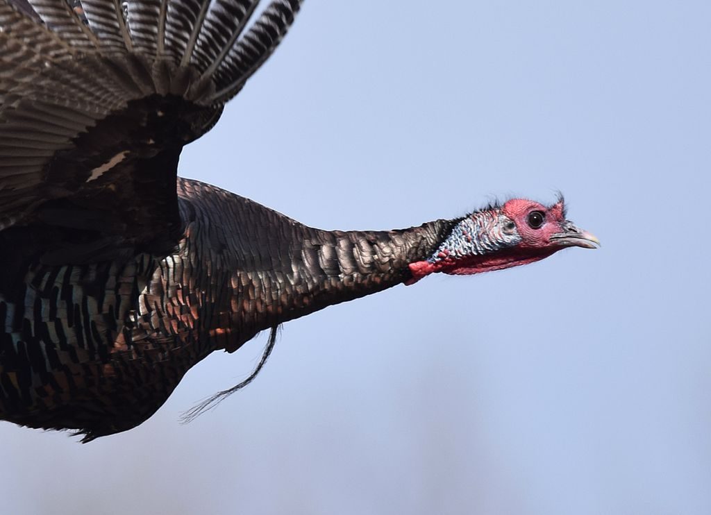
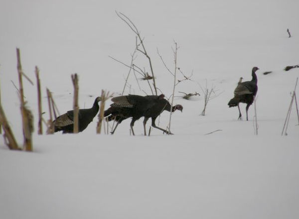
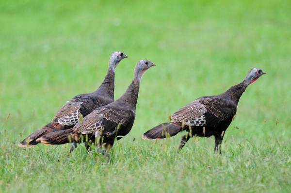
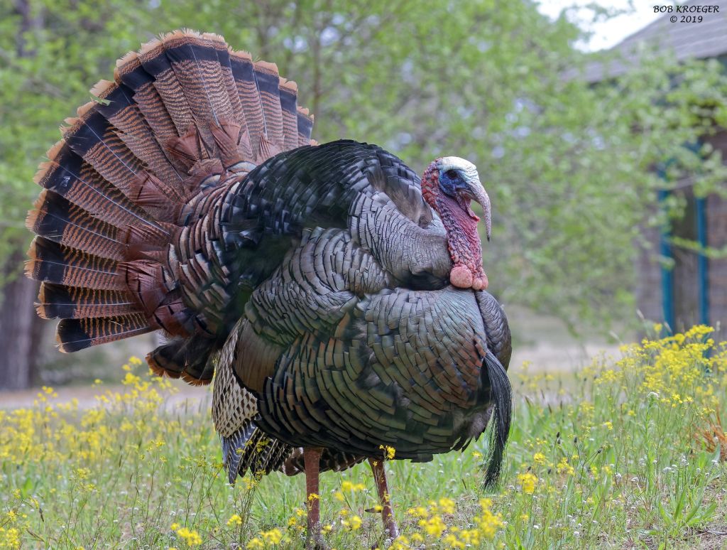
Wild turkey at Wellfleet Bay, Massachusetts, Spring 2019 (photo by Bob Kroeger)

24 November 2019

Wild turkey flocks are going through changes, declining here, expanding there.

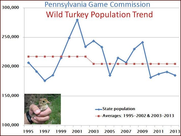
In Pennsylvania their population declined 24% in the past two decades. At their peak in the early 2000’s there were 280,000 statewide. This year there are only 212,200. The graph below shows the turkeys’ rise and fall, 1995 to 2013, carefully tracked by the PA Game Commission (PGC) because turkeys are a game bird.

The Game Commission notes that their decline is from a combination of factors:

  • Negative habitat changes: mono-culture farms, invasive plants, less food (fewer insects, acorns, beech nuts, etc), and less cover (declines in shrubby cover).
  • Unpredictable weather and extreme weather events when poults are young
  • An increase in predators, especially in poor cover areas.

In response to the downward trend the Game Commission lowered the harvest limits so there is less hunting pressure on the birds. They are also studying whether any disease has had a significant effect.

Pennsylvania is not alone. Wild turkeys are declining across the eastern U.S. from western New York state to Mississippi, Arkansas and Missouri.

But not in New England.

Fifty years ago there weren’t any turkeys in Massachusetts but a modest reintroduction effort in the 1970’s (37 birds) turned the tide. They now have 25,000 turkeys and the population keeps growing.

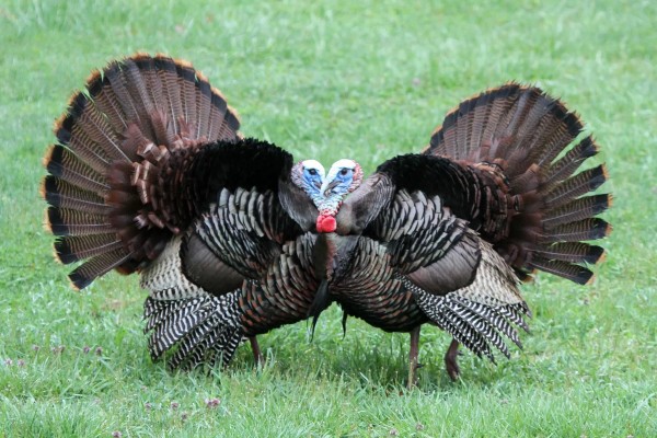
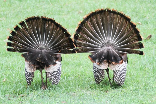
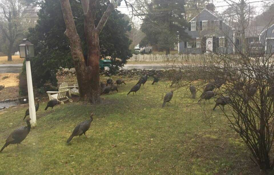
Wild turkeys are especially abundant on Cape Cod where there’s plenty of food and cover and very little hunting. Flocks roam the neighborhoods, scratch for grubs in grass and gardens, and challenge small dogs and people when they feel threatened.

Wild turkeys have pretty much taken over. Here’s a flock in Bob Kroeger’s yard during a Nor’easter in March 2018.

Wild turkeys wait out a Nor’easter in a Cape Cod backyard, March 2018 (photo by Bob Kroeger)

If you’re missing turkeys here in Pennsylvania, I know you’ll find them there.

(photos taken on Cape Cod by Bob Kroeger, graph from the PA Game Commission; click on the caption to see the original)

Audubon Day, Dec 6

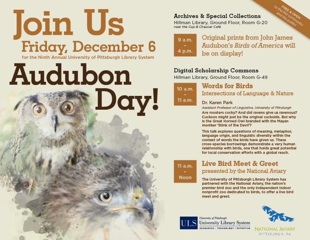
Visit the University of Pittsburgh’s Hillman Library for the 9th annual Audubon Day on Friday 6 December 2019. Events include:

10:00 – 11:00
Hillman library, Ground Floor, Room G-49
Meaning, metaphor and the words that birds have given us. Presentation by Dr. Karen Park, Assistant Professor of Linguistics at the University of Pittsburgh

11:00 – 12:00
Hillman library, Ground Floor, Room G-49
Live Bird Meet-and-Greet presented by the National Aviary. Whooo? will the Aviary bring to the meeting? Come and find out.

9:00 – 4:00
Hillman Library, Ground Floor, Room G-20
Original Prints from John James Audubon’s Birds of America on display.


Check out the event at the University Library System’s Facebook page.