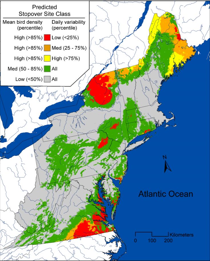
Several years ago this map of nocturnal fall migration stopover sites in the Northeastern U.S. caught my attention. My initial reaction was personal, “Dang! The birds don’t stop in Pittsburgh.”
The map itself is from a 2017 study conducted by the University of Delaware for US Fish and Wildlife Service (downloadable here). Researchers analyzed radar data from 2008-2014 paying particular attention to bird density where nocturnal migrants burst into the sky after sunset, showing where they stopped the night before.
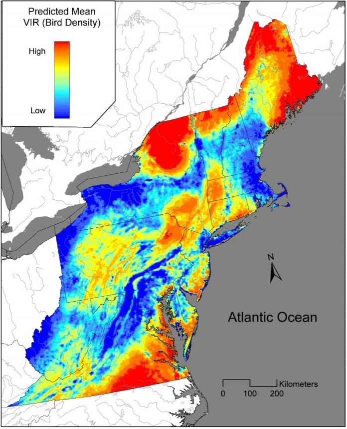
A similar map using vertically-integrated reflectivity (bird density) predicts the stopover sites in 2008-2014. I’m happy to see those orange stripes of higher bird density in Pennsylvania’s Appalachians and Laurel Highlands but I’m disappointed that I live so far away from the hottest inland hotspots — the Adirondacks, Catskills, Poconos, Maine and Southside Virginia.

Sadly, during the study the bird population in the study area dropped 29% in only seven years. The worst declines were in coastal Maine and Virginia with modest increases in Connecticut, New Jersey, the Delmarva peninsula and near State College, PA.
If you were birding in coastal Maine or Virginia in the early 2000’s you probably have a hunch there are fewer birds. There are.
I suppose that’s a bittersweet silver lining for Pittsburgh birders. We never saw those migrants anyway so we haven’t noticed they’re gone.
(maps from USFWS Validation of NEXRAD data and models of bird migration stopover sites in the Northeast U.S., Final Report, August 2017)
