
16 June 2022
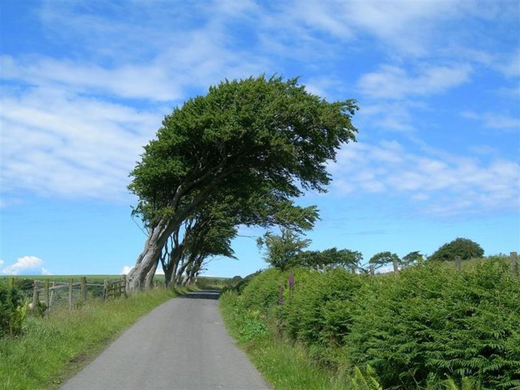
If you live in a windy place, the trees lean away from the prevailing wind.
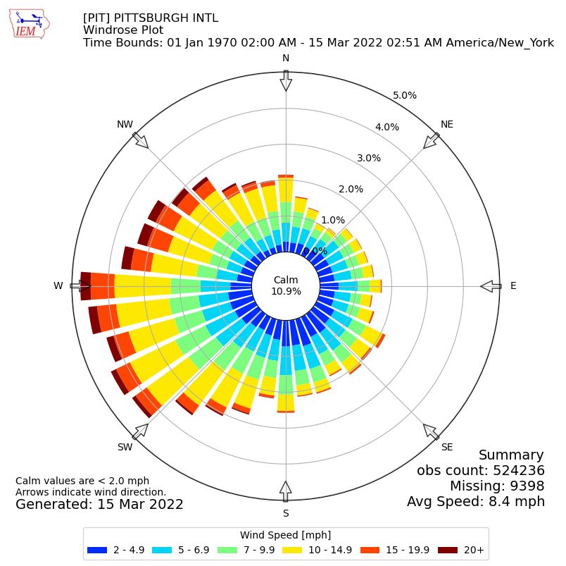
To see this effect on paper meteorologists create a wind rose that graphs the wind’s direction and speed over time. The petals indicate the percentage of wind from each direction. The colors show the speed. The center is calm. Let’s look at some wind roses from Iowa State’s Iowa Environmental Mesonet.
Though Pittsburgh is not a particularly windy place our 50-year wind rose (1970-2022) indicates our prevailing wind is from the southwest. 10.9% of the time there is no wind at all.
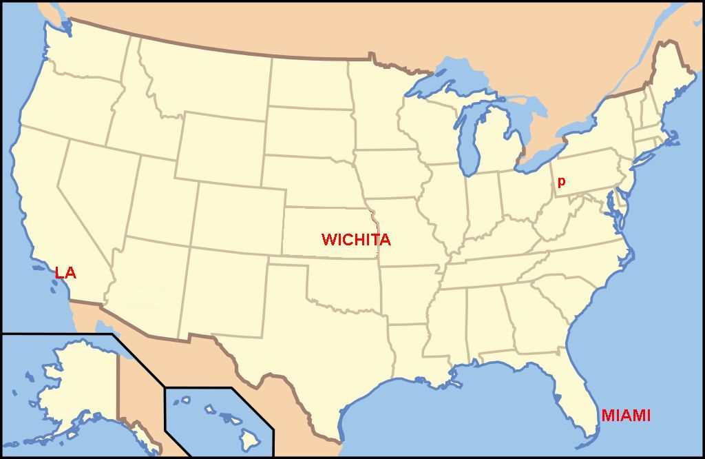
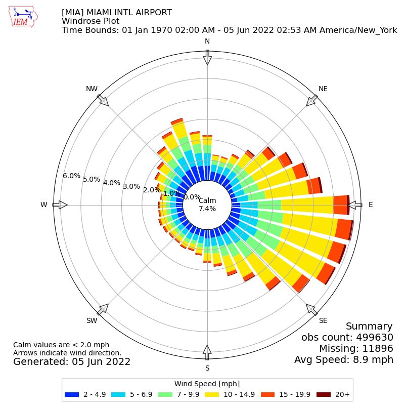
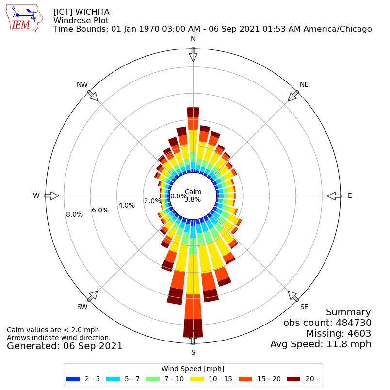
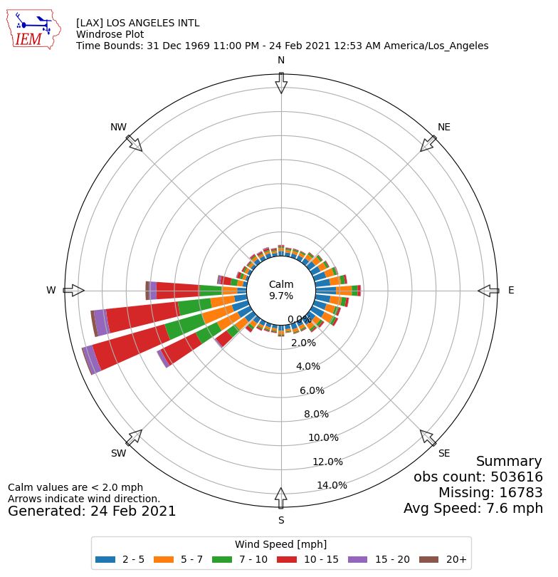
In places where wind is not obstructed, such as the coast and the Great Plains, wind roses are lopsided. This map shows the locations of three extreme wind roses displayed below.
Miami, Florida windrose from Iowa Environmental Mesonet
Wichita, Kansas windrose from Iowa Environmental Mesonet
Los Angeles, California windrose from IEM
Here are some more from Iowa Environmental Mesonet. Click the links.
- Provincetown, MA
- New York, NY
- Chicago, IL (Midway airport)
- Phoenix, AZ (Sky Harbor Airport)
- Yellowstone National Park at Yellowstone Lake RAMOS weather station
- Seattle-Tacoma International Airport, WA
- Seattle, WA (Boeing Field)
- Honolulu, HI (extremely lopsided!)
- Anchorage, AK
- Nome, AK
What’s your wind rose?
Retrieve it here.
- Visit Iowa State’s Iowa Environmental Mesonet Site Locator.
- Select by Network: Drop down to pick your state ASOS network, for example: “Ohio ASOS”. Click on [Switch Network]).
- Then Select by Station (drop down to pick your local weather station, for example “Toledo” and click on [Select Station].
- Click on [*Wind Roses], the 9th of 13 buttons.
(images from Wikimedia Commons and Iowa Environmental Mesonet; click on the captions to see the originals)
Thanks, Kate, for opening an interesting window for further exploration! I had fun finding the windrose for Mount Washington, NH, home of the worst weather (by some accounts), and comparing it to the windrose for the nearest airport at Whitefield.