26 January 2023
More fun with maps!
Earlier this month when I wrote about wind speed maps (How Fast Is The Wind Blowing?) Steve Thomas sent a link to the earth mapping website. I remembered green swirling maps on my own blog, Winds On Water, but seven years ago I didn’t look further than the default surface winds.
The earth website is, in their own words, “a visualization of global weather conditions forecast by supercomputers updated every three hours.” Their action maps include high altitude winds, ocean currents, temperatures, fires and more.
Let’s start exploring with today’s map of surface winds, shown below (click here to open it on your own computer). I guarantee it will look different than this image I pulled yesterday.
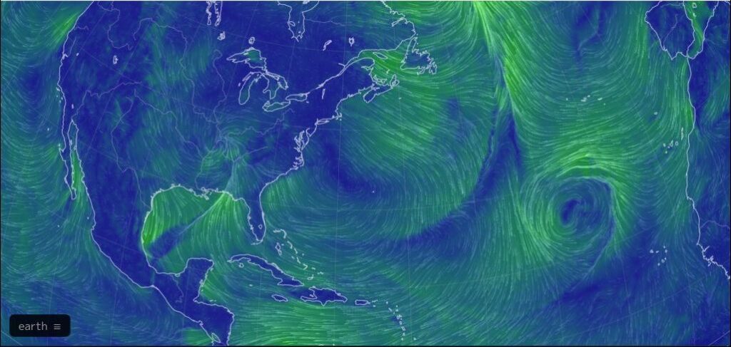
To see the legend and change the map click on the [earth] icon at bottom left. The default setting is:
- Mode=Air
- Animate=Wind
- Height=Sfc (surface)
- Overlay=Wind
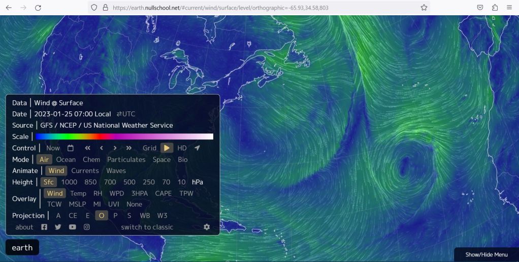
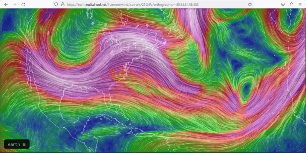
To see winds at higher altitude I chose Height=250. [250 hPa = 250 hectopascals = lower pressure = higher altitude. The lower the hPa number, the higher the altitude above the surface.]
- Mode=Air
- Animate=Wind
- Height=250
- Overlay=Wind
The wind is screaming purple-white at 250 hPa. It looks like the jet stream.
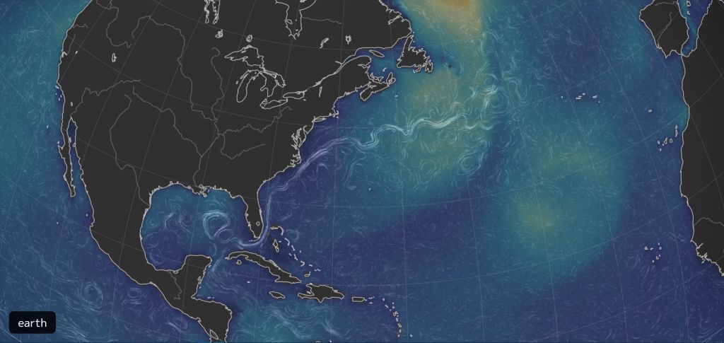
To achieve the map of ocean currents shown at top I chose:
- Mode=Ocean
- Animate=Currents
- Overlay=HTSGW (Significant Wave Height)
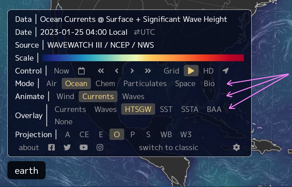
Click here to see an action map of the Gulf Stream at the ocean’s surface (screenshot at top). Watch it rounding the tip of Florida, then pumping north and east into the Atlantic, leaving vortices in the Gulf of Mexico.
That strong current near the east coast of Florida is the water “highway” that many creatures use for migrating north. It’s the reason why you can see whales from shore in early spring.
Try out the other options on earth to have more fun with maps.
(all maps are screenshots from earth, base maps for these screenshots can be found at this link https://earth.nullschool.net/#current/wind/surface/level/orthographic=-65.93,34.58,803)