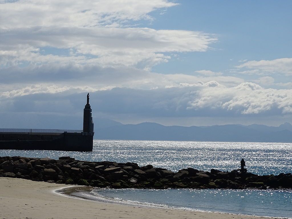
10 September 2024: Day 4, Tarifa and birding at the Strait of Gibraltar, WINGS Spain in Autumn. Click here for a map showing where I am today.
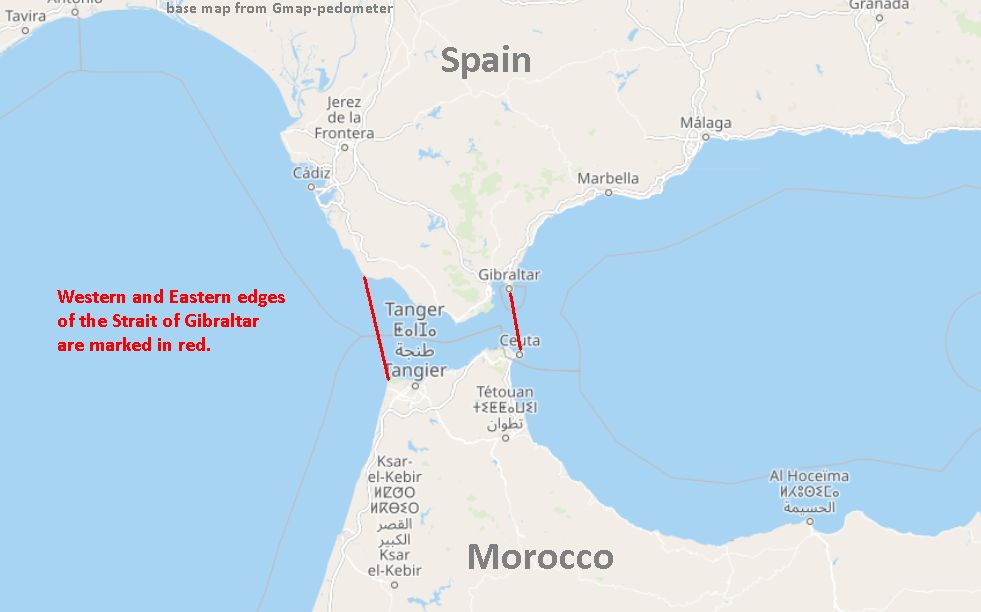
We are now at the Strait of Gibraltar, the closest point between Europe and Africa. At its narrowest the Strait is only 13 km (8.1 miles) across, flanked on each side by mountains.
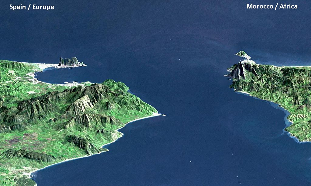
The passage is longer east-to-west than it is wide –> 58 km (36 miles) from beginning to end. Its current, water flow and variable depth give scientists clues as to how it was formed.
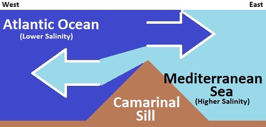
Water flows through the Strait more or less continuously, both east and west, but the balance of water moves eastward from the Atlantic into the Mediterranean. That’s because the Mediterranean evaporates faster than tributaries and precipitation can fill it. The Atlantic pours in but the Mediterranean stays saltier than the Atlantic Ocean.
In fact, Mediterranean waters are so much saltier that they sink below the constantly incoming Atlantic and form a warm highly saline layer of bottom water called a thermohaline. You can see this in the schematic of the Camarinal Sill which is west of the Narrows.
While the Camarinal Sill is the shallowest point (280 m = 920 ft deep), the deepest point is at the Narrows (900 m = 3,000 ft deep). Deep water is black on this underwater topo map.
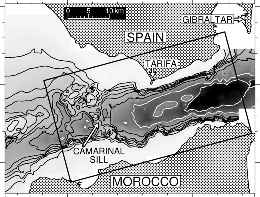
With only 25km (15.5 miles) between the two points the flow often generates internal (subsurface) waves that can be seen from satellites, though they don’t look like waves in surface navigation.

And there is certainly a lot of surface navigation! Every time we look at the Strait there are ships on it. The Strait is the one of the busiest and most crowded waterways in the world. Half the world’s trade and one third of the world’s oil and gas pass through the Strait, according to a CityAM article in 2015.

Incredibly, the Strait of Gibraltar did not exist in the Miocene era when saber-toothed tigers roamed the earth. Here’s how the Strait came to be.
About 6 million years ago plate tectonics(*) closed the connection between the Mediterranean and the Atlantic. Without an influx of water the entire Mediterranean Sea evaporated, leaving behind salt and gypsum deposits. This Messinian Salinity Crisis lasted roughly 700,000 years. Then, rather suddenly, a leak developed between Africa and Europe. It quickly eroded a deep channel to the Mediterranean and eroded backwards (upstream) to create the Gulf of Cadiz. This video of an experimental dam failure shows how that looks.
The Zanclean Flood happened quite rapidly! The Mediterranean filled up within two years!
90% of the Mediterranean Basin flooding occurred abruptly during a period estimated to have been between several months and two years, following low water discharges that could have lasted for several thousand years. Sea level rise in the basin may have reached rates at times greater than ten meters per day (30 feet per day).
— Wikipedia: Zanclean Flood account
The result is an underwater topography carved by the flood. This diagram shows the marine floor but is not to scale (described below). It comes from ScienceDirect: The Zanclean megaflood of the Mediterranean – Searching for independent evidence — Daniel Garcia-Castellanos et al.
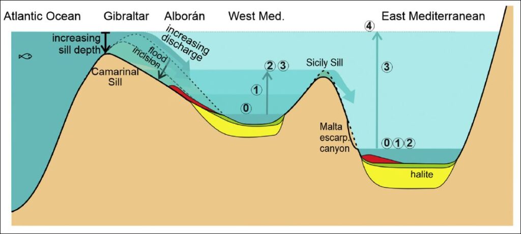
Cartoon (not to scale) showing the timing and the flood erosional and depositional features expected in the eastern and western basins of the Mediterranean as a result of a large water input through the Gibraltar gateway, showing 5 stages: 0) Initial level before significant Atlantic inflow occurred; 1) time of maximum erosion rate at the Strait of Gibraltar; 2) the western basin level reaches the Sicily Sill. 3) eastern basin level reaches the Sicily Sill; and 4) the Mediterranean is filled to the normal oceanic level. — ScienceDirect: The Zanclean megaflood of the Mediterranean – Searching for independent evidence — Daniel Garcia-Castellanos et al)
Everyone had to run away from the flood while the Strait was being formed.
(*) p.s. Plate tectonics closed the Strait 6 million years ago. At present the African Plate is subducting under the Eurasian Plate in the Mediterranean region. Africa is slamming into Europe, albeit very slowly.
UPDATE 25 Sept 2024: Science Magazine: Fossils tell tale of devastating mass extinction when Mediterranean dried up
Another great class, Kate! It’s not just how much you know, it’s how clearly you present it. That’s why I read your blog every morning.