10 September 2017
On Friday afternoon I checked in with my brother while he and his wife prepared for Hurricane Irma at their home in Boca Raton. Located west of I-95, his neighborhood wasn’t part of the mandatory evacuation order but everyone was getting ready and planning to throw a “good luck” party Friday night. They expected to hide indoors until the storm is over — probably midday Monday. All were hoping Irma would go west and so far that’s what she is doing.
Concerned for my friends and relatives in Florida I’ve been monitoring Hurricane Irma on the National Hurricane Center’s website at www.nhc.noaa.gov. My brother suggested watching the wind at windy.com and that reminded me of the similar “earth” website.
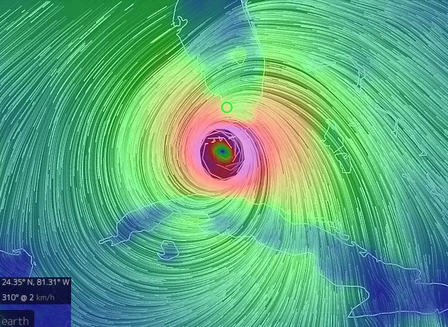
Watch the wind at these links, centered on Marco Island, Florida along the path of the storm.
- windy.com provides current conditions and 10-day forecasts by location. Here’s Marco Island at windy.com.
- “earth” at nullschool.net provides a visualization of weather patterns on the entire globe. Click here or on the image above to see the Marco Island area.
Move the map around and you’ll see strong wind blowing onshore toward Georgia. That’s why there’s a storm surge warning in Savannah.
There’s one thing these maps can’t show. Hurricanes spawn many tornadoes but they don’t appear on the wind maps. Right now there’s a tornado watch in Boca Raton until noon on Monday. Yikes!
(screenshot from earth.nullshool.net on 10 Sept 2017, 5am. Click on the image to see the current wind map)
UPDATE at 11:30pm on Sept 10: My brother reports that they are OK at home in Boca Raton. The power went out for eight hours but came on around 11pm. They’ll go outside Monday morning to see what happened to the landscape.
Satellite imagery focusing on ‘IRMA’ – the “storm floater” imagery is available at
http://www.ssd.noaa.gov/PS/TROP/floaters/11L/11L_floater.html