15 January 2021
Seven years ago we were in the grips of subzero temperatures as the wobbly jet stream drove arctic air south over the U.S. It was called the arrival of the Polar Vortex.
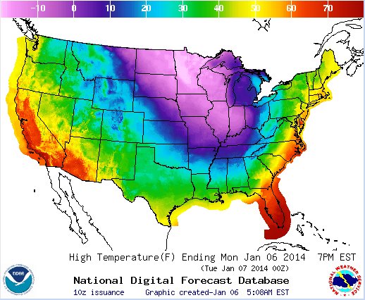
Seven years ago on 6 January 2014 much of the U.S. was below zero as shown on the map below. Pittsburgh was above freezing that day but the warmth ended soon as the blob of cold air headed east.
This winter has been mild and the jet stream has been behaving. But a sudden stratospheric warming event occurred in the arctic in early January 2021. The warmth made the arctic vortex unstable. Meteorologists speculated: Are we in for another polar vortex in the Lower 48? Will we have a major cold snap?
Not necessarily. NEWS CENTER Maine in Portland has a good explanation of what’s going on, published on Monday 11 Jan 2021. (This news is for Mainers but it applies to us, too.)
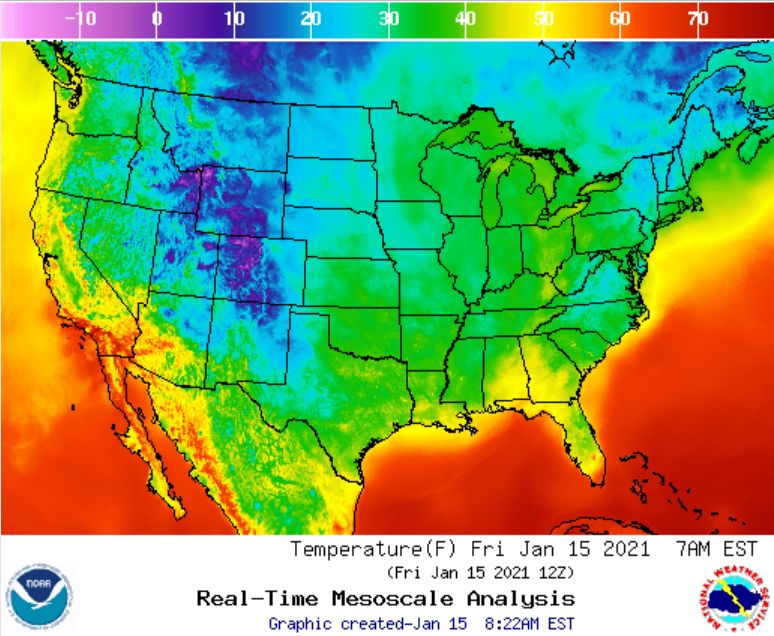
Meanwhile it’s quite warm across the U.S. Here’s the same U.S. temperature map seven years later, published today 15 January 2021.
Read about the original polar vortex in this 2014 article: Polar Vortex.
(graphics from NOAA; click on the captions to see their origins)


Turn on the falcon cam. Please.
I would love to see them in action.
It’s going to start on Feb 1. Meanwhile consider donating for its upkeep at https://www.birdsoutsidemywindow.org/2020/12/15/support-the-national-aviary-falconcam/