Category Archives: Travel

In UV Light This Bird Can Glow Red

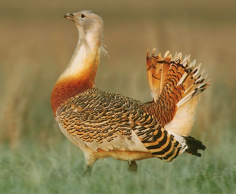
Male great bustard working up to a display (photo from Wikimedia Commons)

16 September 2024: Day 10, Fuente de Piedra, Osuna, and the plains east of Sevilla, WINGS Spain in Autumn Click here to see (generally) where I am today.

One of the target species during our tour’s final days is a very large bird that lives on the steppes and grasslands of Spain. The great bustard (Otis tarda) is the most sexually dimorphic of all birds in terms of size. The males can weigh as much as 42 pounds, are the second heaviest flying bird on earth(*), and average 2.48 times the weight of females. They also stand 3+ feet tall so if one’s out there in the grass we should be able to see it.

Unfortunately the colorful range map below is a bit misleading. The great bustard (Otis tarda) is Endangered and in low numbers everywhere except Spain. According to Wikipedia, “More than half the global population is found in central Spain with around 30,000 individuals.” Some locations in Europe have as few as 100 to 1,000 birds.
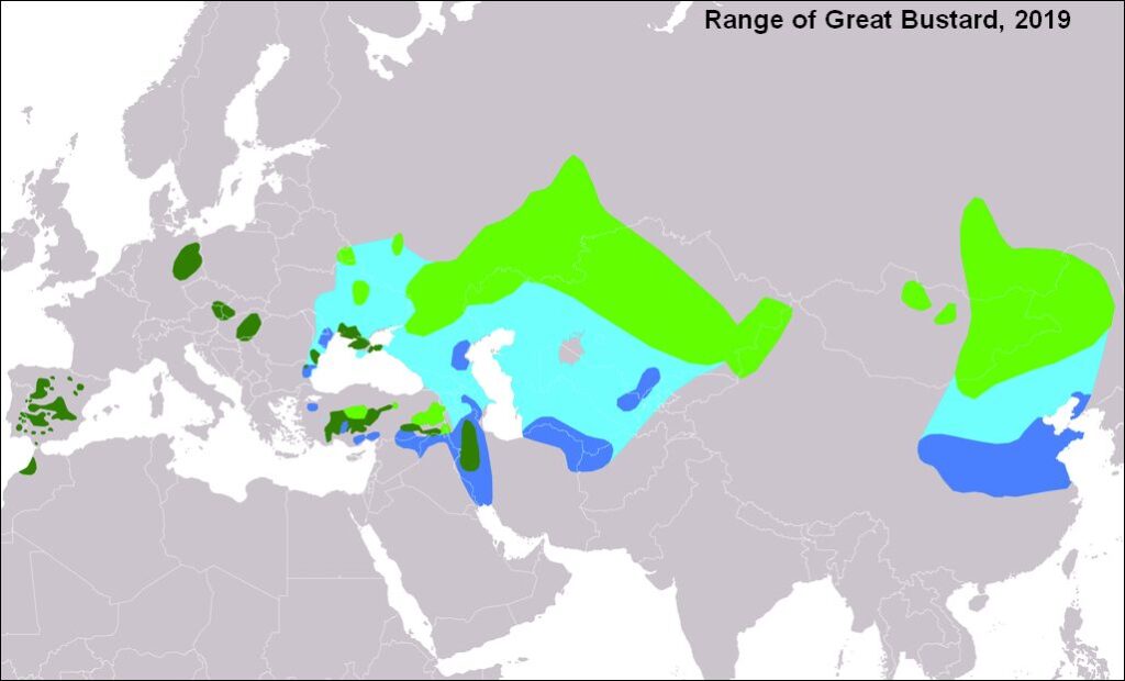
Range of the Great Bustard (map from Wikimedia Commons)

Great bustards are famous for their courtship displays. In March the males gather on a lek to joust and puff their feathers.

Females are attracted by features of the display that we humans cannot hear or see. For instance, bustards make low frequency sounds that carry a long distance in open country. Perhaps she hears him from far away.
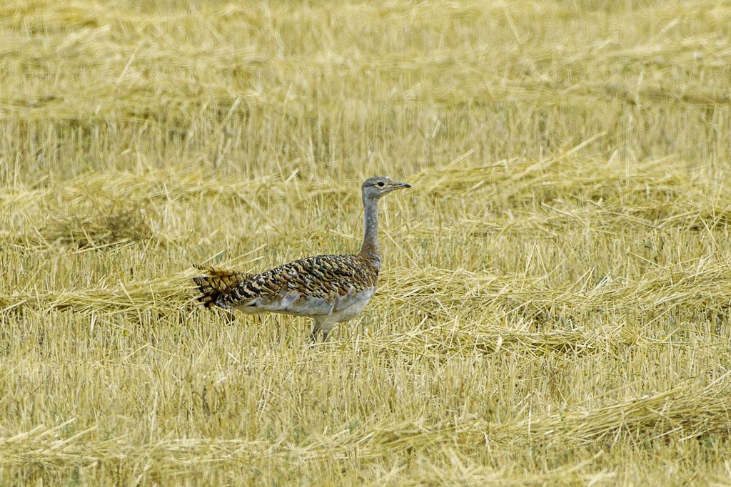
Female great bustard (photo from Wikimedia Commons)

Bustards’ ability to see UV light plays a part in their courtship. The males’ reddish/brownish feathers contain a pigment called porphyrin, chemically related to hemoglobin, that shows intense red fluorescence under ultraviolet light, as seen in an experiment below.

Experiment showing fluorescence of porphyrin (photo from Wikimedia Commons)

When a male great bustard fluffs his throat feathers the females see bright glowing magenta in UV light.

Porphyrin pigment breaks down during exposure to sunlight so this feature is lost in older feathers as male breeding plumage ages. By the time the glow is gone, the males don’t need it. Courtship is over until next year.


(*) p.s. The heaviest bird capable of flight is the Kori bustard.
Today is the Day For Crows With Red Beaks

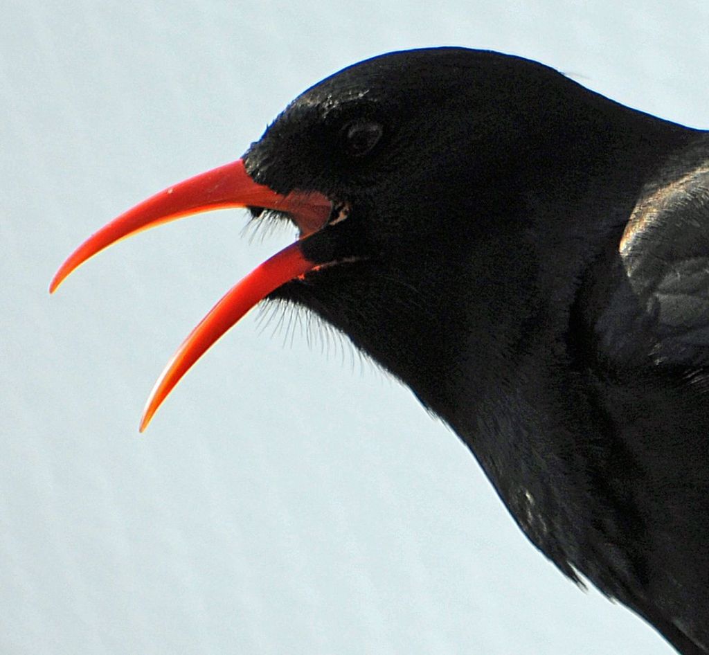
Red-billed chough, headshot (photo from Wikimedia Commons)

15 September 2024: Day 9, Ronda and the Sierra Grazalema Mountains, WINGS Spain in Autumn Click here to see (generally) where I am today.

It’s been nine years since I first became fascinated by the long curved bills of the “crows with red beaks.” Today I am in red-billed chough (Pyrrhocorax pyrrhocorax) territory in Spain, home of this Life Bird.

Red-billed choughs, pronounced “chuff“, are native corvids in Europe, Asia and North Africa but they are essentially sedentary. They don’t migrate so I have to visit their homeland if I want to see them.

Their favorite habitats are coastal cliffs and mountain meadows strewn with boulders where they poke their beaks into grass and soil to find insects. They will also forage in grassy areas in mountain towns.

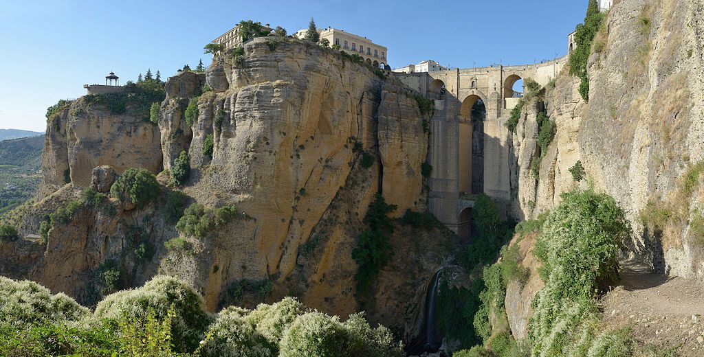
Red-billed choughs roost on the cliffs of Ronda where we are staying two nights. They arrive before sunset in the cliff valley spanned by the Puente Nuevo bridge, right of center in the photo below.

Ronda and Puente Nuevo bridge (photo from Wikimedia Commons)

Here they are in a similar setting in Cadiz.

Just like crows, choughs assemble in flocks and make a lot of noise. However, choughs sound different from crows. Their name “chough” is supposed to mimic the sound but nothing can quite compare.

Red-billed choughs at Parque Regional Sierra del Carche, Spain (video embedded from Canal Natura on YouTube)

In North America people claim to have seen red-billed choughs in the wild but we don’t have them. Read about it in this vintage article, especially the comments.

And Now To The Mountains

Sierra de Grazalema Natural Park (photo from Wikimedia Commons)

14 September 2024: Day 8, Ronda and Sierra Grazalema Natural Park, WINGS Spain in Autumn. Click here to see (generally) where the tour is today.

Today we leave the sea at Tarifa and climb to the mountains of Sierra Grazalema Natural Park. Its 200 square miles contain rivers, lakes, karst valleys, whitewashed villages and several mountain ranges. The highest mountain, Pinar at 5,427 ft (1,654 m), is more than a mile high.

Map of Sierra Grazalema Natural Park (from Wikimedia Commons)

The Natural Park is not a wilderness for there are small villages of whitewashed buildings called pueblos blancos — literally “white villages” — sprinkled throughout. Grazalema (pictured below, population 2,053) shares its name with the mountains and the park. The town is north of the center of the map above.

Grazalema, a pueblo blanco of Andalucia (photo from Wikimedia Commons)

Because our lodging is in Ronda, chances are good we will be birding on the eastern side of the park where eBird indicates we can see these target species.

Species in order of appearance:

  1. Eurasian griffon (Gyps fulvus)
  2. Bonelli’s eagle (Aquila fasciata)
  3. Iberian grey shrike (Lanius meridionalis)
  4. Crested tit (Lophophanes cristatus)
  5. Thekla’s lark (Galerida theklae)
  6. Sardinian warbler (Curruca melanocephala)
  7. Black redstart (Phoenicurus ochruros)
  8. Blue rock thrush (Monticola solitarius)
  9. Black wheatear (Oenanthe leucura)
  10. White-throated dipper (Cinclus cinclus)
  11. Rock bunting (Emberiza cia)

We might also see an Iberian ibex (Capra pyrenaica) looking down at us from high above. These are literally the mountain “goats” of Spain for they are in the same genus as the domestic goat.

Iberian ibex looking down the mountain near Madrid (photo from Wikimedia Commons)

There are a lot of birds to see in two days before we head north to Osuna.

Flamingo Flamenco

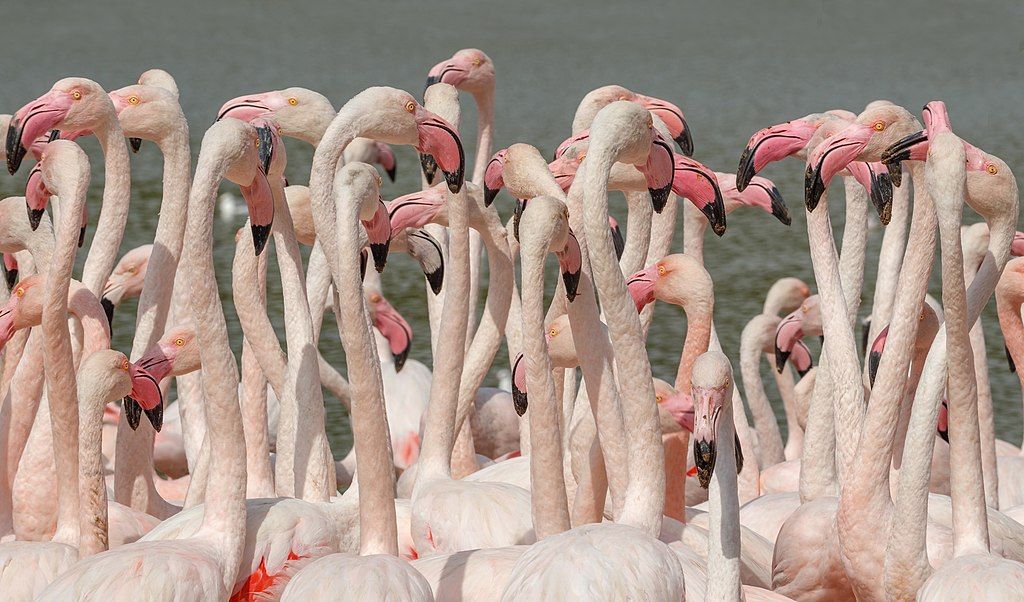
Flock of greater flamingos (photo from Wikimedia Commons)

13 September 2024: Day 7, at the Strait of Gibraltar, Tarifa, WINGS Spain in Autumn
Click here to see (generally) where I am today.

In Spanish the word “flamenco” is both a male adjective meaning “Flemish” and the name of the bird “flamingo.”

Several hundred years ago the term Flamenco was also used to identify the Romani people (Gitanos) of Spain, mistakenly identifying them as German/Flemish.

In the late 17th century the Gitanos in Andalusia developed a music and dance art form based on the folkloric music traditions of southern Spain. When this art form became famous it was called Flamenco.

So now we are in Andalusia, home of the real Flamenco. Video is from the 2016 Flamenco Festival at New York City Center.

video embedded from NYCityCenter on YouTube

We won’t see a flamenco performance on our birding trip but we have seen greater flamingos (Phoenicopterus roseus). Lots of them! They live year round in southern Spain.

Notice the moves these flamingos make during their courtship dance. (Click here to see on YouTube. These are Chilean flamingos.)

(video embedded from BBC America)

The flamingo moves are explained in the video below. I am especially fond of the Wing Thing. (Click here to see on YouTube.)

(video embedded from the Smithsonian Channel)

Since the same word is used for both the bird and the dance it makes me wonder: Where did the human dance moves come from? Did we adopt them by watching flamingos?

More Than a Hawk Watch

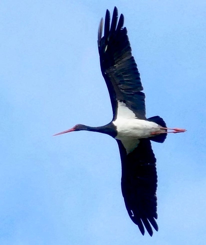
Black stork in flight, Algeria (photo from Wikimedia Commons)

12 September 2024: Day 6, Tarifa and birding at the Strait of Gibraltar, WINGS Spain in Autumn. Click here to see (generally) where I am today.

At U.S. hawk watches we track vultures, hawks, eagles, falcons and kites but rarely record other species at the official HawkCount.org. That is not the case at Tarifa where fall migration includes a total of 150,000 white storks (Ciconia ciconia) + black storks (Ciconia nigra).

This short video is the slow motion passage of four raptors. I am not sure of the first one but the others are two booted eagles (Hieraaetus pennatus) and an Egyptian vulture (Neophron percnopterus).

video embedded from Birding The Strait, Tarifa

Watch as huge numbers of soaring birds wait to cross the Strait. Notice the sound track! It is WINDY!

video embedded from Per Stensland on YouTube

Birding at the Strait is more than watching hawks.

p.s. We had a great morning on 10 September at Algarrobo hawk watch with thousands of hawks and eagles plus alpine & common swifts, four black storks, and 22 European bee-eaters.

The Pillars of Hercules

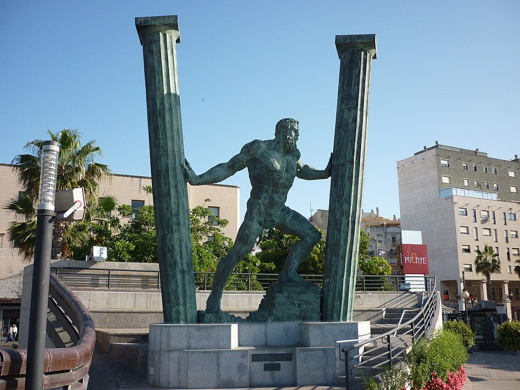
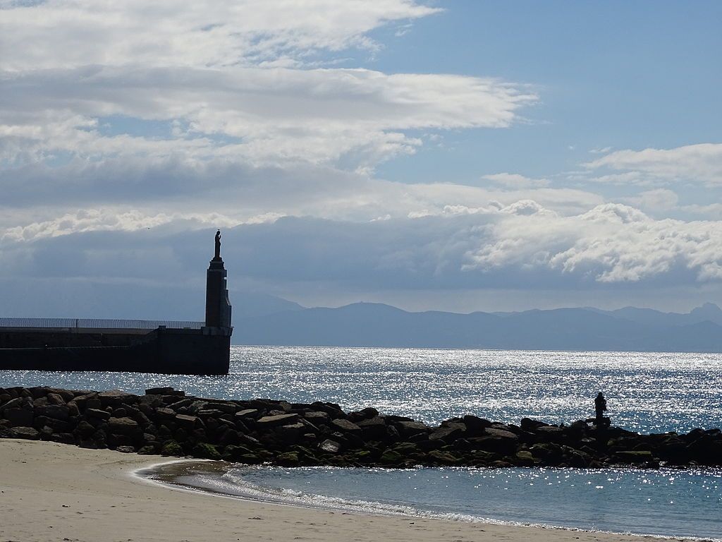
Hercules spreading the Pillars apart, statue at Ceuta, Spain in North Africa (photo from Wikimedia Commons)

22 September 2024

Yesterday I described the amazing geologic event that created the Strait of Gibraltar. There is also a myth about its creation that says it was made by Hercules.

In Greek mythology, Heracles (= Hercules) was the strongest and most courageous man on earth and the greatest hero of Greece. He often used his strength to help others but he was not very bright and sometimes experienced fearsome rages or (one time) temporary madness induced by the Goddess Hera that caused him to kill his wife and children.

Whenever Hercules caused trouble, he was always contrite and accepted punishment for his mistakes. He felt terrible about killing his family and willingly accepted the punishment of completing 12 impossible tasks, the Labors of Hercules.

The 10th task was to collect the cattle of Geryon (a monster), which were housed at the western end of the Mediterranean basin, and take them back to Cyprus. On the way there…

According to some Roman sources, while on his way to the garden of the Hesperides [to complete his 10th task] on the island of Erytheia, Hercules had to cross the mountain that was once Atlas. Instead of climbing the great mountain, Hercules used his superhuman strength to smash through it. By doing so, he connected the Atlantic Ocean to the Mediterranean Sea and formed the Strait of Gibraltar. One part of the split mountain is [the Rock of] Gibraltar and the other is either Monte Hacho or Jebel Musa. These two mountains taken together have since then been known as the Pillars of Hercules, though other natural features have been associated with the name.

Wikipedia: Pillars of Hercules

Interestingly, one version of the myth says the Mediterranean basin was dry at the time so Hercules’ action made it a sea again. It fascinates me that these myths describe something similar to what actually happened, even though humans would never have seen it. (According to Britannica the oldest known remains of the genus Homo date to 2.8–2.75 million years ago in Ethiopia.)

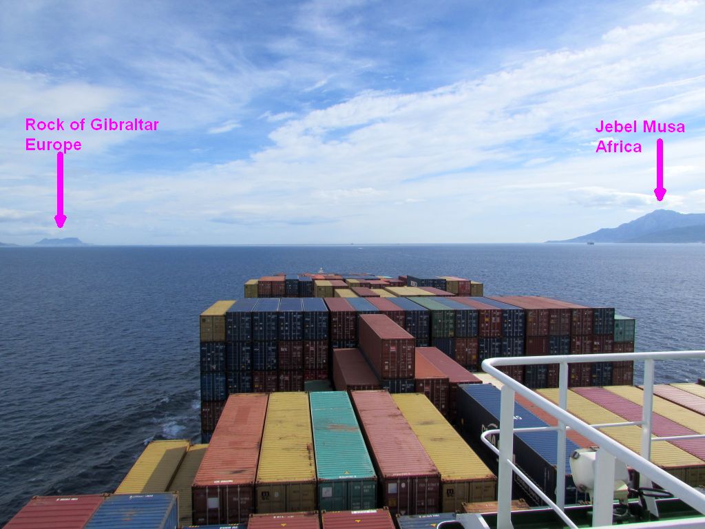
So now the Pillars of Hercules guard the entrance to the Mediterranean. No matter which way you sail through the Strait you will see them. In this photo a cargo ship is entering from the Atlantic so the Rock of Gibraltar in Europe is on the left, Jebel Musa (Mount Moses) in Africa is on the right.

Pillars of Hercules as seen while approaching from the Atlantic side of the Strait (photo from Wikimedia Commons)

p.s. At both sides of the Narrows there are governance surprises.

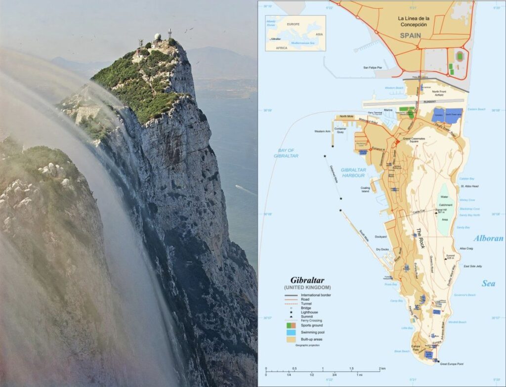
The Rock of Gibraltar and the town below it are a 2.6 sq.mi. British Overseas Territory called Gibraltar. It is not part of Spain. In 1704, Anglo-Dutch forces captured Gibraltar from Spain during the War of the Spanish Succession; it was ceded to Great Britain in perpetuity under the Treaty of Utrecht in 1713 (according to Wikipedia).

The Rock with Levant clouds and a map of Gibraltar, the British Overseas Territory (both from Wikimedia)

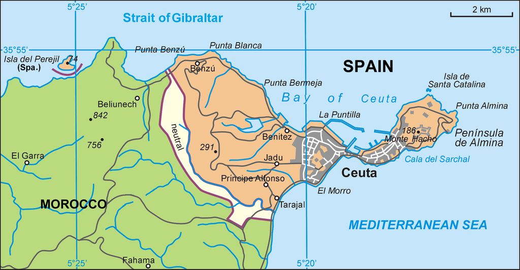
On the other side of the narrows on the Peninsula of Almina on the North African Coast is the town of Ceuta, an autonomous city of Spain. Ceuta is not part of Morocco. It is where the Pillars of Hercules statue stands, shown at top.

Map of Ceuta, Spain from Wikimedia Commons

What Made the Strait of Gibraltar?

Strait of Gibraltar at Tarifa (photo from Wikimedia Commons)

10 September 2024: Day 4, Tarifa and birding at the Strait of Gibraltar, WINGS Spain in Autumn. Click here for a map showing where I am today.

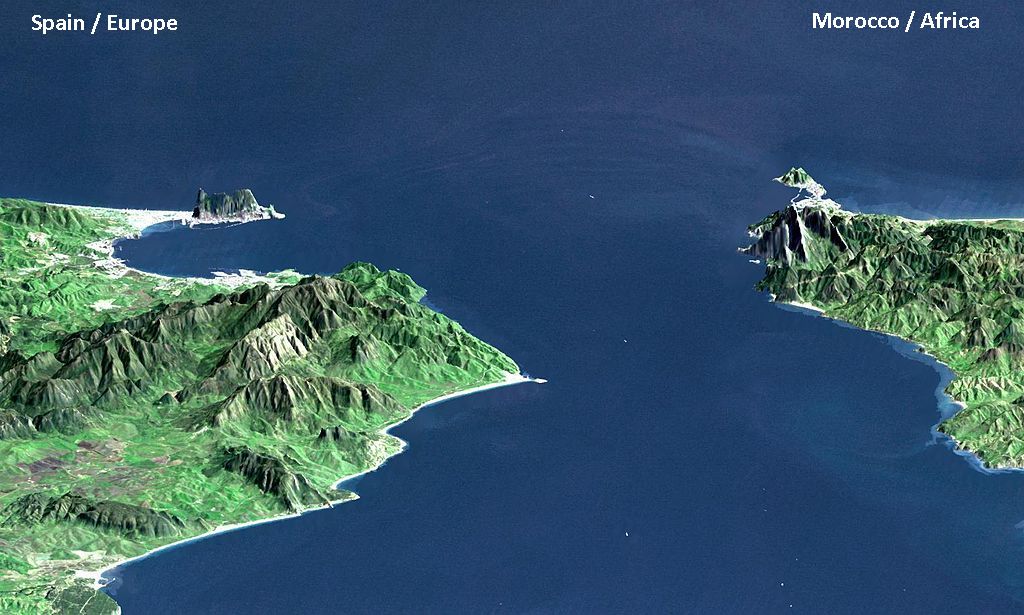
We are now at the Strait of Gibraltar, the closest point between Europe and Africa. At its narrowest the Strait is only 13 km (8.1 miles) across, flanked on each side by mountains.

3D map of the Strait of Gibraltar (image from NASA via Wikimedia Commons)

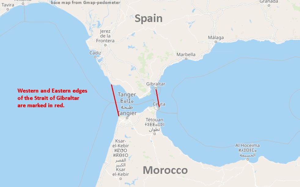
The passage is longer east-to-west than it is wide –> 58 km (36 miles) from beginning to end. Its current, water flow and variable depth give scientists clues as to how it was formed.

Western and eastern edges of the Strait of Gibraltar, marked in red (base map from gmap-pedometer)

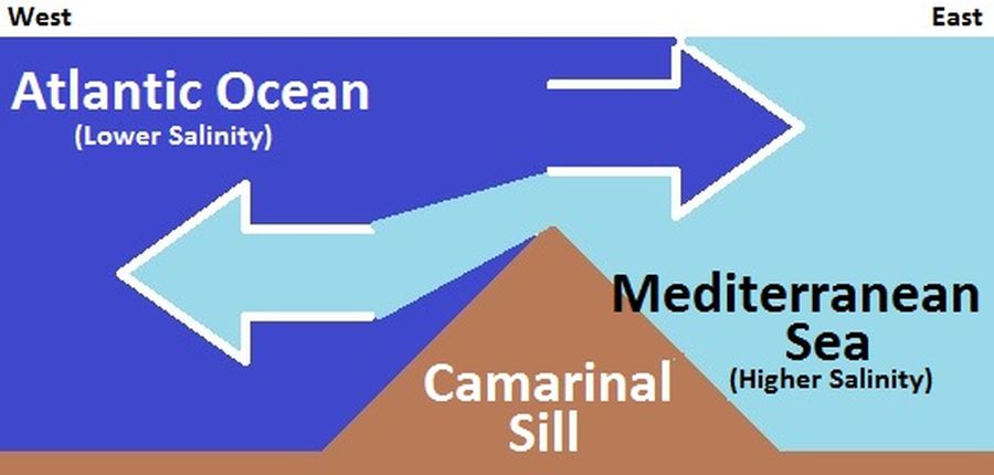
Water flows through the Strait more or less continuously, both east and west, but the balance of water moves eastward from the Atlantic into the Mediterranean. That’s because the Mediterranean evaporates faster than tributaries and precipitation can fill it. The Atlantic pours in but the Mediterranean stays saltier than the Atlantic Ocean.

In fact, Mediterranean waters are so much saltier that they sink below the constantly incoming Atlantic and form a warm highly saline layer of bottom water called a thermohaline. You can see this in the schematic of the Camarinal Sill which is west of the Narrows.

Schematic of water flow at western side of the Strait of Gibraltar (image embedded from Wikimedia Commons)

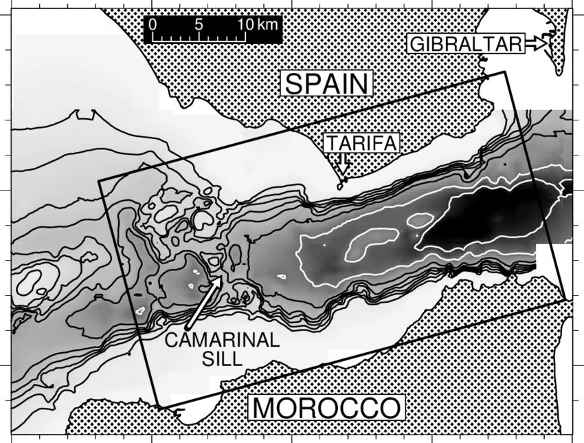
While the Camarinal Sill is the shallowest point (280 m = 920 ft deep), the deepest point is at the Narrows (900 m = 3,000 ft deep). Deep water is black on this underwater topo map.

Underwater topographic map of the Strait of Gibraltar, darkest colors are deepest (from Alpers Recent contributions of remote sensing to the study of internal waves in the straits of Gibraltar and Messina at ResearchGate)

With only 25km (15.5 miles) between the two points the flow often generates internal (subsurface) waves that can be seen from satellites, though they don’t look like waves in surface navigation.

Internal waves — not breaking the surface — in the Mediterranean at the Strait of Gibraltar (satellite image via Wikimedia Commons, color-corrected)

And there is certainly a lot of surface navigation! Every time we look at the Strait there are ships on it. The Strait is the one of the busiest and most crowded waterways in the world. Half the world’s trade and one third of the world’s oil and gas pass through the Strait, according to a CityAM article in 2015.

Cargo ship heading east into Mediterranean after leaving Strait of Gibraltar (photo from Wikimedia Commons)

Incredibly, the Strait of Gibraltar did not exist in the Miocene era when saber-toothed tigers roamed the earth. Here’s how the Strait came to be.

About 6 million years ago plate tectonics(*) closed the connection between the Mediterranean and the Atlantic. Without an influx of water the entire Mediterranean Sea evaporated, leaving behind salt and gypsum deposits. This Messinian Salinity Crisis lasted roughly 700,000 years. Then, rather suddenly, a leak developed between Africa and Europe. It quickly eroded a deep channel to the Mediterranean and eroded backwards (upstream) to create the Gulf of Cadiz. This video of an experimental dam failure shows how that looks.

video embedded from SAF Labratory on YouTube

The Zanclean Flood happened quite rapidly! The Mediterranean filled up within two years!

90% of the Mediterranean Basin flooding occurred abruptly during a period estimated to have been between several months and two years, following low water discharges that could have lasted for several thousand years. Sea level rise in the basin may have reached rates at times greater than ten meters per day (30 feet per day).

Wikipedia: Zanclean Flood account

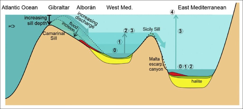
The result is an underwater topography carved by the flood. This diagram shows the marine floor but is not to scale (described below). It comes from ScienceDirect: The Zanclean megaflood of the Mediterranean – Searching for independent evidence — Daniel Garcia-Castellanos et al.

Cartoon (not to scale) showing the timing and the flood erosional and depositional features expected in the eastern and western basins of the Mediterranean as a result of a large water input through the Gibraltar gateway, showing 5 stages: 0) Initial level before significant Atlantic inflow occurred; 1) time of maximum erosion rate at the Strait of Gibraltar; 2) the western basin level reaches the Sicily Sill. 3) eastern basin level reaches the Sicily Sill; and 4) the Mediterranean is filled to the normal oceanic level. — ScienceDirect: The Zanclean megaflood of the Mediterranean – Searching for independent evidence — Daniel Garcia-Castellanos et al)

Everyone had to run away from the flood while the Strait was being formed.

(*) p.s. Plate tectonics closed the Strait 6 million years ago. At present the African Plate is subducting under the Eurasian Plate in the Mediterranean region. Africa is slamming into Europe, albeit very slowly.

UPDATE 25 Sept 2024: Science Magazine: Fossils tell tale of devastating mass extinction when Mediterranean dried up

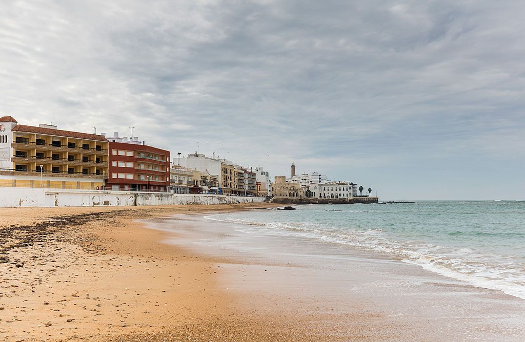
From the Beach

Beach at Chipiona near the mouth of the Guadalquivir (photo from Wikimedia Commons)

9 September 2024: Day 3, birding in Chipiona and driving to Tarifa, WINGS Spain in Autumn
Click here to see (generally) where I am today.

Yesterday we went birding at local hotspots near Chipiona. One of the best was Playa de Montijo at the mouth of the Guadalquivir River. We arrived just after high tide so the cobbles beyond the sand (not shown above) were exposed yet the birds were still close.

(embedded Google map of Playa de Montijo, Chipiona, Spain)

Since I wrote this article before this trip, the birds shown below are a selection of what was seen a year ago in September 2023. We saw them!

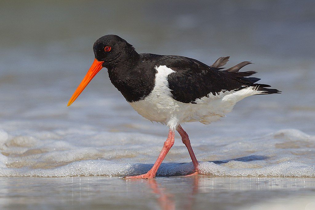
Of the 11 species of living oystercatchers, only the Eurasian oystercatcher (Haematopus ostralegus) has a distribution in Europe and Asia north of the equator. It is a Near Threatened species. We saw several noisy groups bowing and shouting, 25 in all.

Eurasian oystercatcher, adult (photo from Wikimedia Commons)

A few whimbrelds fed near the oystercatchers. Interestingly the whimbrel (Numenius phaeopus) has recently been split into Eurasian whimbrel and Hudsonian whimbrel. Some taxonomic authorities do not accept the split and have kept them as one species. Alas, eBird is one of them so I won’t gain this Life Bird until eBird says changes its mind.

The bar-tailed godwit (Limosa lapponica) is the most cosmopolitan of godwits, breeding in northernmost Eurasia and Alaska and spending the winter on the coasts of Africa, southern Asia, Australia and New Zealand. Its close relatives — black-tailed, Hudsonian and marbled godwits — are all New World birds.

The common greenshank (Tringa nebularia) resembles a greater or lesser yellowlegs except that its legs are green. All of them are in the Tringa genus.

Last September there was quite a collection of birds on this rocky bar including Eurasian oystercatchers, a black-bellied plover, common terns and the rare-to-the-area elegant tern. We saw them all plus a rare roseate tern.

A bonus for me was the slender-billed gull (Chroicocephalus genei).

Great birding from the beach.

Out to Sea

Balearic shearwater (photo from Wikimedia Commons) (used here)

8 September 2024: Day 2, birding near Chipiona, WINGS Spain in Autumn. Pelagic eBird Hotspot = Salida Pelágica desde Chipiona Click here to see (generally) where I am today.

This morning we’re at the coast in lovely weather. But out to sea, beyond the continental shelf, the wind is blowing hard and the sea is too rough for our planned pelagic birding tour in the Gulf of Cadiz in a boat that comfortably holds 12 people.

No problem. There are plenty of birds to see from land, some of which we would have seen on the boat and I’m willing to pass up an opportunity to learn about seasickness.

One of birds we cannot see from here is the critically endangered Balearic shearwater (Puffinus mauretanicus).

The Balearic Shearwater is one of the rarest birds in Europe, being one of just two species there to be listed as Critically Endangered on the IUCN Red List. Its successful conservation will require considerable effort, across country borders. As its name implies, as a breeder this shearwater is confined to the Spanish-owned Balearic Islands in the western Mediterranean, where its population is usually estimated at just 1,800–2,500 breeding pairs (of which about 50% nest on Mallorca).

… Counts at sea (especially through the Strait of Gibraltar) suggest it is possibly more numerous, which has led to a revised estimate of 24,000–26,500 individuals.

Birds of the World: Balearic shearwater account

This bird might be really rare. Or there might be 10 times as many as we thought.

Balearic shearwaters are regularly seen in autumn in the Gulf of Cadiz as they leave their breeding grounds on the Balearic Islands in the Mediterranean …

Balearic Islands, province of Spain (map from Wikimedia Commons)

… and move to the Atlantic and the North Sea for the winter.

Range map of the Balearic shearwater (map from Wikimedia Commons)

To me shearwaters all look the same so I would never have known I was looking at a Balearic shearwater without a guide. They’re a little like confusing fall warblers. 😉

UPDATE on 24 Sept 2024: In Tarifa on 11 September we did a seawatch at Isla de las Palomas where we saw Baelaric shearwaters flying close to shore … and flamingos!

Atlantic Inlet Became a River

Sunset at Brazo del Este del Guadalquivir (photo from Wikimedia Commons)

7 September 2024: Day 1, East bank of the Guadalquivir River and birding en route to Chipiona, WINGS Spain in Autumn
Click here to see my evening destination today

Today we follow the Guadalquivir River from Seville to the the ocean at Chipiona, birding along the way. This 51 mile stretch of river used to be an inlet of the Atlantic Ocean, but by the time of the Romans it was Lacus Ligustinus, a salty lake. Since then the lake has silted up and become a big marsh with a river running through it.

Lacus Ligustinus (map from Wikimedia Commons)

The Guadalquivir River has many twists and turns and some oxbow lakes but the downriver section (highlighted on map) has been straightened and channelized for navigation to Seville.

map of Guadalquivir River, markup highlights final section (from Wikimedia Commons)

Meanwhile the marsh on both sides of the river is crisscrossed with canals to drain it for agriculture. The former eastern branch of the Guadalquivir River (Brazo del Este del Guadalquivir) is cut off from the main channel. In 1989 4,000 acres of it, mainly following the old river, were protected as a natural area.

embedded Goggle map of Brazo del Estes del Gualdalquivir

eBird and our tour description both indicate we’ll find marbled duck, white-faced duck, red-knobbed coot, Spanish eagle, greater flamingo and white stork at the marsh.

  • Marbled duck

… plus the hoped-for star of the show, the collared pratincole. I saw this species loafing on river banks in Botswana but I have never seen it fly.

embedded video by Per Stensland on YouTube

I’m also hoping to see Eurasian spoonbills (Platalea leucorodia). Here’s a pair in Portugal discussing their next move.

Eurasian spoonbills in Portugal: “Well, what do you think? Do you want to go to Spain?” (photo from Wikimedia Commons)