Category Archives: Water and Shore

Wild Bird Flu Outbreak in PA & Delaware

Snow geese landing in a field in Central PA, Jan 2023 (photo by fishhawk via Flickr Creative Commons license)

3 January 2025

On New Year’s Day Paul Nale reported hundreds of dead and dying snow geese in Northampton County on the PA Birders Facebook group.

screenshot of PA Birders Facebook post by Paul Nale on 1 Jan 2025

There were over 100 dead and dying snow geese at the limestone quarry in Nazareth PA [Northampton County] this afternoon. We have a possible avian influenza outbreak on our hands. I have contacted the PA Game Commission.

PA Birders Facebook Post, 1 January 2025 by Paul Nale

Yesterday the PA Game Commission said there were also dead snow geese at Upper Macungie Township in Lehigh County, both with a “strong suspicion of avian influenza.”

UPDATE as of 8:50 AM 1/2/25: The PA Game Commission has had specialists in the quarry at Nazareth to collect the dead snow geese. There are reportedly hundreds now. There are too many to even try to collect them all. The birds are reportedly on their way to or at the lab for autopsy. In my post last evening, I used the word POSSIBLE … This morning the staffer calling me used the words “strong suspicion of avian influenza.” Tests will confirm or reject that hypothesis.

PA Birders Facebook Post, 2 January 2025 by Paul Nale

The Pennsylvania outbreak follows quickly on the heels of a similar outbreak in Delaware just five days earlier.

On 27 December dead and dying snow geese were discovered at Prime Hook and other sites in Surrey County, DE. On 28 December the State of Delaware confirmed avian influenza and warned poultry farmers and the public to take precautions.

It is not surprising that bird flu is spreading in the wild from state to state. Birds fly and Prime Hook, Delaware is only 130 miles from Nazareth, PA, well within the snow goose range of up to a thousand miles per day in migration.

Meanwhile, the state of Pennsylvania urges everyone to take these precautions:

from PA Press Release, 2 Jan 2025, INFLUENZA SUSPECTED IN SNOW GOOSE MORTALITIES

  • Those encountering sick or dead wild birds can report them to the Pennsylvania Game Commission by calling 1-833-PGC-WILD (1-833-742-9453), by emailing pgc-wildlifehealth@pa.gov or by using the online Wildlife Health Survey tool.
  • Any sick or dead domestic birds should be reported to Pennsylvania Department of Agriculture at 717-772-2852. If you have had contact with sick or dead birds and are not feeling well, contact your primary care physician or the Pennsylvania Department of Health at 877-724-3258.
  • Always observe wildlife from a safe distance. Avoid contacting surfaces that may be contaminated with feces from wild or domestic birds. Do not handle wildlife unless you are hunting, trapping, or otherwise authorized to do so.
  • Waterfowl hunters are encouraged to continue participating in the remaining season, but should take precautions while handling and dressing birds. These include wearing nitrile gloves, protective eye wear, and a mask. Following any hunt make a point to practice good hygiene, including washing hands and any clothing used in the process of dressing game that may contain blood or feces. Finally, never handle wildlife that is sick or displaying signs of sickness. Instead, report it to the Game Commission.

At this moment bird flu can only be caught by human contact with infected birds or animals but we should take care not catch it. Why? Because the more people who catch it, the more likely it will mutate within humans to something we can spread directly to each other. When that happens, all bets are off. Read more about bird flu transmission and humans at the BBC.

p.s. This map of recent HPAI (highly pathogenic avian influenza) outbreaks in the wild is current to 9 Dec 2024. It is maintained by USDA but does not yet include this week’s news from PA and Delaware which I’ve added in pink. Watch here for a USDA update this month!

States detecting HPAI (bird flu) in wild birds in last 30 days as of 9 Dec 2024 (map from USDA) — updated in pink with PA & DE outbreaks 27 Dec to 1 Jan 2025

Just a Few Rare Geese

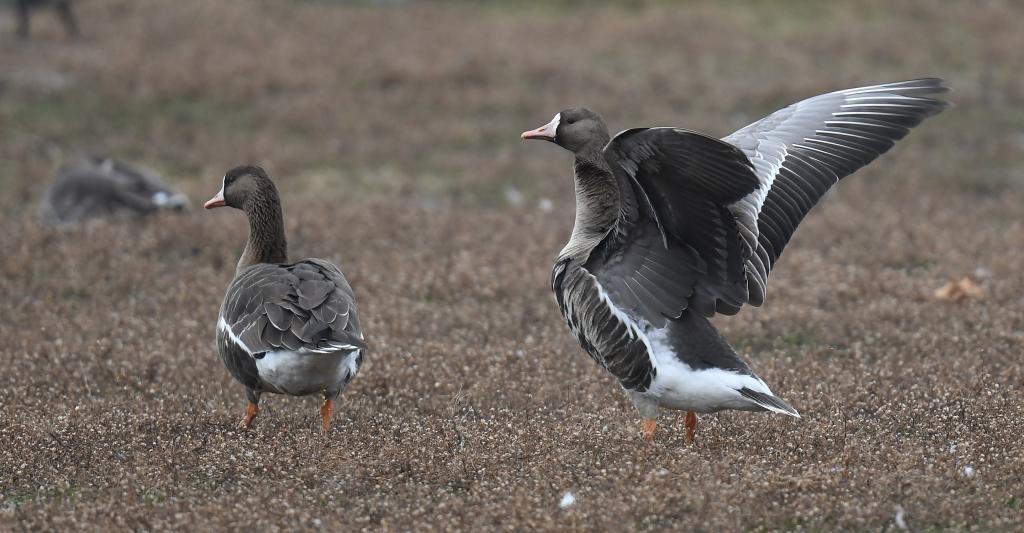
Greater white-fronted geese (photo from Wikimedia Commons)

23 December 2024

It seems that Pittsburgh missed waterfowl migration this fall with only a handful of the expected migrants landing on our rivers and lakes. Except for long distance migrants, waterfowl haven’t come at all.

Some ducks, geese and gulls only move south when ice overtakes their location. If they’re hanging out at Lake Erie near Presque Isle, the map of yesterday’s water temperature indicates they have no reason to leave. The water there is more than 40°F and the only ice is in small bays (black color on the map).

Great Lakes surface Temperature and ice cover as of 22 Dec 2024 (map from Great Lakes Environmental Research Lab)

There are a few rare geese, though, photographed and posted to eBird and embedded below.

There’s currently a Ross’s goose (Anser rossii) at North Park, noticeably small than the Canada geese it’s hanging out with.

Yesterday there was a brant (Branta bernicla) at Duck Hollow without any Canada geese to keep it company. So it hung out with ring-billed gulls.

And a flock of 16 greater white-fronted geese (Anser albifrons) who normally migrate west of the Mississippi and winter in Louisiana, southern Texas and Mexico have been hanging out with Canada geese in Butler County since 1 December.

These geese are called “white-fronted” because their foreheads are white.

Wondering why the ducks aren’t here? This 2021 vintage article explains why.

Creatures of the Chilean Deep

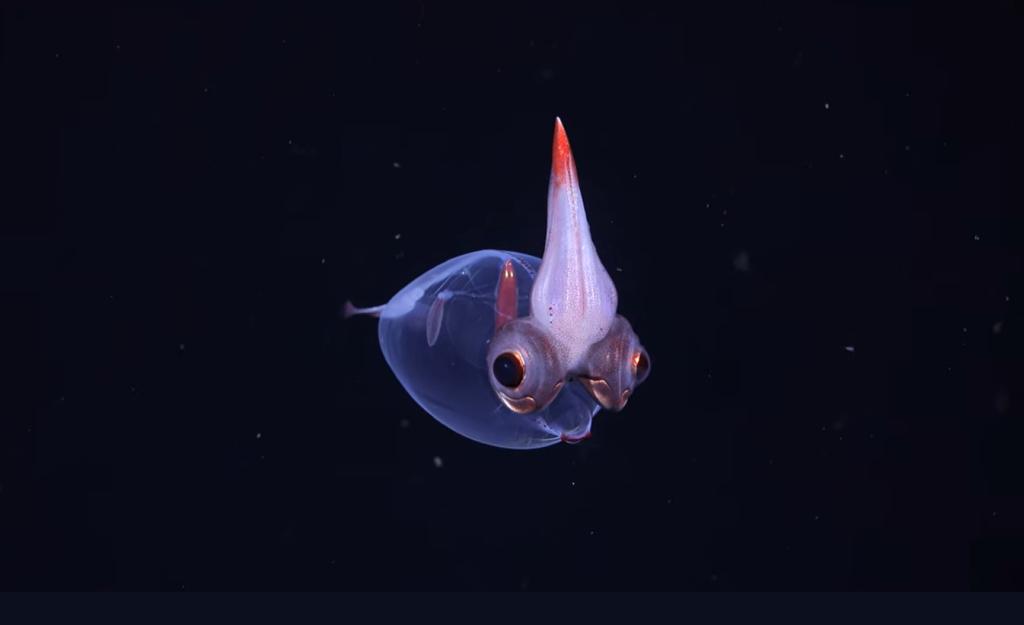
Deep-dea glass squid, Chile Margin in Pacific Ocean (screenshot from Schmidt Ocean video below)

20 December 2024

This month Schmidt Ocean posted a beautiful deep sea video from their deep sea rover’s voyage off the Pacific coast of South America.

11 Dec 2024: After 55 days of exploration, the #ChileMargin2024 expedition team is heading home. Researchers have been exploring along a margin where a submerged continental shelf extends from the country’s west coast and drops steeply and suddenly into the Pacific Ocean.

video description from Schmidt Ocean on YouTube
video embedded from Schmidt Ocean on YouTube

Did you see the rocks and cliffs in the video? If you could see the entire formation without the ocean in the way, it is actually a very steep mountain range from the bottom of the trench to the top of the Andes, more than 15,000 meters or about 49,300 feet(*) with squids at the bottom and birds at the top.

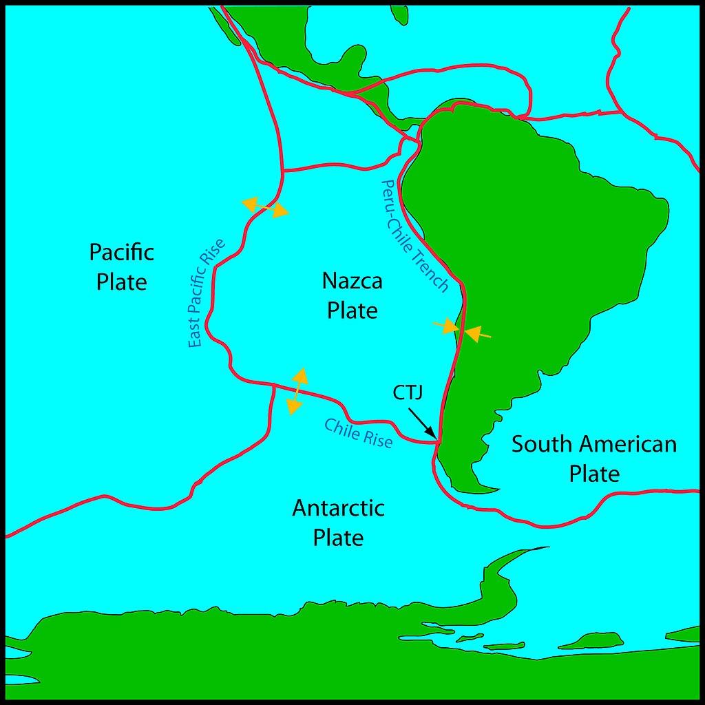
This area is so deep because the Nazca Plate is subducting under the South American Plate, causing the Andes to rise and the Peru-Chile Trench to plunge deeper.

Nazca Plate is subducting under the South American Plate (map from Wikimedia Commons)

And who is the creature with the big eyes and cockatoo crest? Learn more in this short video from Schmidt Ocean on Instagram.

(*) The Himalayas are 8,849 meters (29,032 feet).

Schmidt Ocean Institute is a 501(c)(3) private non-profit operating foundation established to advance oceanographic research, discovery, and knowledge, and catalyze sharing of information about the oceans. 

About Schmidt Ocean Institute

Great Lakes Water is a One Time Gift

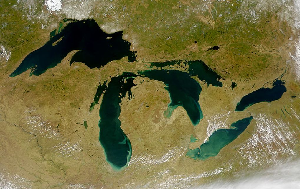
Satellite image of the Great Lakes from space, April 2000 (photo from NASA via Wikimedia)

11 December 2024

While writing about Lake Erie last month I found this amazing fact.

The Great Lakes hold nearly 20% of the world’s fresh surface water. And, more astonishingly, the lakes hold more than 90% of North America’s fresh surface water.

But this water supply is not unlimited. The Great Lakes are a one-time gift from the glaciers that melted in our region thousands of years ago. Less than 1 percent of the lakes’ water is renewed annually through rainfall and snowmelt. That means the Great Lakes can be depleted if we don’t keep Great Lakes water in the Great Lakes Basin.

Alliance For The Great Lakes: The Great Lakes Compact

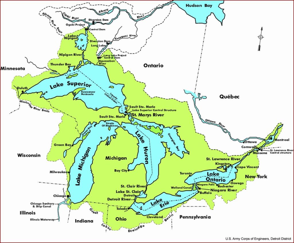
The Great Lakes watershed map shows how little of the surrounding land drains into lakes. This is especially true of northern Pennsylvania and Chautauqua County, NY.

Great Lakes watershed map (from Wikimedia Commons via USACE)

As climate change puts enormous strains on fresh water resources, multinational companies look longingly at bottling our rivers and lakes. Fortunately the Great Lakes basin had an early wake up call.

In 1998, an obscure Canadian consulting company, the Nova Group, announced its intention to ship 158 million gallons of Lake Superior water to Asia. Though that specific plan seemed unlikely to materialize, it raised alarms about the vulnerability of the Great Lakes in an increasingly hot and thirsty world.

Alliance For The Great Lakes: The Great Lakes Compact

And so the Great Lakes Compact was born. Signed into law in 2008, it prohibits diversion of water outside the Great Lakes basin with very limited exceptions.

This one-time gift of the Ice Age glaciers won’t be frittered away.


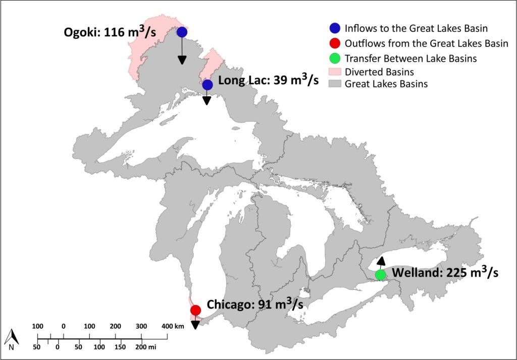
p.s. Prior to 1945 humans diverted Great Lakes water in four locations but these have barely made a dent in the total watershed.

  • Ogoki pulls water from Hudson Bay watershed into Lake Superior. 1943.
  • Long Lac pulls water from Hudson Bay watershed into Lake Superior. 1939.
  • The Chicago River is diverted away from Lake Michigan and into the Mississippi watershed. Beginning in the 1800s.
  • Welland Canal is a navigation channel from Lake Erie to Lake Ontario that bypasses Niagara Falls. Beginning in 1824.
Great Lakes diversions map from International Joint Commission (of the US & Canada)

The combined effects of the Long Lac, Ogoki and Chicago diversions and the Welland Canal have been to permanently raise Lake Superior by an average of 2.1 centimeters (0.8 inches), lower Lakes Michigan-Huron by 0.6 cm (0.2 in), lower Lake Erie by 10 cm (4 in) and raise Lake Ontario by 2.4 cm (1 in), according to the IJC’s 1985 Great Lakes Diversions and Consumptive Uses report. 

international Joint Commission: An Overview of Great Lakes Diversions

2nd p.s. The Colorado River Basin is an extreme example of what happens when water is diverted. See Disappearing Into This Air.

This Can’t Be Good for Our Eagles

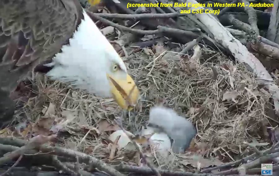
Bald eagle with nestling, 23 March 2019 (screenshot from Bald Eagles in Western PA – Audubon Facebook page)

26 November 2024

On 14 November The Allegheny Front described oil pollution on the Monongahela River that’s been happening for more than two years. Monitored by Three Rivers Waterkeeper since May 2022, an oil sheen sometimes covers the water from bank to bank for three miles, all the way to McKeesport. This can’t be good for our bald eagles who nest along on the Mon and eat fish from its water.

In October 2023 Three Rivers Waterkeeper posted photos of the oil sheen on Instagram.

“These are pretty serious sheens,” said Captain Evan Clark, a boat captain for Three Rivers Waterkeeper. “When I’m boating around up there, my boat is running through a heavy rainbow sheen that can extend from one bank of the river to the other, literally for miles.”

In August 2022, an EPA inspector reported oil discharge from the plant’s outfall, or drainage pipe, and found “substantial rainbow sheening could be seen for approximately 3 miles downstream.”(*)

The Allegheny FRONT: Group wants stricter permit for U.S. Steel to stop oily releases into Mon River

Last year the Pennsylvania Dept of Environmental Protection (DEP) determined the oil was coming from a USS Irvin Works outfall and “issued a compliance order requiring U.S. Steel to deploy absorbent booms, investigate the cause of the releases and implement a plan to fix any problems.” — The Allegheny Front 

But a year later the problem has not been addressed and it happened again last month. DEP has proposed setting a water pollution permit level on that outfall. Three Rivers Waterkeeper wants real-time monitoring on it.

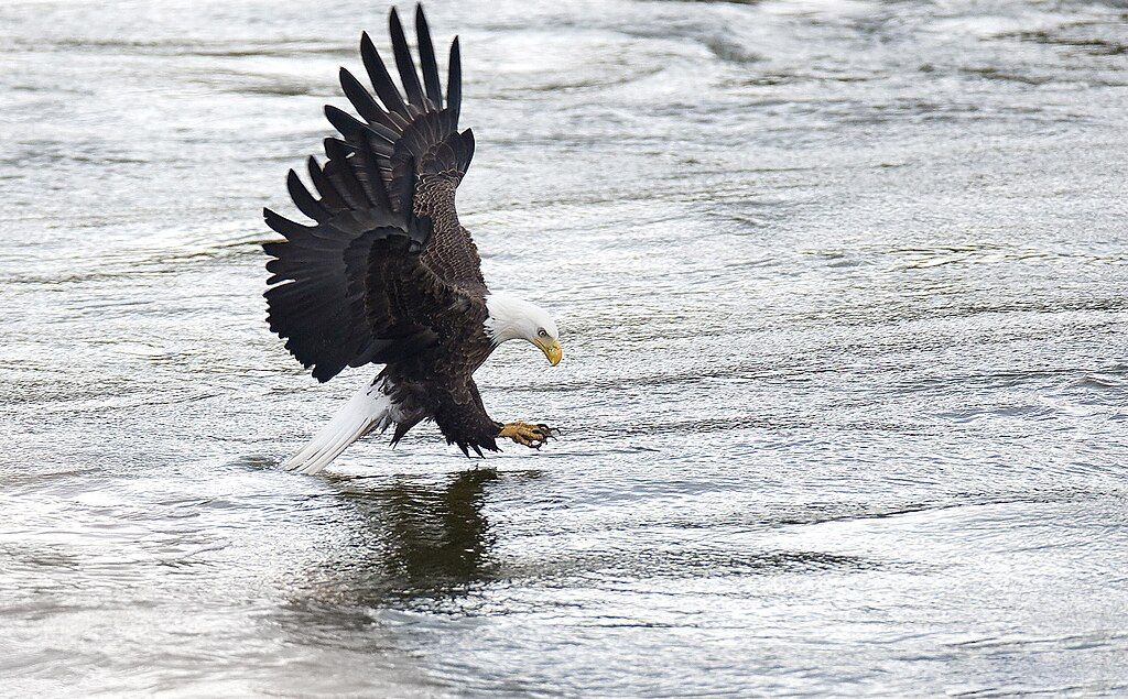
Meanwhile, oil-covered water cannot be good for our bald eagles who touch the water’s surface and eat fish and waterfowl captured in or on the water.

Bald eagle about to catch a fish (photo from Wikimedia Commons)

During an oil sheen episode the pair that nests at USS Irvin Works cannot hunt the Mon for three miles downstream of their nest without being exposed to the oil. This is a lot of territory to avoid with hungry chicks in the nest.

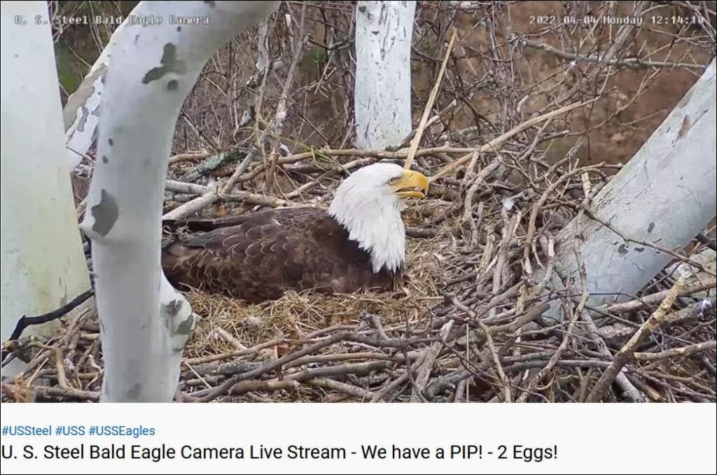
screenshot from USS Irvin Works Eaglecam via PixCams on YouTube, 5 April 2022

Employees at USS Irvin Works are so proud of their bald eagle pair that the company installed an eaglecam to watch them at the nest. Surely USS Irvin Works will clean up this outfall to protect everyone who uses the Mon including their favorite eagles.

Read more about the issue here at The Allegheny Front …

… and WTAE’s 26 November report: Mon River oil sheens: Environmentalists urge stricter enforcement on US Steel.

Some Ducks at Duck

25 November 2024

Charity Kheshgi and Jon Woon joined me yesterday at Duck Hollow where we looked for birds under extremely overcast skies. Unfortunately the ducks were so far away and the light was so poor that we have no photos to show for it. Instead I’ve embedded look-alike photos from Macaulay Library.

Best birds were these very distant ducks.

1 Canvasback female (sample photo above): We pondered this bird for a long time because she was paired with a male ring-necked duck. Yes, she was a canvasback. We were witnessing future hybridization within the Aythya genus.

The Ring-necked Duck entry in Birds of the World includes eBird records with photos of hybrids between Ring-necked Ducks and Canvasback, Redhead, Tufted Duck, and Great and Lesser Scaup.

Eastside Audubon Bird of the Month

1 Ring-necked duck, male. Easy to identify because of his head shape and white striped beak.

1 Hooded merganser, female. She kept her crest sleeked back even more than this.

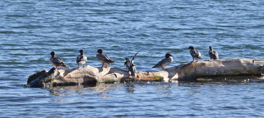
12 Common mergansers flew by but were never as close to us as this group in good light on 9 November.

Common mergansers at Duck Hollow, 9 Nov 2024 (photo by Charity Kheshgi)

I’ve put our best ducks in boldface. See our checklist online at https://ebird.org/checklist/S203488389.

Duck Hollow, Allegheny, Pennsylvania, US
Nov 24, 2024 8:30 AM – 10:00 AM
Protocol: Traveling, 1.2 mile(s)
22 species

Canada Goose (Branta canadensis) 55
Mallard (Anas platyrhynchos) 30
Canvasback (Aythya valisineria) 1 Female
Ring-necked Duck (Aythya collaris) 1 Male
Hooded Merganser (Lophodytes cucullatus) 1
Common Merganser (Mergus merganser) 12
Pied-billed Grebe (Podilymbus podiceps) 2

Red-tailed Hawk (Buteo jamaicensis) 1
Belted Kingfisher (Megaceryle alcyon) 1
Blue Jay (Cyanocitta cristata) 3
American Crow (Corvus brachyrhynchos) 2
Carolina Chickadee (Poecile carolinensis) 2
Carolina Wren (Thryothorus ludovicianus) 4
European Starling (Sturnus vulgaris) 50
American Robin (Turdus migratorius) 125 Along the road
Cedar Waxwing (Bombycilla cedrorum) 1
House Finch (Haemorhous mexicanus) 10
American Goldfinch (Spinus tristis) 3
Dark-eyed Junco (Junco hyemalis) 12
White-throated Sparrow (Zonotrichia albicollis) 4 This is probably a low count
Song Sparrow (Melospiza melodia) 5
Northern Cardinal (Cardinalis cardinalis) 3


p.s. Here’s how overcast it was. I took this sky photo when I got home.

Overcast sky in Pittsburgh, 24 Nov 2024 (photo by Kate St. John)

Watching a Live Stream

Stream at Acadia National Park, Sept 2013 (photo by Kate St. John)

22 November 2024

“Sorry I can’t talk right now. I’m watching a live stream.”

So said U.S. Fish and Wildlife with their video of salmon swimming upstream.

Stream watching can be very peaceful, as I found at Powdermill Run.

Powdermill Run soundscape, 19 August 2023 (video by Kate St. John)

“Sorry I can’t talk right now. I’m listening to a live stream.”


p.s. Mike Fialkovich watched a live stream, too, at Slippery Rock Creek.

McConnell's Mill State Park Video 10-24-2024 (2)

Wind Makes Lake Erie Slosh Like a Bathtub

A shallow shore at Lake Erie (photo from Wikimedia Commons)

19 November 2024

Those who live at the eastern and western ends of Lake Erie are well aware that a strong west wind can trigger a storm surge in Buffalo and dry lake bottom at Toledo. When the storm is gone it becomes a seiche that makes the lake slosh back and forth like a bathtub. If you’ve never seen it, these videos will help.

Of all the Great Lakes, Lake Erie is the most likely to slosh because it is shallow and oriented along the storm path. The wind has a long distance (fetch) to kick up waves and amplify the effect.

Map of Great Lakes highlighting Lake Erie (from Wikimedia Commons)

What is a seiche? The name comes from the French word meaning “dry.”

video embedded from Sandusky Register News on YouTube

First there is wind, then the water becomes a standing wave as it moves to reach equilibrium.

Phenomenon of seiches (image from Wikimedia Commons)

On 10 November there was a big seiche event that exposed the lake bottom at Toledo.

video embedded from WTVG Toledo YouTube

Tomorrow and Thursday a strong cold front will sweep west to east across the region with winds gusting as high as 38mph. Perhaps there will be another seiche.

From Flood to Drought in Four Months

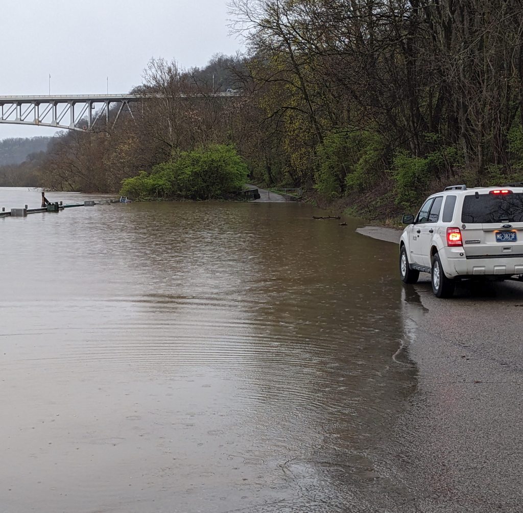
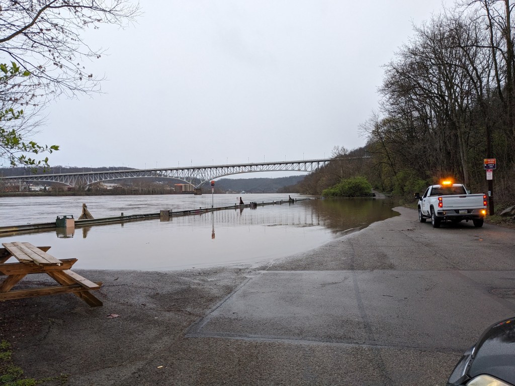
4 April 2024, 7:26am ET: Monongahela Rivers floods Duck Hollow parking lot

11 November 2024

In late October all of Pennsylvania went into a Drought Watch. We are not alone.

Every US state except Alaska and Kentucky is facing drought, an unprecedented number.

More than 150 million people and 318 million acres of crops are affected by drought after a summer of record heat.

Guardian: Nearly all of US states are facing droughts, an unprecedented number

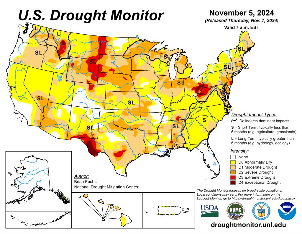
As of 5 November the drought is Severe to Extreme in Southeastern Ohio, West Virginia, western Maryland and the southwestern corner of Pennsylvania.

US Drought Monitor from UNL

The amazing thing is that it took only four months to get that way.

In April the Monongahela River flooded the Duck Hollow parking lot — twice — when we had two downpour days of more than 2.6 inches each.

Duck Hollow parking lot — A River Runs Through It — 4 April 2024, 7:19am ET

Then it stopped raining in June and the weather turned exceptionally hot. A drought began in July that became Severe that month in West Virginia and western Maryland.

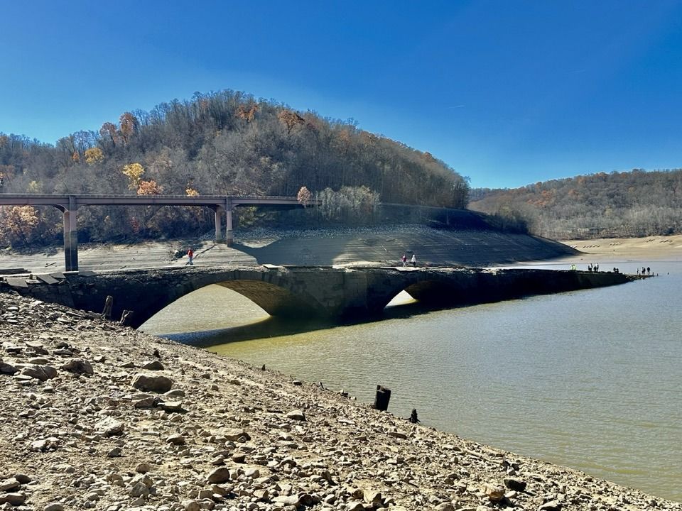
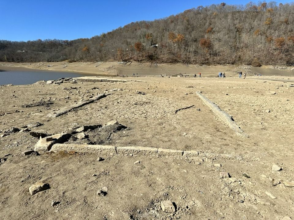
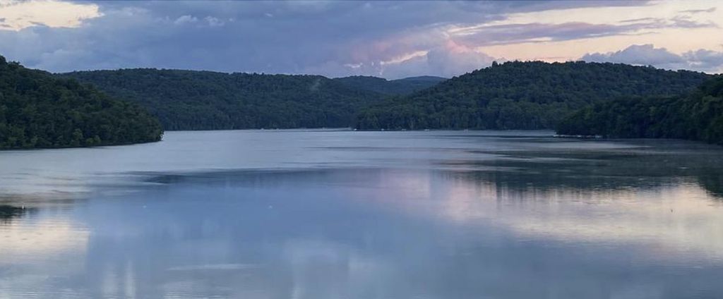
By late August the boating season was over at Youghiogheny River Lake due to low water. On 1 November when Judy Stark took these pictures, the lake had dropped so far that an old bridge and the foundations of a submerged town were revealed above low water.

Drought reveals old bridge on Youghiogheny River Lake, 1 Nov 2024 (photo by Judy Stark)
Drought reveals remains of Old Somerfield in Youghiogheny River Lake, 1 Nov 2024 (photo by Judy Stark)

In just four months the Monongahela River switched from flood to drought. Since it flows from West Virginia to Pittsburgh, it’s useful to look at precipitation in Morgantown, WV to understand these extremes.

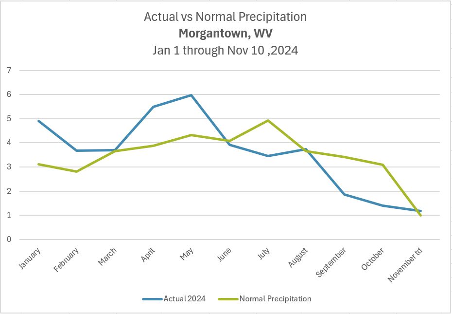
The graph below shows Morgantown’s 2024 monthly precipitation through yesterday, 10 November. Normal precipitation is in green, Actual is in blue. Notice it was at or above normal until July and severely below normal in September and October. (“Normal” precipitation in August came in two downpours that ran off rather than soaking in.)

Monthly Actual vs. Normal Precipitation in Morgantown WV, Jan 1 – Nov 10, 2024 (graph by Kate St. John using NWS data)

Yesterday it rained in the Monongahela watershed for the first time in weeks, a long soaking rain that lasted all day. In Morgantown it accumulated just over an inch (1.02″) and was enough to match their month-to-date “normal” for November.

We’re so thankful for yesterday’s soaking rain but we’ll need more than one day to end the drought.

Fingers crossed. Thursday looks good for rain.


p.s. Yes, Sunday’s rain was not enough. This evening KDKA TV News showed footage of brush fires over the weekend, including one that was burning while it was raining.

video embedded from CBS Pittsburgh on YouTube

The NWS meteorologist in this video, Colton Milcharek, says that it will take a rainy day like yesterday every week for 5 weeks for us to get out of this long term drought without mishaps.

Emerging From The Deep

Youghiogheny River dam with lake at normal level (photo from 1993 via Wikimedia Commons)

1 November 2024

In 1944 the US Army Corp of Engineers completed a flood control dam across the Youghiogheny River that created a lake into Maryland. The project included a new bridge for US Route 40 because the Great Crossings Bridge at Somerfield would be submerged and so would the town’s low lying streets and buildings.

map of Youghiogheny River Lake and Recreational Area from USACE via Wikimedia

Normally the lake is full and beautiful. You would never know there was a bridge underneath it.

Beautiful Youghiogheny River Lake (photo from recreation.gov)

But this year a drought in the Youghiogheny watershed has lowered the lake so far that you can walk out on the old Great Crossings Bridge.

video embedded from CBS Pittsburgh on YouTube

This Google Map shows both bridges.

embedded Google Map showing submerged Great Crossings Bridge north of US Route 40

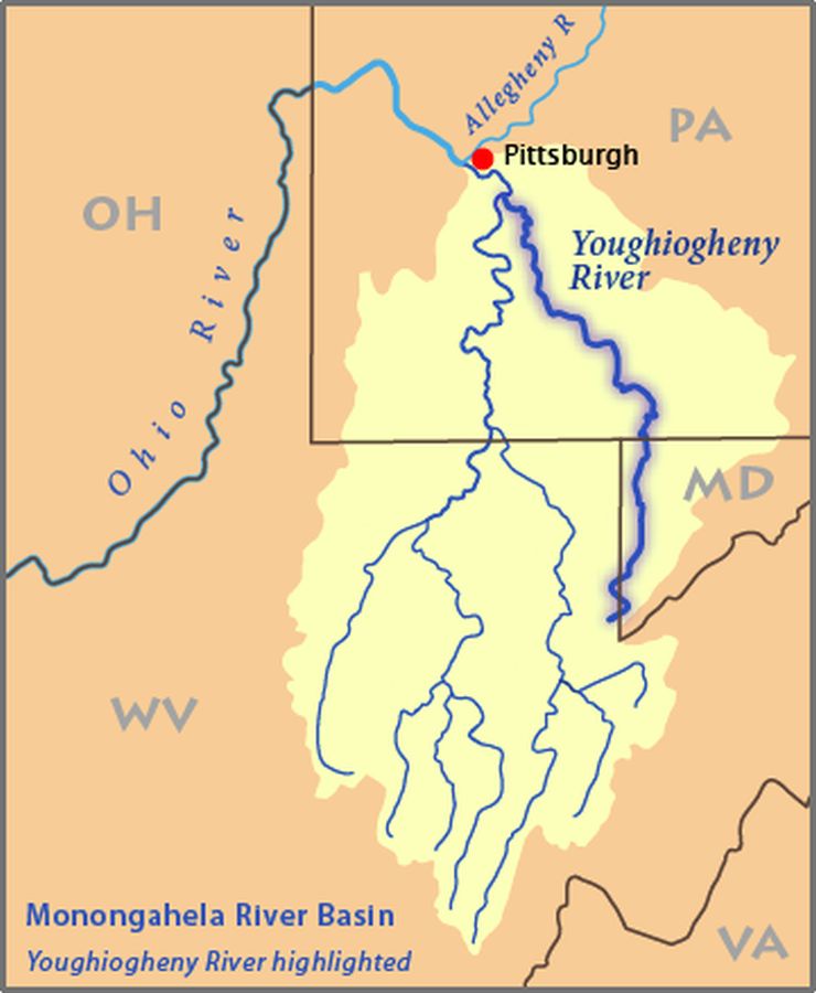
Pittsburgh is not in severe drought so it’s hard to understand how this lake could drop unless you know where the river comes from. The Youghiogheny is a north-flowing river with headwaters in the mountains of West Virginia and Maryland. Notice that the rest of the Monongahela river basin starts in West Virginia as well.

Monongahela River Basin, Youghiogheny highlighted (map from Wikimedia Commons)

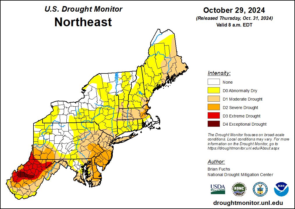
The headwaters of both the Youghiogheny and Monongahela have been in drought since early July. At this point the drought is Extreme to Exceptional in western Maryland and West Virginia.

Northeastern US Drought Map, 29 Oct 2024 (map from US Drought Monitor at UNL)

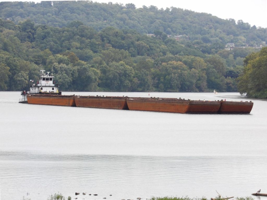
Water levels have dropped in both rivers but the Monongahela cannot afford to get too low because it carries a lot of barge and boat traffic.

Barge moving downstream on the Monongahela River at Duck Hollow, 18 Sep 2023 (photo by John English)

However, there is water upstream to feed the Monongahela. Releases from Youghiogheny River Lake have, in part, kept the Mon navigable.

And so the old bridge emerges from the deep.

p.s. This isn’t the first time the old bridge has been exposed.