Deptford pink, Butler County, 10 July 2022 (photo by Kate St. John)
16 July 2022
Flowers are blooming, fruits are ripening and the sky has been spectacular. Here are just a few things seen outdoors this week and last.
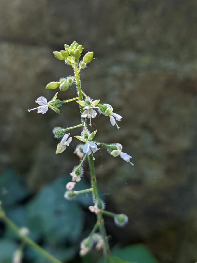
Deptford pink’s (Dianthus armeria) small flower, at top, is worth a closer look. Native to Europe it does well in North America but is disappearing from the UK.
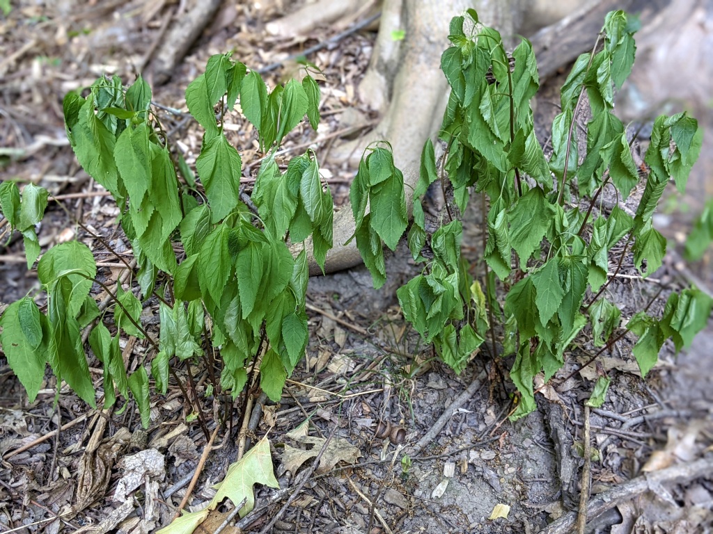
Enchanter’s nightshade (Circaea canadensis) was in bloom last week in Schenley Park, shown below.
Enchanter’s nightshade in bloom, Schenley Park (photo by Kate St. John)
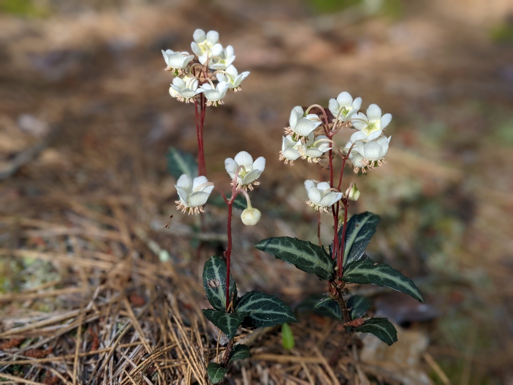
Spotted wintergreen (Chimaphila maculata) is blooming in Butler County. This plant goes by several names including “striped wintergreen.” Here’s why it is not pipsissewa.
Spotted wintergreen, Butler County, PA, 10 July 2022
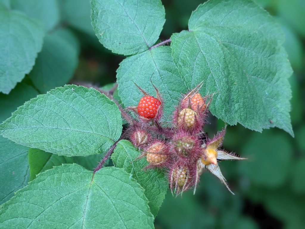
Wineberry fruits (Rubus phoenicolasius) are ripening in Frick Park. This shrub was introduced from Asia as breeding stock for Rubus cultivars in 1890 but it grows so vigorously that it’s now invasive in Pennsylvania. Unlike native raspberries, wineberries are sticky to the touch. They taste well enough when you eat them in the woods but are boring on cereal. I tried.
Wineberry, Frick Park, 14 July 2022 (photo by Kate St. John)
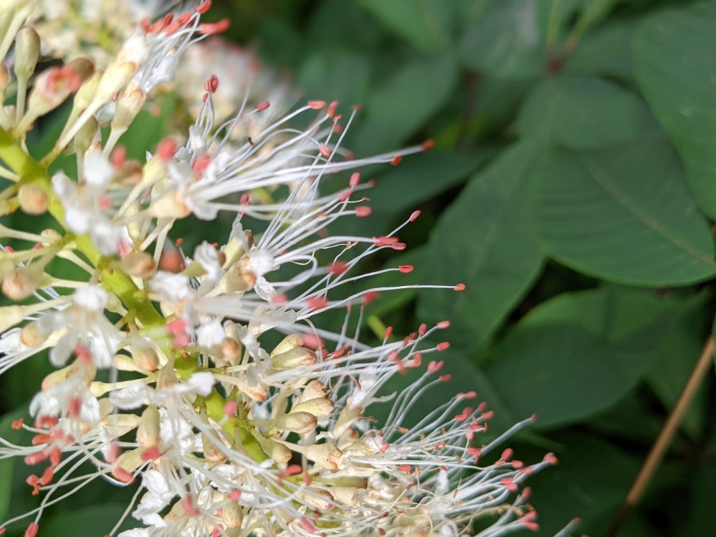
Bottlebrush buckeye flowers were at their peak last week in Schenley Park. This closeup shows the feathery stamens.
Bottlebrush buckeye, closeup of flower, 8 July 2022 (photo by Kate St. John)
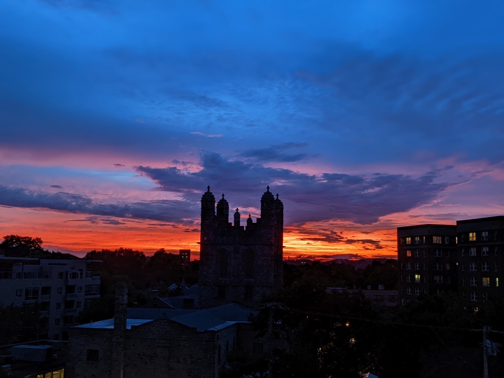
And finally, we’ve had some spectacular sunrises in the past two weeks. A deep blue sunrise on Wed 6 July (below) and a fiery orange one on the 8th. Click here to see the fiery sunrise.
Sunrise in Pittsburgh, July 2022 (photo by Kate St. John)
Wilted white snakeroot at Schenley Park, 4 July 2022 (photo by Kate St. John)
9 July 2022
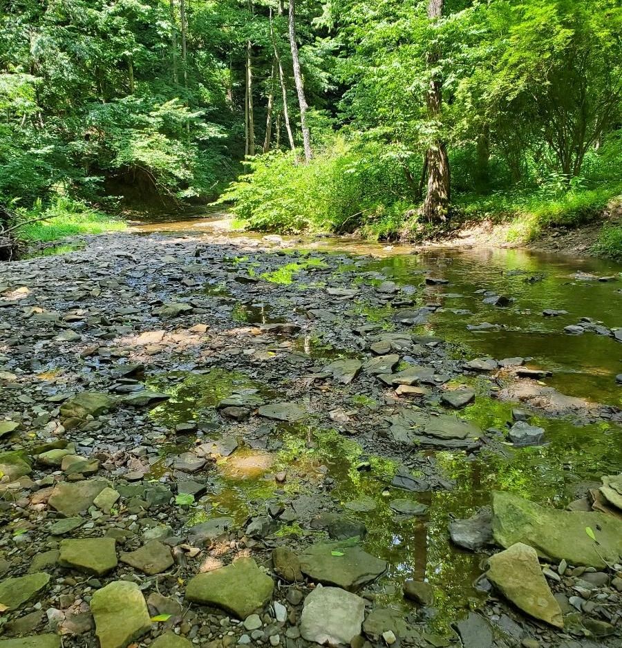
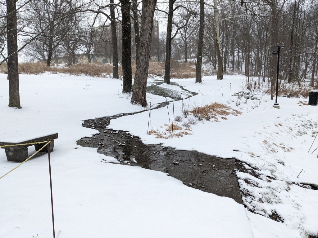
Hot dry weather since early June has turned the grass brown and caused low water in Pittsburgh area streams. By the Fourth of July leaves were wilting in Schenley Park and Little Sewickley’s creek bed was exposed at Sneed’s.
Low water exposes the creekbed of Little Sewickley Creek at Sneeds, 4 July 2022 (photo by Karyn Delaney)
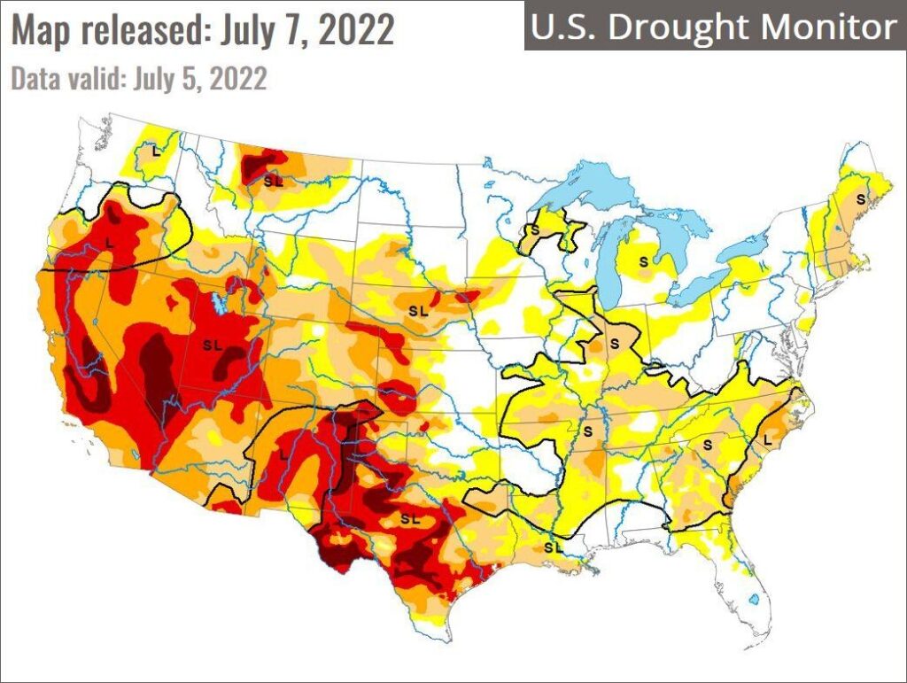
Precipitation had changed in only five weeks from 1.20 inches above normal at the end of May to -1.58 inches below normal on 4 July. A thunderstorm on 6 July reduced the deficit to -1.24 inches below normal this morning. (See statistics at the NWS Pittsburgh Local Climate page.)
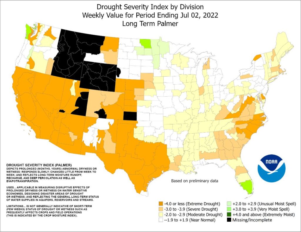
Are we in a drought?
Not really. Despite wilting leaves this week’s U.S. Drought Monitor map puts most of Pennsylvania in the normal range. (S=short-term impacts, L=long term impacts)
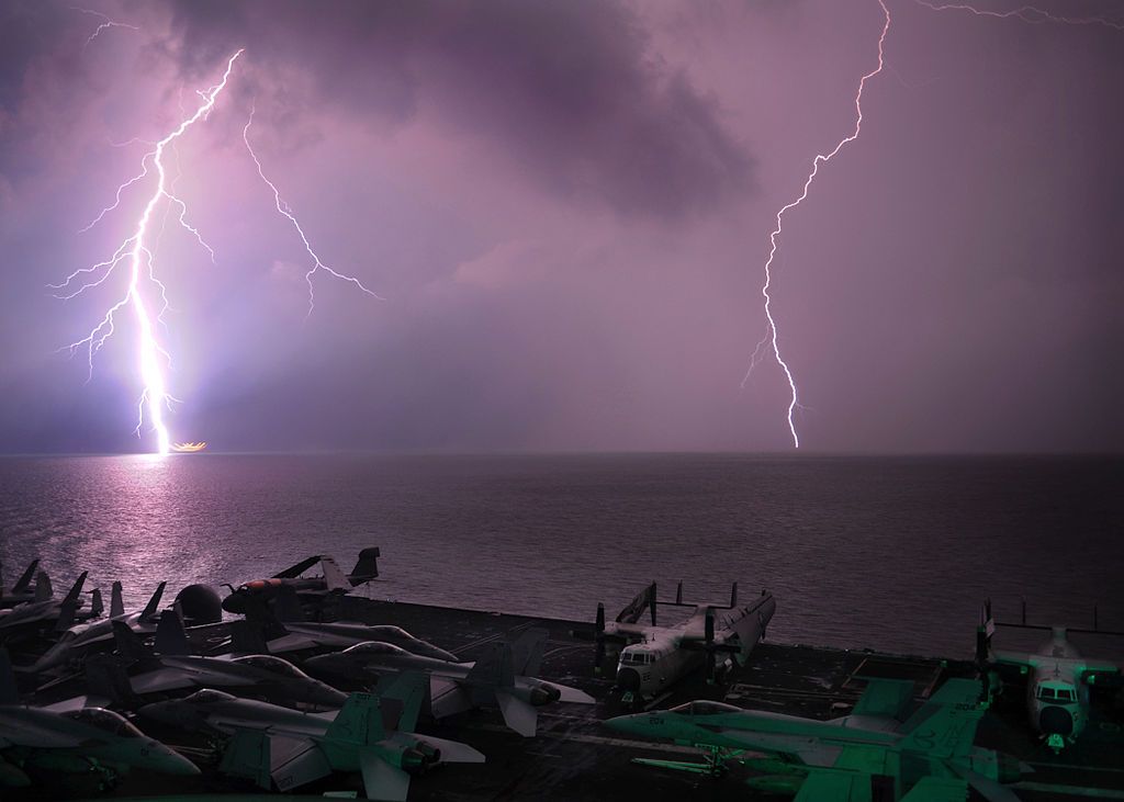
When a thunderstorm approaches at the beach or a swimming pool, the lifeguards tell everyone to get out of the water. Lightning often strikes water and anyone in it can be electrocuted.
Fish live in water so why don’t they die from lightning? The National Weather Service explains:
Before a lightning strike, a charge builds up along the water’s surface. When lightning strikes, most of electrical discharge occurs near the water’s surface. Most fish swim below the surface and are unaffected.
This NWS animation shows the positive charge building on the surface and the negatively charged lightning strike spreading horizontally. Fish swim below it all.
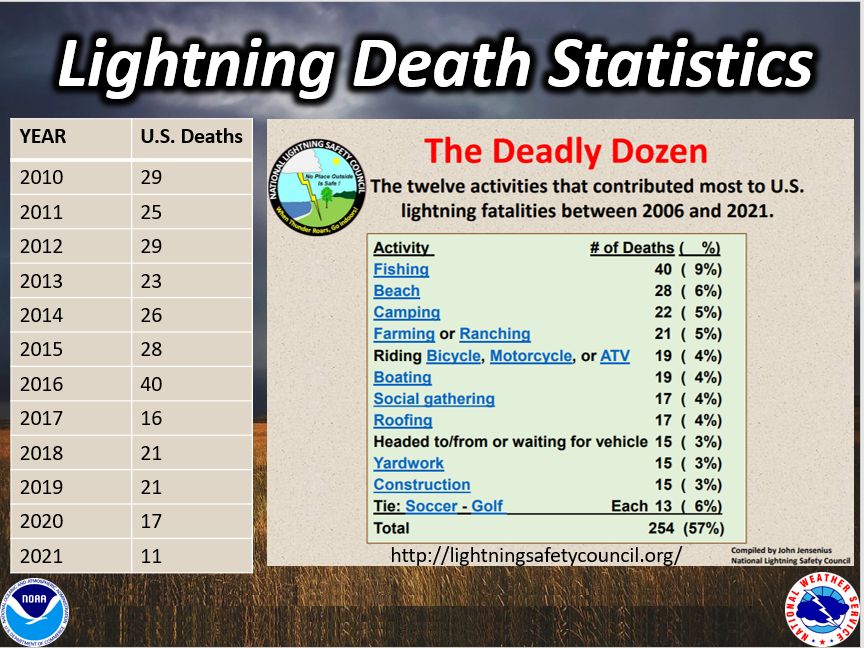
Interestingly in the US, the most dangerous activity during lightning is fishing; beaches are second. We thought golf was the worst but it is far down on the list.
Pittsburgh is 300 miles from the Atlantic Ocean so the hurricanes that pass over us are not even tropical storms by the time they reach southwestern Pennsylvania. We usually don’t know the names of the remnant hurricanes that bring us rain but there is one that lives in infamy. Fifty years ago this month Hurricane Agnes devastated Pennsylvania, New York, Maryland and Virginia.
In June 1972 I lived with my parents and worked in a restaurant in the South Hills of Pittsburgh. I remember the heavy rain that soaked me during my few steps to the car when my mother picked me up at work. Our neighborhood was not flooded but Downtown Pittsburgh was.
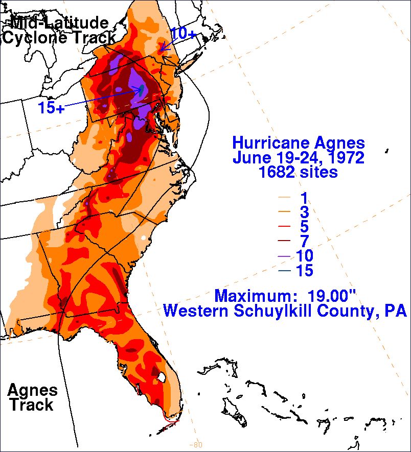
“The Agnes flood crested at 35.85 feet in downtown Pittsburgh, eleven feet above flood stage. The US Army Corps of Engineers estimated it would have topped 47 feet if not for the flood control dams and reservoirs, built since 1938, that held back much of the water. East Branch on the Clarion River was more than full. Kinzua Dam in Warren, PA was within three feet of the top. Tygart Reservoir in West Virginia was 85% full. Other dams stored water at 90% capacity.” — paraphrased from Flood of 1972 at brooklineconnection.com.
Pittsburgh was fortunate to receive a fraction of the rain that fell in the Susquehanna River watershed. More than 10 inches fell in much of east-central Pennsylvania, reaching a maximum of 19 inches in western Schuylkill County.
Many Pennsylvania towns were ravaged, including Harrisburg.
So was the Southern Tier of New York, as shown in this 2018 video about Elmira.
That September I returned to college in Geneva, NY and joined a crew of volunteers doing flood relief work in Horseheads, NY, six miles from Elmira. Our job was to remove mildewed interior walls in a house flooded by Newtown Creek during Agnes. The owners were living in a disaster-relief trailer in the backyard and hoped to rebuild their house.
It was a lesson in empathy. The walls were plasterboard on studs, just like those in my parents’ house. We broke the plasterboard and levered it off with crowbars. It could have been my own home that I was taking apart and my own life upended by the flood. I felt very lucky.
p.s. This 10-minute archival video shows Corning, NY in June 1972 before and after the flood. It includes flood relief efforts like the work we did in Horseheads.
(photos and maps from the NOAA / NWS, Pittsburgh flood photo embedded from brooklineconnection.com. Click on the captions to see the originals)
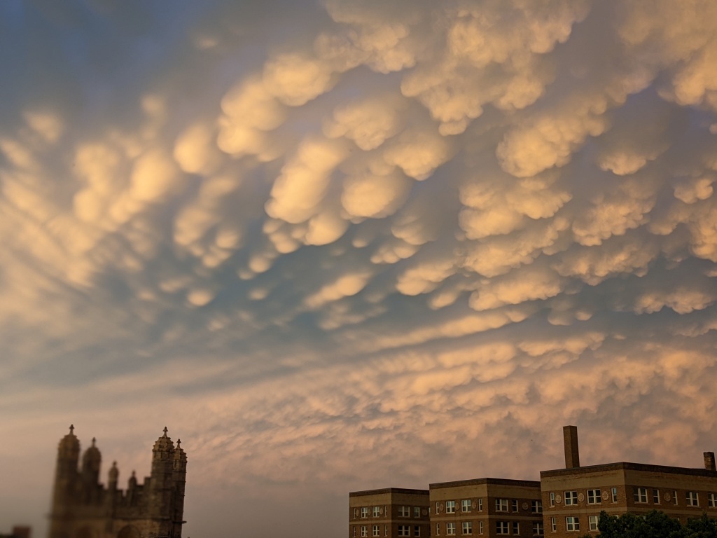
Mammatus clouds over Pittsburgh, 16 June 2022, 9:00pm (photo by Kate St. John)
17 June 2022
Severe thunderstorms were predicted for 6:00pm yesterday in the upper Ohio Valley. By 2:00pm the Severe Thunderstorm Watch called for an inch of rain in 1 hour — definitely flash flood material — but at 5:00pm the storm line split. Some went north toward I-80, the rest went south to West Virginia. Pittsburgh had no lightning, no strong winds, no rain. Nothing happened. But the sky got weird.
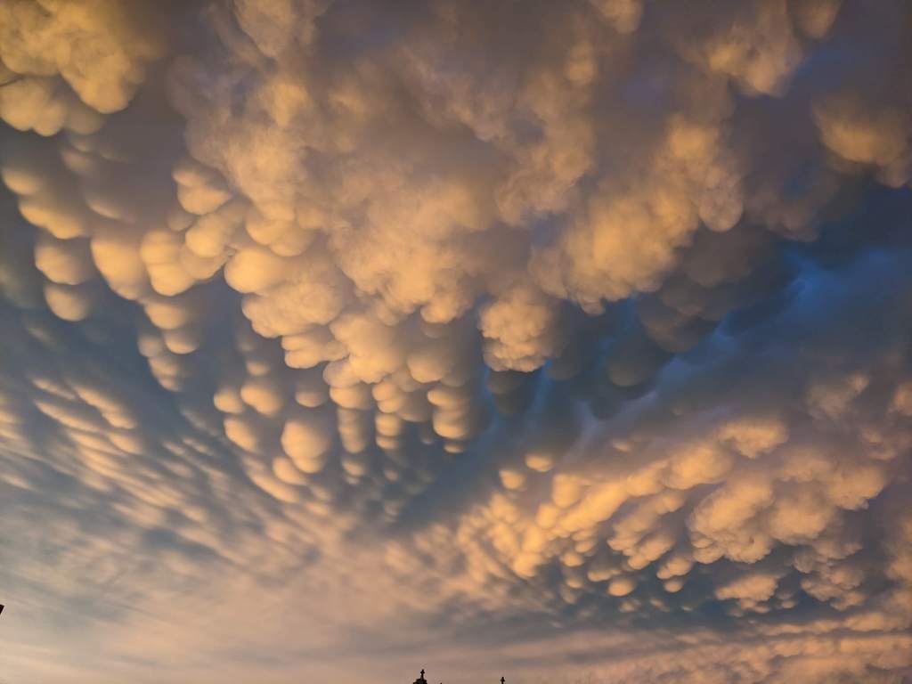
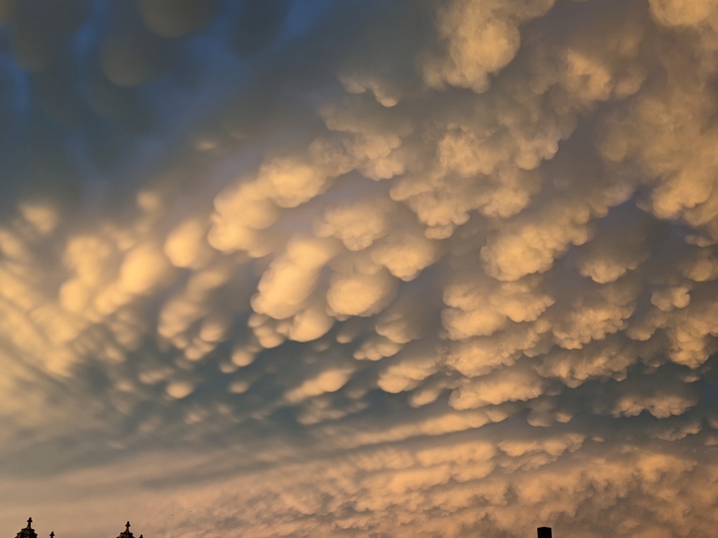
At sunset the last of the storm clouds left our area with a flourish of rare mammatus clouds, dramatically lit from below. Their name is derived from the Latin word for breast or udder.
As Wikipedia explains, mammatus are formations that hang from the base of rain clouds. The distinct lumpy undersides are formed by cold air sinking down to form pockets. Usually composed of ice, each lobe averages 1/2 to 2 miles across and 0.3 mile deep. Alone a lobe can last 10 minutes but a cluster may last several hours.
Mammatus are an indication of a severe thunderstorm in the vicinity. In Pittsburgh often show up after the storm has passed.
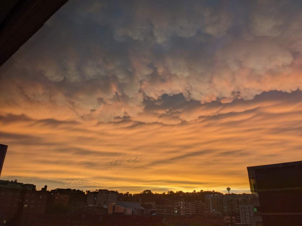
The clouds started out as lines and gave way to stratus clouds and a gleam at sunset.
Mammatus clouds forming lines, Pittsburgh PA, 8:58pm, 16 June 2022 (photo by Kate St. John)Mammatus clouds looking east, Pittsburgh PA, 8:58pm, 16 June 2022 (photo by Kate St. John)Last line of mammatus clouds gives way to stratus at sunset, looking west, Pittsburgh PA, 9:05pm, 16 June 2022 (photo by Kate St. John)
Next time you see these weird clouds, remember their name describes their shape.
p.s. Steve Tirone left a comment with a link to his video of the clouds.
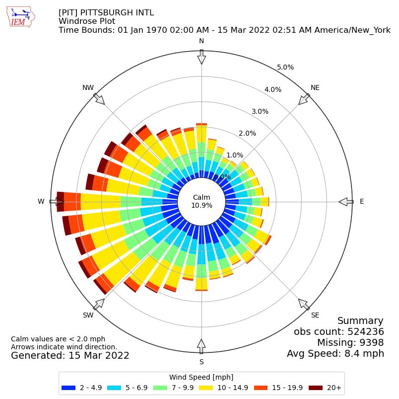
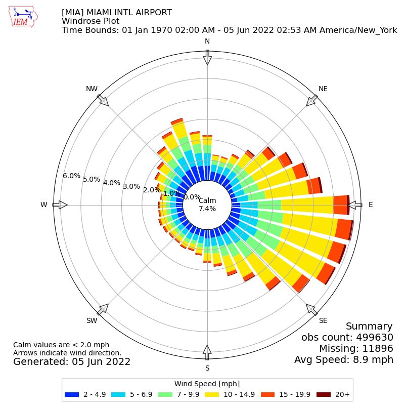
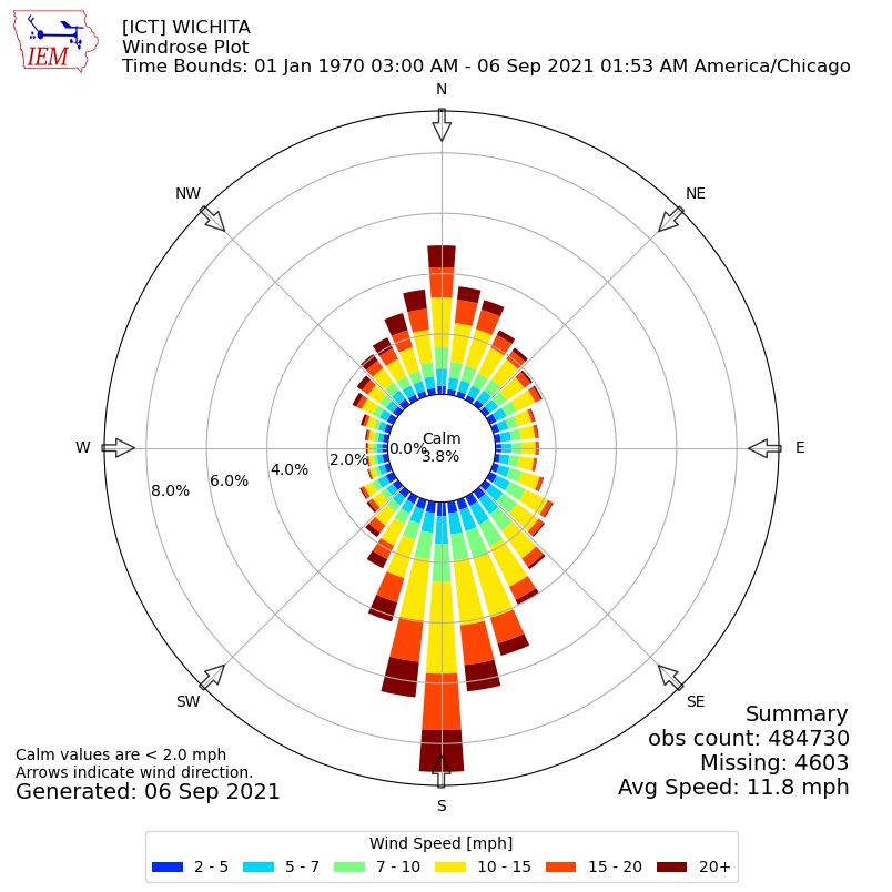
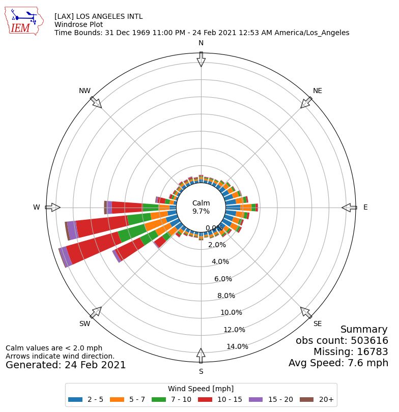
To see this effect on paper meteorologists create a wind rose that graphs the wind’s direction and speed over time. The petals indicate the percentage of wind from each direction. The colors show the speed. The center is calm. Let’s look at some wind roses from Iowa State’s Iowa Environmental Mesonet.
Though Pittsburgh is not a particularly windy place our 50-year wind rose (1970-2022) indicates our prevailing wind is from the southwest. 10.9% of the time there is no wind at all.
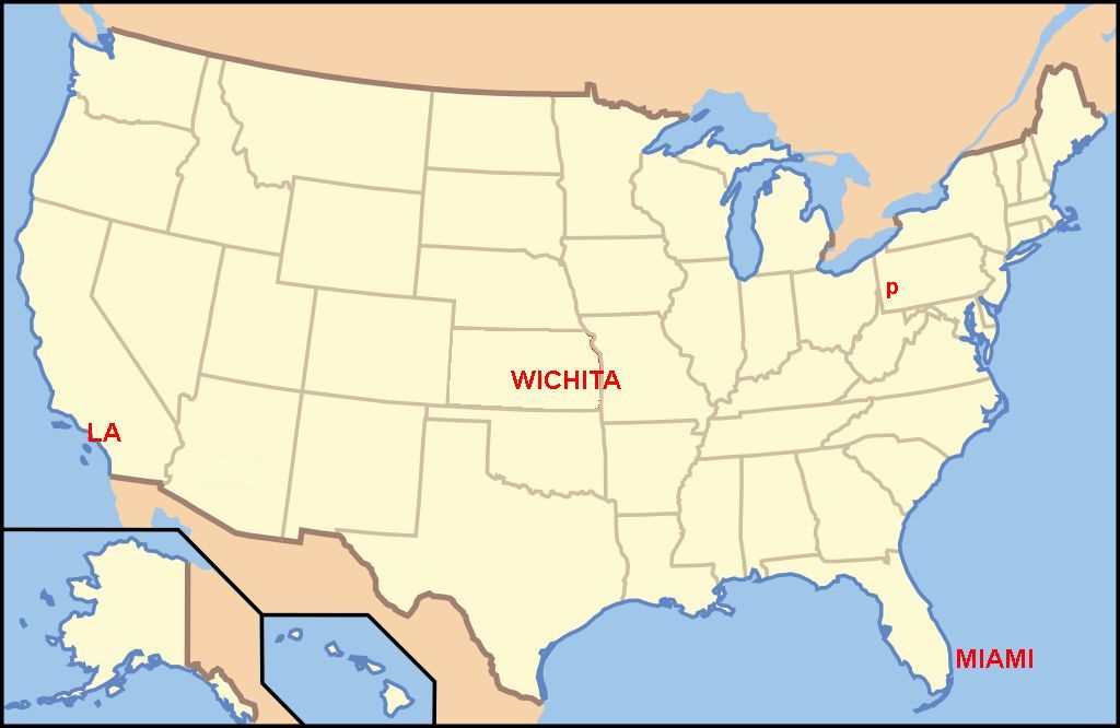
In places where wind is not obstructed, such as the coast and the Great Plains, wind roses are lopsided. This map shows the locations of three extreme wind roses displayed below.
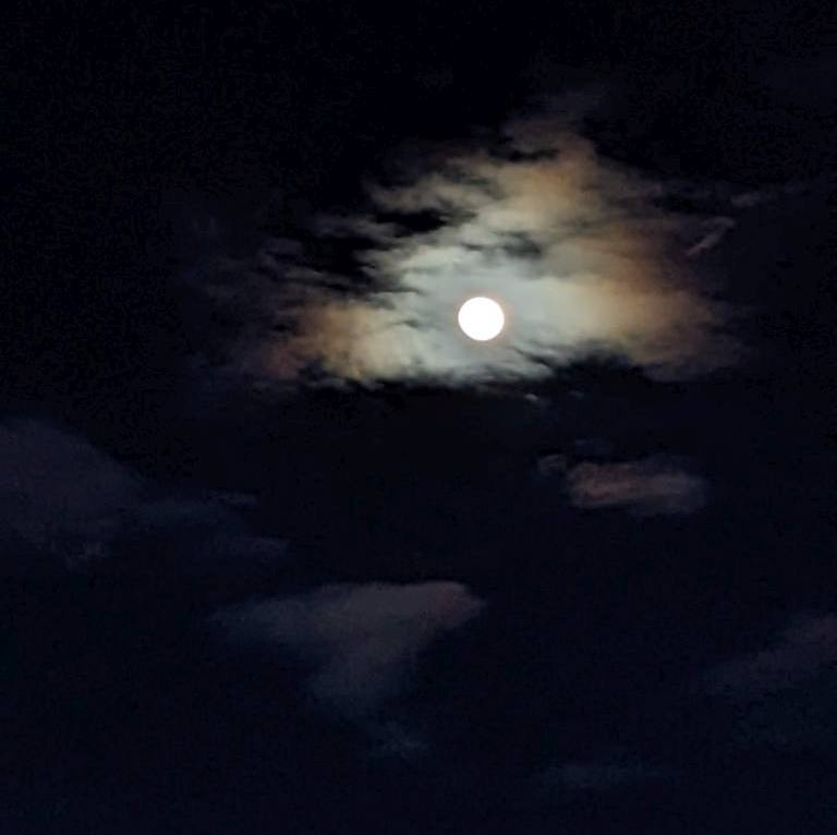
The sun set at 7:27pm, the sky flamed and dimmed. It was barely glowing twenty minutes later when we heard the first “peent.”
On dry Spring nights male American woodcocks (Scolopax minor) gather in shrubby fields to mate with females who intend to nest there. Within the hour after sunset or in the hour before sunrise, they let the ladies know they’re available by stomping around in the dark calling “peent, peent, peent.” After some peenting each male flings himself into the sky climbing hundreds of feet before circling back down. While ascending his wings make a twittering sound, while descending his wings chirp. You can tell what he’s doing by listening in the dark. He lands where he started and does it again.
On Wednesday the moon was almost full and the woodcocks were very active. We heard at least six of them!
Waxing moon over Upper Field, North Park, 16 March 2022, 8:01p (photo by Kate St. John)
The spring peepers at Eagles Nest parking area were active, too.
Spring peeper calling in the Ozarks (photo by Justin Meissen via Wikimedia Commons)Spring peepers at North Park, 16 March 2022 (recorded by Kate St. John)
Woodcocks will continue their sky dance in April and early May but if you want two audio treats at once, go out in March by the light of the moon.
(sunset and moon photos + sound of spring peepers by Kate St. John. Woodcock and peeper photos from Wikimedia Commons. Woodcock audio from Xeno Canto)
This sundial in Ecuador at GPS 00.000, -78.103 shows the sun’s shadow falling on the equator during the equinox. Mark the shadow at your own home and see the sun return to this position on the Autumnal Equinox on 23 September.
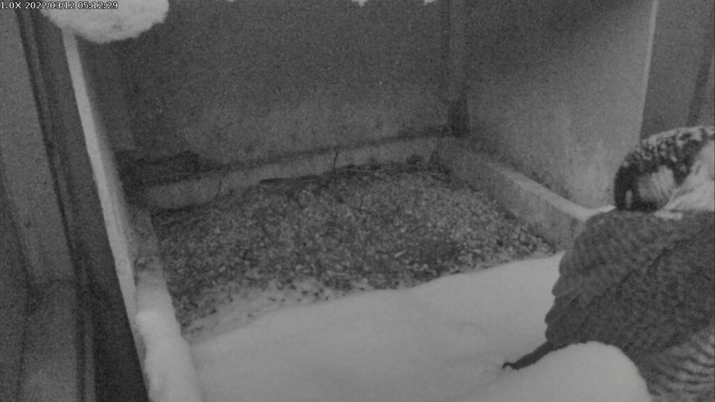
After yesterday’s sunny Spring weather we are waking up to snow this morning. Fortunately Pittsburgh missed the heavy snow and blizzard conditions to our east.
Last night Morela slept in the open at the Cathedral of Learning peregrine nest. You can tell that her feathers provide excellent insulation because several inches of snow did not melt right next to her body.
Snow cover in Schenley Park, 4 Feb 2022 (photo by Kate St. John)
8 March 2022
Pennsylvania has the highest rate of Lyme disease in the U.S. (CDC, 2019) so in early March the approach of tick season is always in the back of my mind. This winter we had some spates of bitter cold and some long runs of snow cover. Did winter suppress the ticks?
This month I learned from Keystone Trails Association that: “All the snow keeping our grounds covered throughout the cold winter months has only helped the tick population. Snow coverage acts as a giant quilt or insulator to keep the ticks warm under the leaf litter.”
Snow helps ticks survive the winter and we had a lot of it this year.
This month the ground is warming and black-legged ticks are getting active. All they need is unfrozen ground and an air temperature of 37°F to start moving out of the leaf litter. This spells danger for hikers, birders and especially for gardeners who handle all that leaf litter.
Before you go outdoors, take time to protect yourself as described in this vintage blog: Today is Spray Your Clothes Day. Did you find a tick on your body? Get it tested for Lyme disease at PA Tick Research Lab (https://www.ticklab.org/)
Spring is coming but so are the ticks. Be prepared.