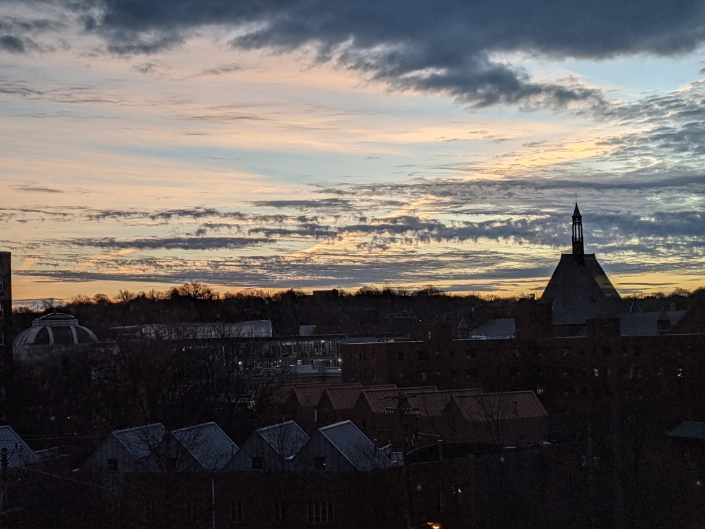
Clouds and blue sky above Nine Mile Run, Pittsburgh, 11 Jan 2021 (photo by Kate St. John)
25 January 2021
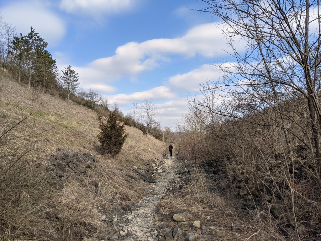
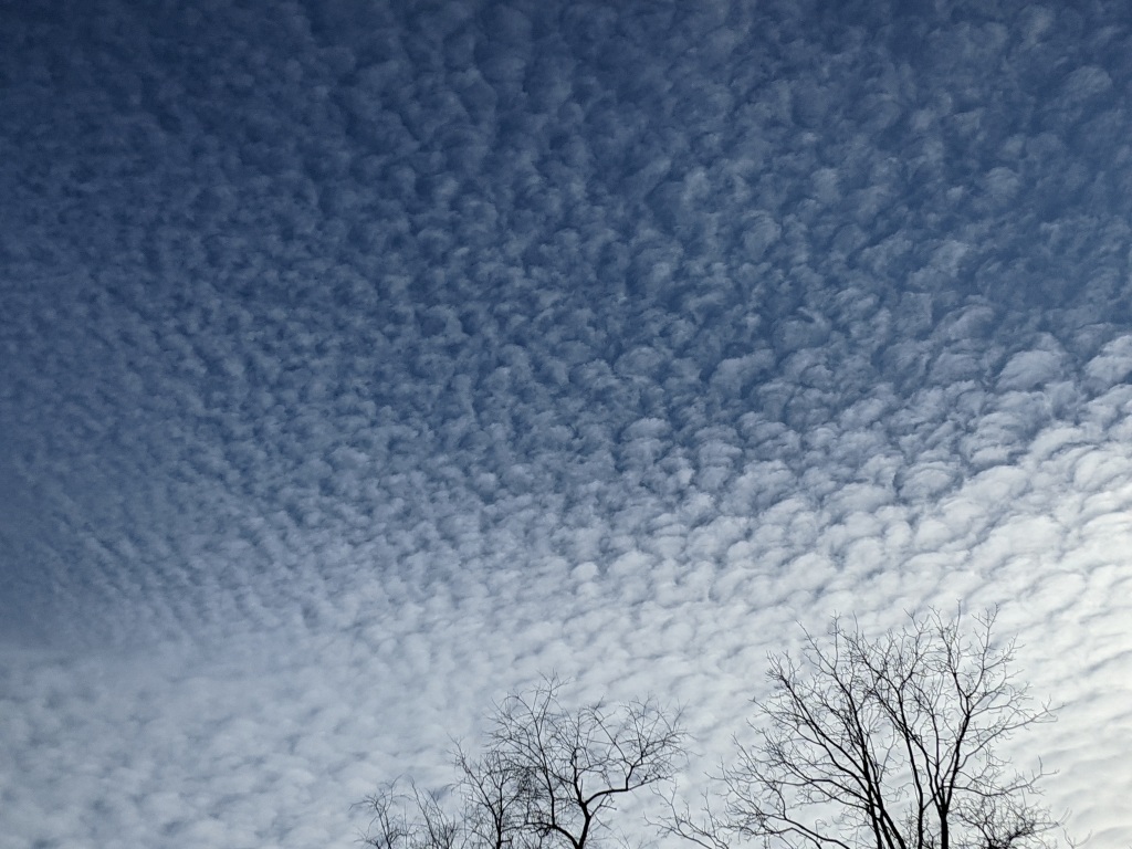
During Pittsburgh’s overcast winters we grumble about clouds and pray for sunshine. On Saturday after blogging about last week’s clouds, I was outdoors with Liz Spence when the clouds broke at 1pm. “Look! We have shadows!”
For real excitement, though, check out these lenticular clouds over the Rincon Mountains in Tucson, Arizona, 18 January 2021. We never see this in Pittsburgh(*).
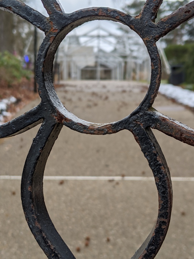
Through the garden gate at Phipps Conservatory, 17 Jan 2021 (photo by Kate St. John)
On overcast days it’s too easy to convince myself not to go outdoors but last week, when five of seven days were overcast, I forced myself to walk to Phipps to take photos of dawn redwoods. While there I looked through the garden gate — like a large keyhole.
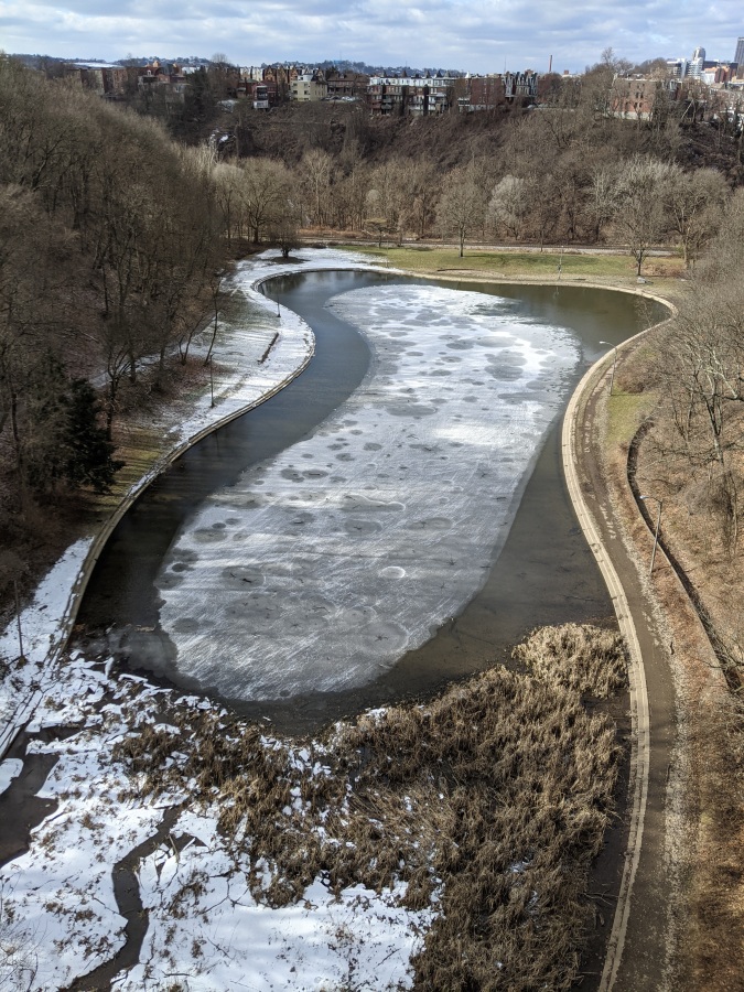
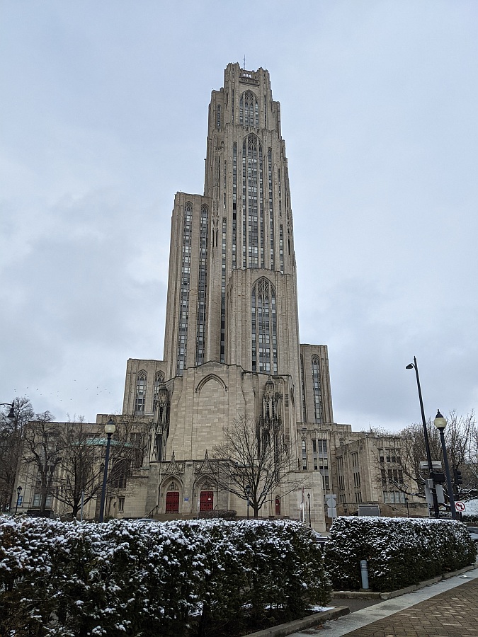
On the 20th I promised myself to be at Schenley Park Overlook at noon for a big view of the sky, the city and the Cathedral of Learning (falcon home). On the way there I snapped a photo of Panther Hollow Lake, surprisingly shaped like a giant keyhole.
Panther Hollow Lake, normal water level, 20 Jan 2021 (photo by Kate St. John)
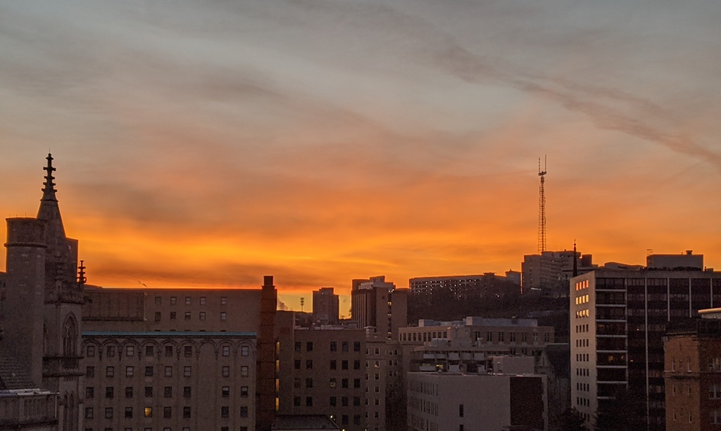
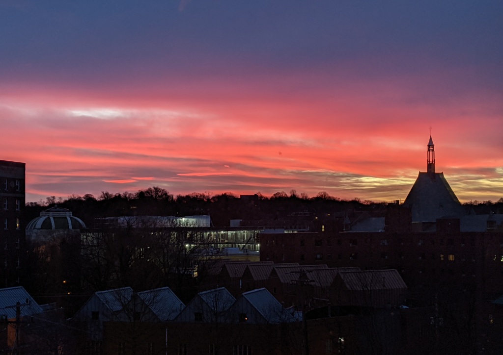
The day ended with a Gleam At Sunset, 10 minutes of happy sunshine before darkness. Below you can see the source of the gleam, a patch of clear sky in the lowest notch between the buildings.
The Gleam at Sunset, Pittsburgh PA, 20 Jan 2021 (photo by Kate St. John)
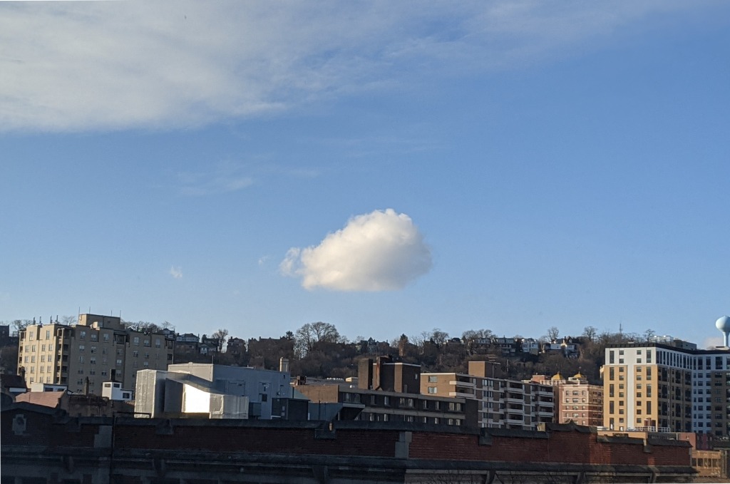
Working backwards in time, 19 January provided a welcome respite with a panoply of blue sky and clouds. One cloud broke away from the pack.
One cloud above the hill, Pittsburgh PA, 19 Jan 2021 (photo by Kate St. John)
January 16th was gloomy with freezing fog, light snow and mist but two merlins and The Gleam At Sunset made my late-day walk to Schenley Park worthwhile.
The Gleam at Sunset, Schenley Park, 16 Jan 2021 (photo by Kate St. John)
This morning is overcast with a 10oF wind chill. I plan to go outdoors … later.
Little did we know a year ago today when the first known case of COVID-19 was reported in the U.S. that we were heading for a year of recurring fear, illness, death, isolation, political unrest and economic hardship. By now almost everyone knows someone who tested positive. Too many know someone who died.
Yesterday the U.S. COVID-19 death toll reached 400,000. To put this in perspective, that’s the entire population of Tulsa, Oklahoma or Tampa, Florida or 1/3 of Allegheny County, Pennsylvania.
For a year we have been grieving alone or in small groups. Yesterday for the first time we mourned as a nation for the lives lost to the coronavirus. A nurse from Livonia, Michigan who cares for COVID patients sang Amazing Grace as a tribute to those we’ve lost.
Michigan nurse Lori Marie Key, who went viral singing ‘Amazing Grace’ at work, reprises the song at the national COVID-19 memorial ceremony pic.twitter.com/8OtCaNU5mw
Sunrise in Pittsburgh, 15 January 2021, 7:26am (photo by Kate St. John)
16 January 2021
Red sky at morn, sailors forewarn.
Sunrise on Friday 15 January was a deep crimson red. Though it was sunny for a couple of hours yesterday, gusty wind arrived at 9:30a and rain followed five hours later.
Mackerel sky without rain.
Sky over Frick Park, 9 Jan 2021, 2:30pm
A mackerel sky can predict rain 6-8 hours later, but that wasn’t the case over Frick Park on Saturday 9 January 2021. The day was brilliantly sunny for two hours but became overcast by 5p. These clouds were the leading edge.
Are they a “mackerel sky” or not? What do you think?
Meanwhile, I’d say the bottom right corner is a Harbinger of Gloom.
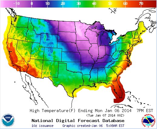
Seven years ago we were in the grips of subzero temperatures as the wobbly jet stream drove arctic air south over the U.S. It was called the arrival of the Polar Vortex.
Seven years ago on 6 January 2014 much of the U.S. was below zero as shown on the map below. Pittsburgh was above freezing that day but the warmth ended soon as the blob of cold air headed east.
Not necessarily. NEWS CENTER Maine in Portland has a good explanation of what’s going on, published on Monday 11 Jan 2021. (This news is for Mainers but it applies to us, too.)
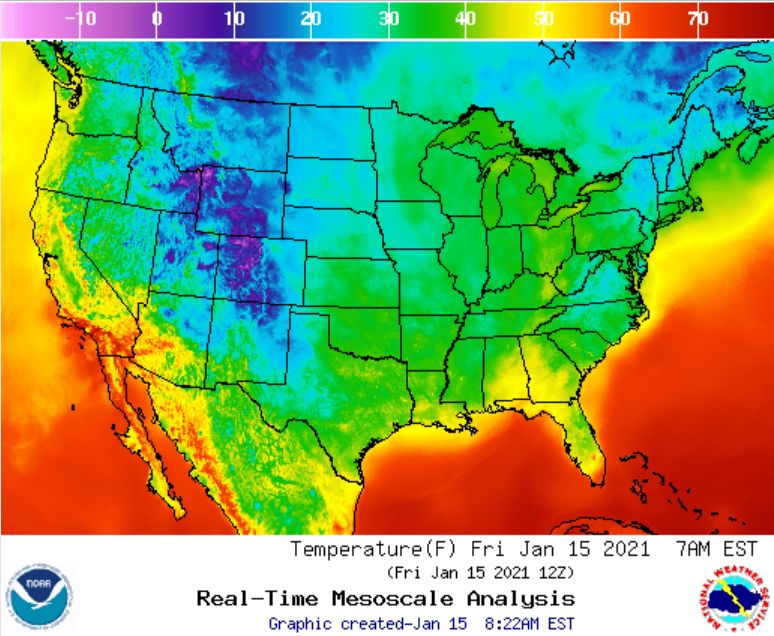
Meanwhile it’s quite warm across the U.S. Here’s the same U.S. temperature map seven years later, published today 15 January 2021.
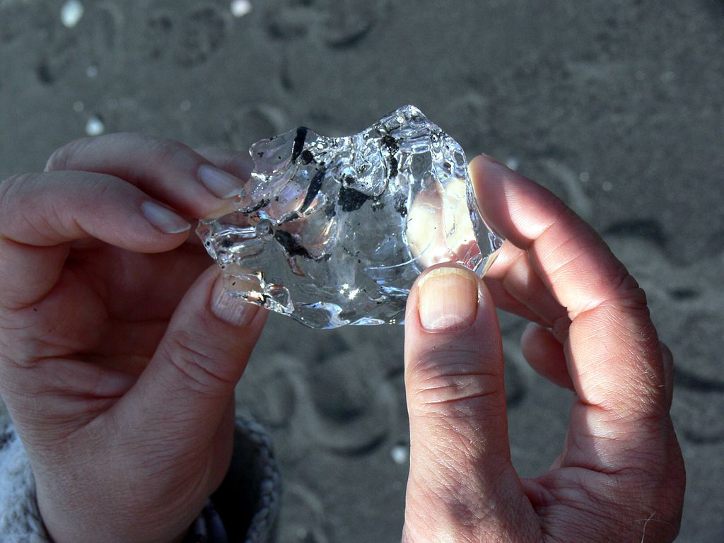
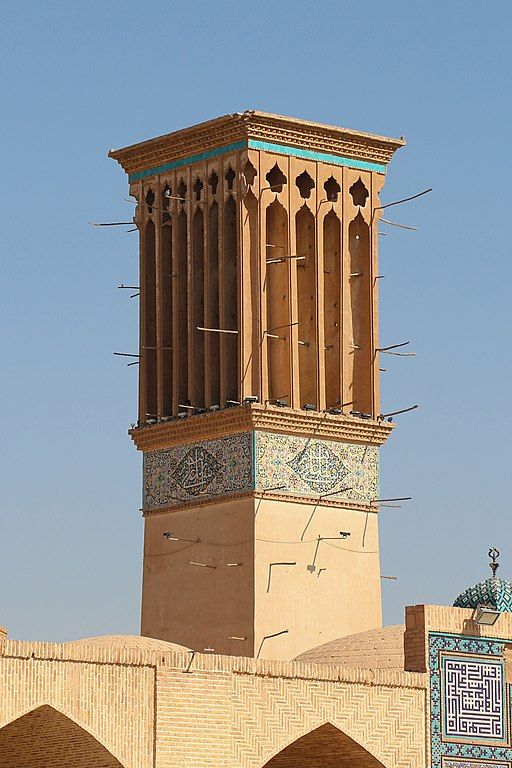
The desert dips below freezing on winter nights but if you want ice in the summer, how do you get it? This is a story of human innovation using natural processes.
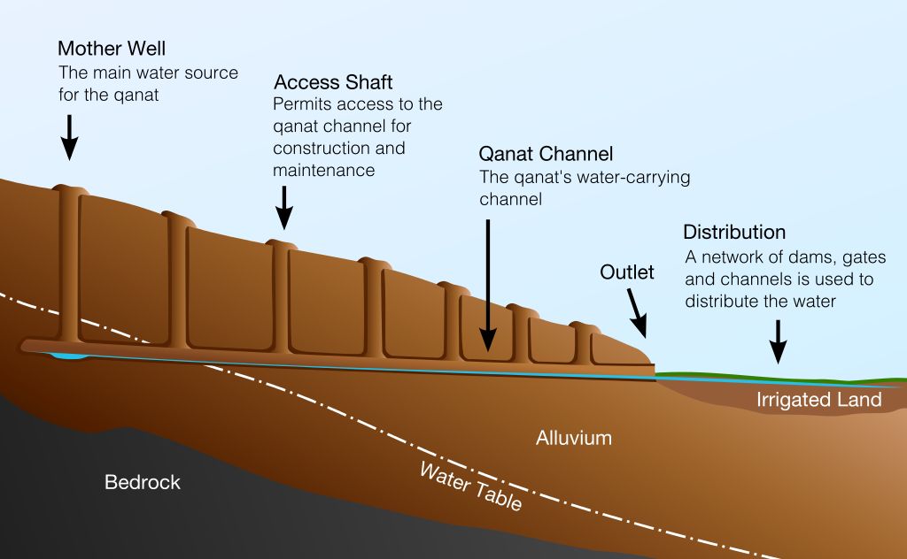
In the 17th century BCE the Persians (Iranians) figured out how to make ice in the desert and store it through long hot summers. They used this method for 3,600+ years until electric refrigeration replaced it in the 20th century.
Though water is scarce in Iran, the method works well because the air is so dry. The process requires many steps: deliver water, make ice, store ice and keep it cool.
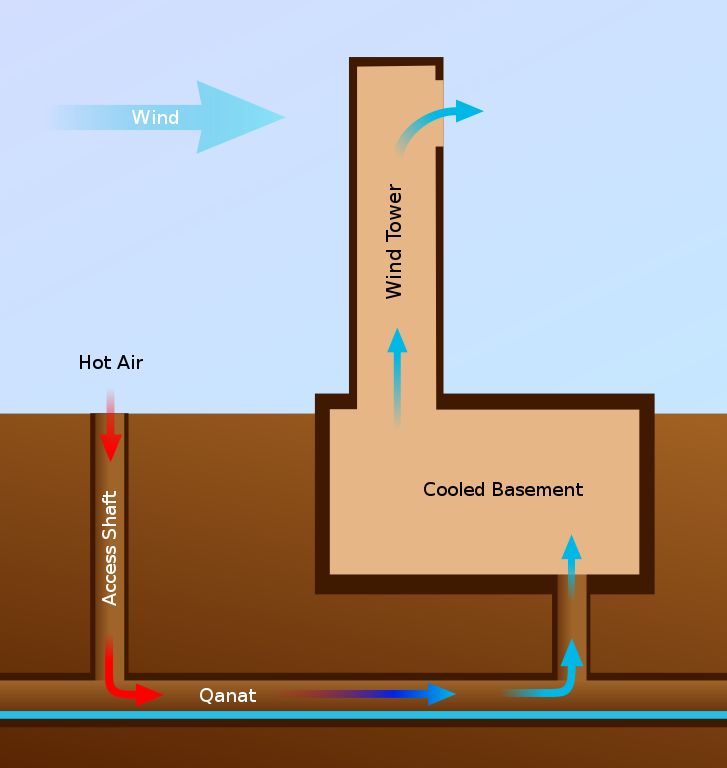
Deliver water to the ice-making location: The Persians built underground water channels called qanats to deliver water from uphill wells to the downhill population. Water in the qanat does not evaporate in the sun and stays cooler because it’s underground.
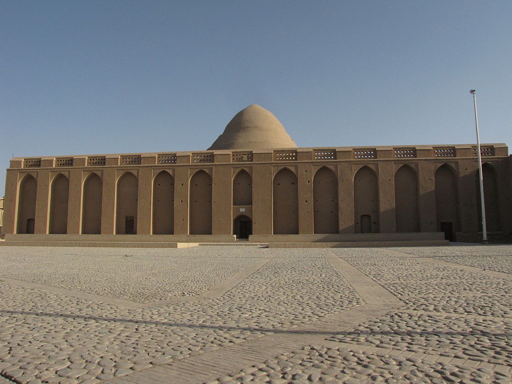
Make ice: To make ice the Persians built plaza-like ponds, shaded by a high wall, where the shallow water froze on winter nights. Collecting the ice before sunrise, they stored it in the ice house (dome in the background). Here are two photos of the same ice plaza no longer in use. People give it a sense of scale.
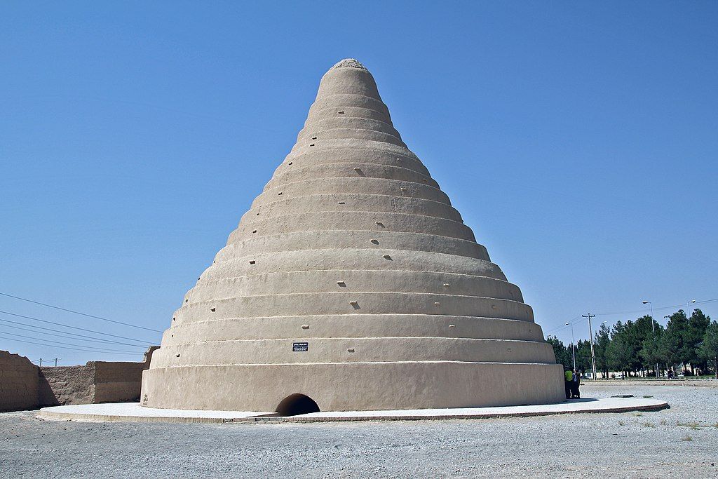
Store the ice: The ice house, called a yakhchal, stored ice underground, where conditions are naturally cooler, and protected it with an insulated dome. The hole at the top of the dome allowed hot air to escape.
Keep the ice cool: The ice was kept cool using natural ventilation to draw in cold air and remove hot air. Windcatcher towers in some towns were quite ornate.
Unusual clouds at sunrise, 30 December 2020 (photo by Kate St. John)
2 January 2021
Since last Sunday Pittsburgh has been warm, wet and overcast except for a single sunny day, 29 December, which I largely spent indoors (foolish me!). I don’t have much to show for a gray week.
The next morning, 30 December, dawned with thin ragged clouds, a tantalizing end to sunshine.
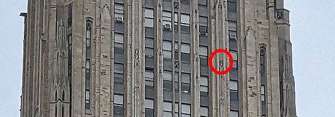
On New Year’s Eve I took a three hour walk in Schenley Park and stopped to look for the Pitt peregrines. There’s a peregrine perched on this building. Can you see it?
There’s a peregrine on this building. Can you see it? Pittsburgh, 31 Dec 2020, 11:43am (photo by Kate St. John)
Zoomed in, the peregrine is on the right hand leaf-stem. Morela matches the building.
Peregrine falcon on the leaf-stem, 31 Dec 2020 (photo by Kate St. John)
Later she spent an hour at the nestbox.
Morela at the nestbox, 31 Dec 2020, 2:20pm (photo from the National Aviary snapshot camera at Univ of Pittsburgh)Morela preening at the nestbox, 31 Dec 2020, 2:34pm (photo from the National Aviary snapshot camera at Univ of Pittsburgh)
New Year’s Day 2021 was a washout. No photos. No peregrines. (I tried to find them. no luck) It rained most of the day.
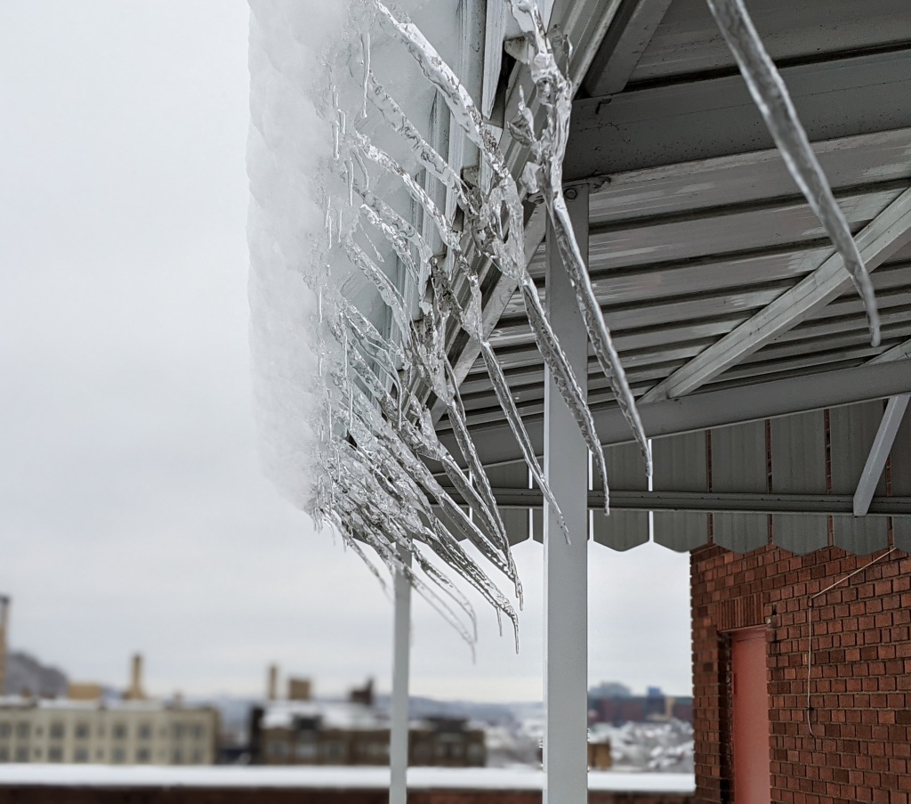
Icicles lean inward, deformed by the wind, 18 December 2020 (photo by Kate St. John)
27 December 2020, Pittsburgh
Nestled between two bouts of winter on Dec 16 and 25 the snow melted and the birds fed frantically before snow and bitter cold returned.
The melting began right after heavy snow stopped on Dec 17. The wind that day was so steady that dripping icicles leaned away from it. Then the wind dropped and new icicles formed straight down. (photo above)
While the deep snow lasted I found many tracks in Schenley Park including evidence of humans and …
Evidence of humans in the snow, Schenley Park, 19 December 2020 (photo by Kate St. John)
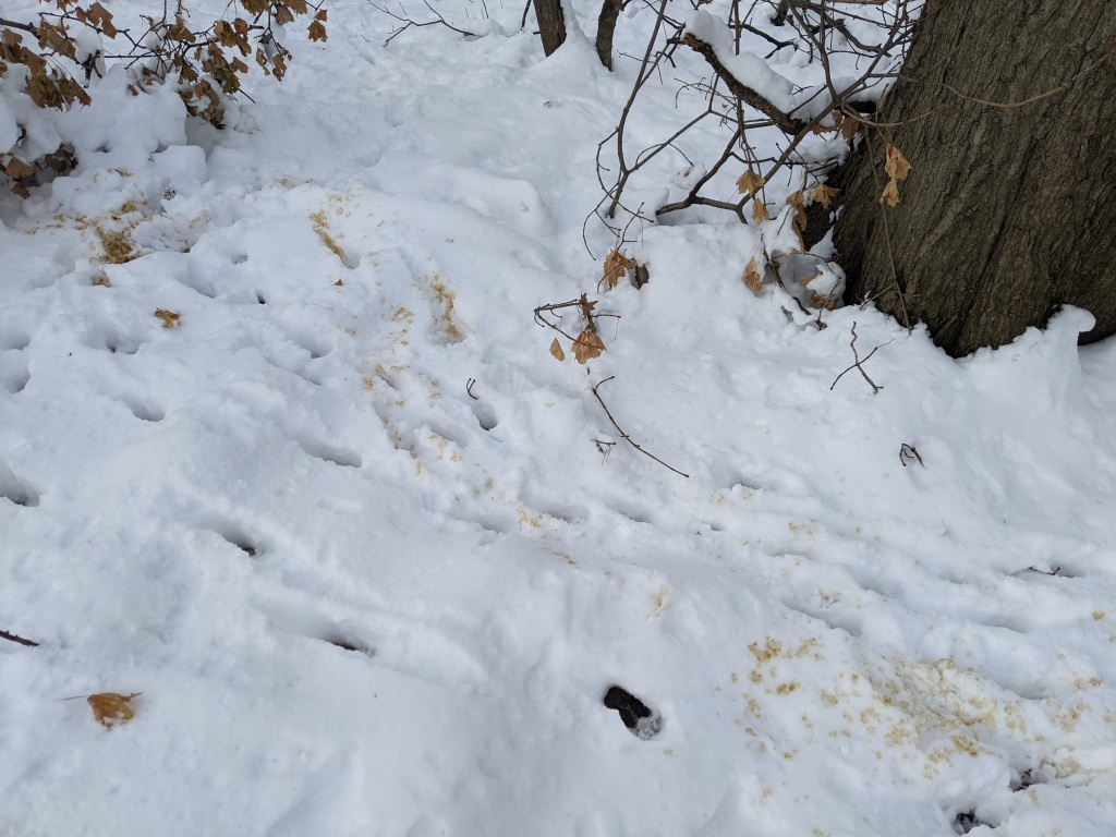
… evidence of white-tailed deer, below. With the rut still in progress it looks as if the deer are leaving “calling cards” on the snow. (Can you tell me more about this brownish (maybe) urine? I found it in several locations.)
Evidence of deer, footprints and dark urine, Schenley Park, 19 Dec 2020 (photo by Kate St. John)
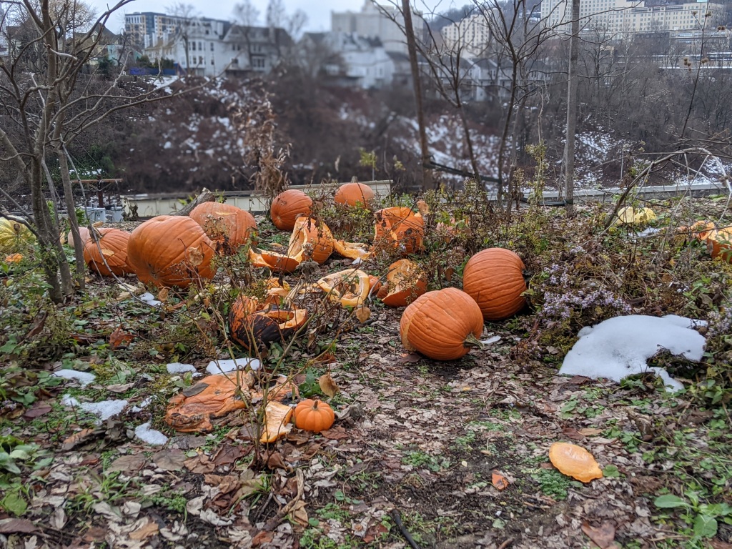
On 22 December the snow was mostly gone when I found a pumpkin graveyard on Aloe Street in Bloomfield.
Pumpkin graveyard, Aloe St. Bloomfield, 22 Dec 2020 (photo by Kate St. John)
The next day’s “red sky at morn” presaged Christmas Eve’s all-day rain.
Red skies forewarn a winter storm, 23 December 2020 (photo by Kate St. John)
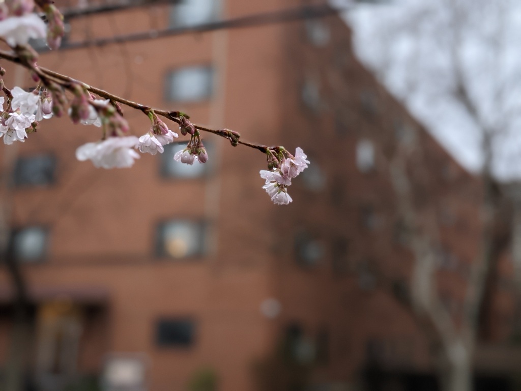
On 24 December cherry trees started to bloom on Craig Street. It was 57oF.
Cherry trees start to bloom in Oakland, 57 degrees F and rain on 24 Dec 2020 (photo by Kate St. John)
And then it turned cold.
A white Christmas, overcast sky, 25 Dec 2020 (photo by Kate St. John)
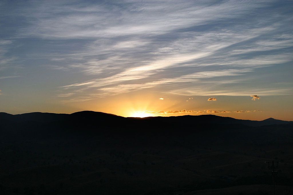
Today is one of two days per year when the sun stands still.
By the time you read this article the December solstice has already happened. The sun paused over the Tropic of Capricorn at 10:02 UTC, the same moment everywhere on Earth. In Pittsburgh it occurred at 5:02am local time, more than two and a half hours before sunrise.
If you wanted to experience sunrise and the December solstice simultaneously the best place would have been Georgetown, Guyana where the sun rose at 5:59am and the solstice occurred 3 minutes later at 6:02am local time (GYT). It’s too late to do that this year but 2021 is a possibility. By then we hope to travel safely thanks to the COVID-19 vaccine.
The good news for now is that the days are already getting longer in Pittsburgh. Tomorrow will be 3 seconds longer than today.
(photo by Fir0002/Flagstaffotos via Wikimedia Commons; click on the caption to see the original)
City lights glow on the snow and clouds, Pittsburgh at dawn 17 Dec 2020 (photo by Kate St. John)
18 December 2020
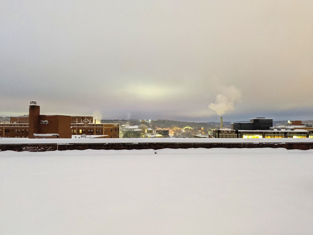
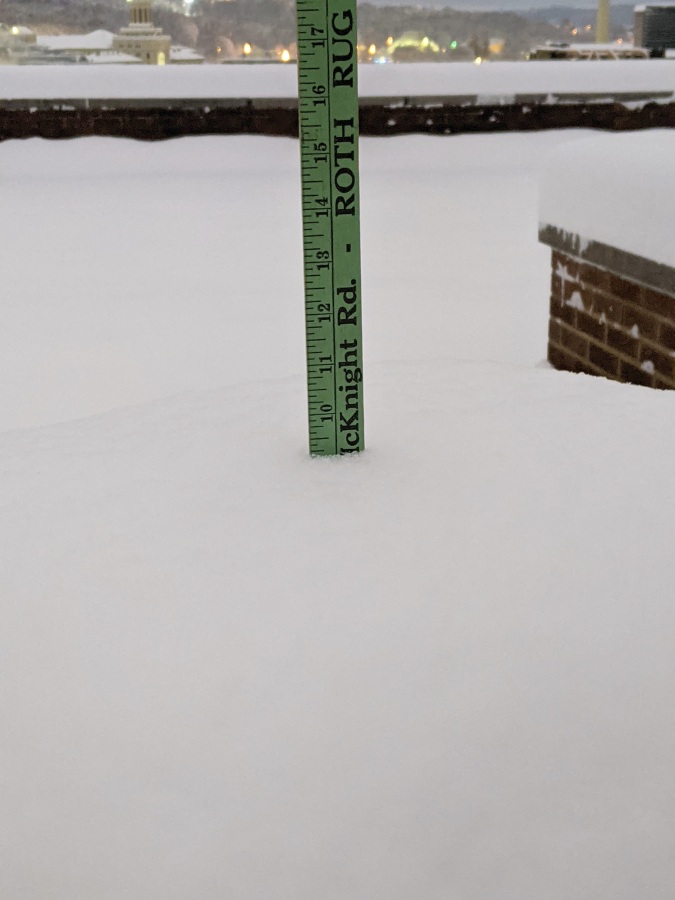
It began snowing here in Pittsburgh on Wednesday morning, 16 December 2020, and didn’t stop for 17.5 hours. By 7:30 the next morning there were 9.25 inches of snow in Oakland. City lights glowed against the snow and clouds.
9.25″ of snow in Oakland, 17 Dec 2020, 7:30am (photo by Kate St. John)
Yesterday I took a long walk to Pitt’s campus, Carnegie Library and Schenley Park to appreciate the beauty. Here are a few of the scenes I encountered.
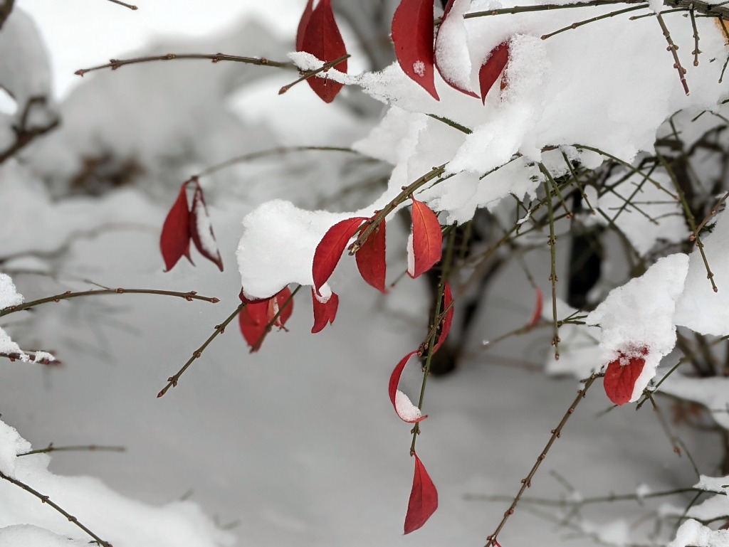
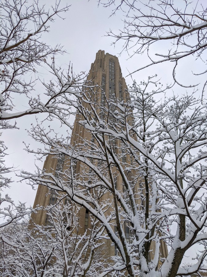
Red Euonymus leaves peek out of the snow, Univ of Pittsburgh, 17 Dec 2020 (photo by Kate St. John)White trees frame the Cathedral of Learning, 17 Dec 2020 (photo by Kate St. John)
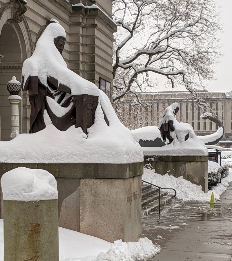
Bach, Shakespeare, and Dippy wear snowy blankets at Carnegie Museum, 17 Dec 2020 (photo by Richard St. John)
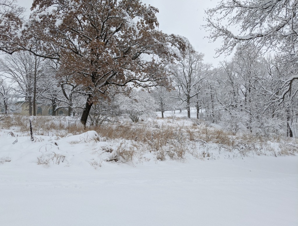
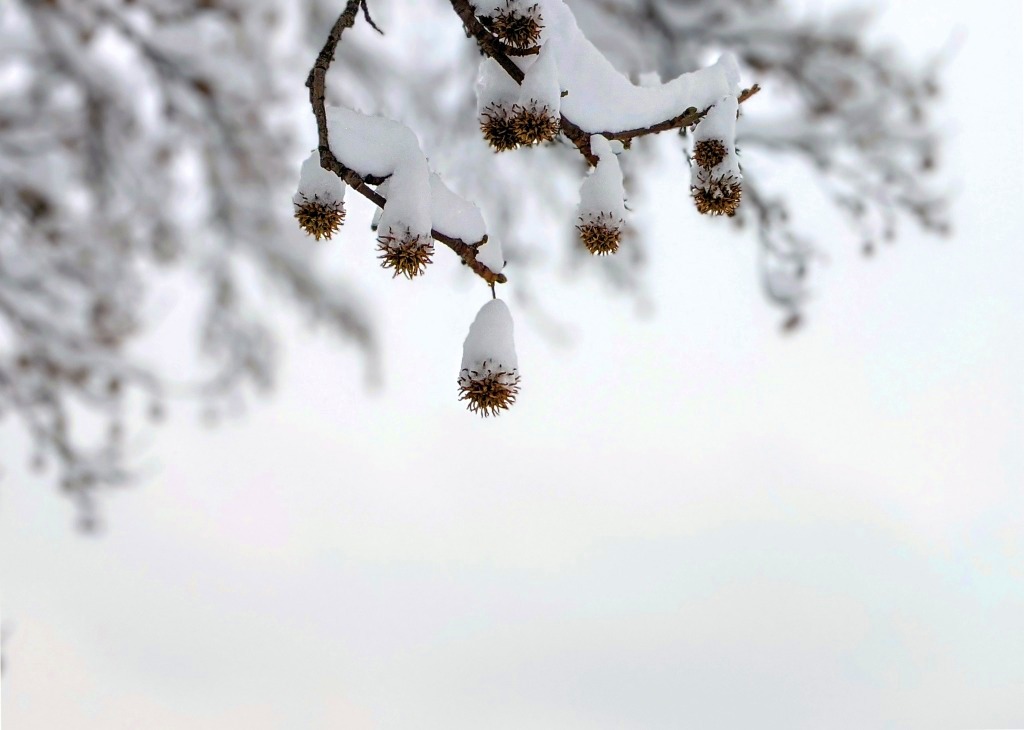
This meadow near Schenley’s Westinghouse Fountain offers seeds for sparrows and juncos, 17 Dec 2020 (photo by Kate St. John)Sweetgum seed balls wear snowy caps, 17 Dec 2020 (photo by Kate St. John)
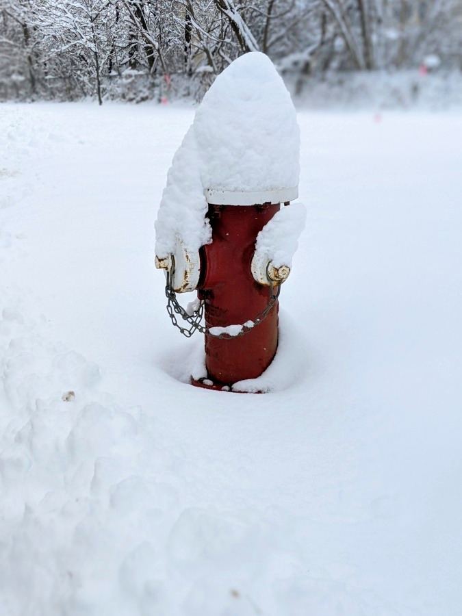
On my way home I found one of Santa’s elves near the Library!
Santa’s elf or fire hydrant? 17 Dec 2020 (photo by Kate St. John)
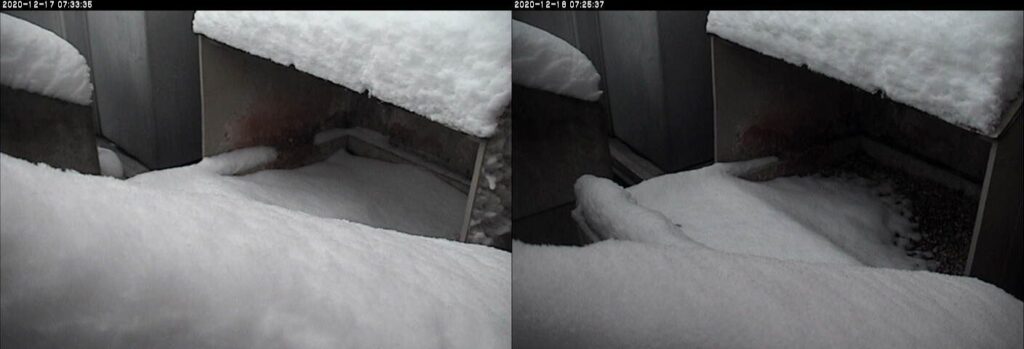
Though the snow didn’t melt it did compress in 24 hours. Here are two snapshots of the Pitt peregrine nestbox at 7:30am on Thurs 17 Dec and Fri 18 Dec. Though there is still a lot of snow it is not as daunting, even if it hasn’t been shoveled.
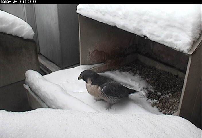
No peregrines visited the nest yesterday but I know they are present. I saw Morela perched on a gargoyle.
UPDATE 18 Dec 2020, 4:08pm: Morela examines the snow.
(photos by Kate St. John; statues photo by Richard St. John)