The National Weather Service forecast for Pittsburgh is:
Today Cloudy, with a high near 35. Northwest wind around 6 mph.
— National Weather Forecast for Pittsburgh, PA, 6 December 2020 at 7am
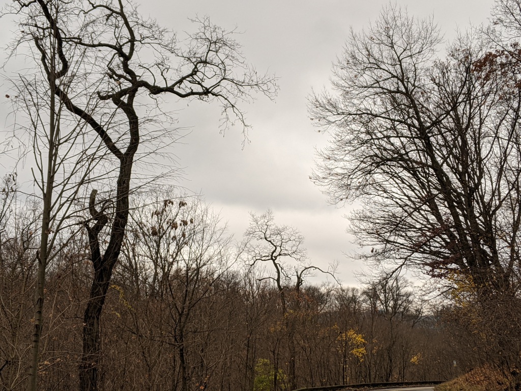
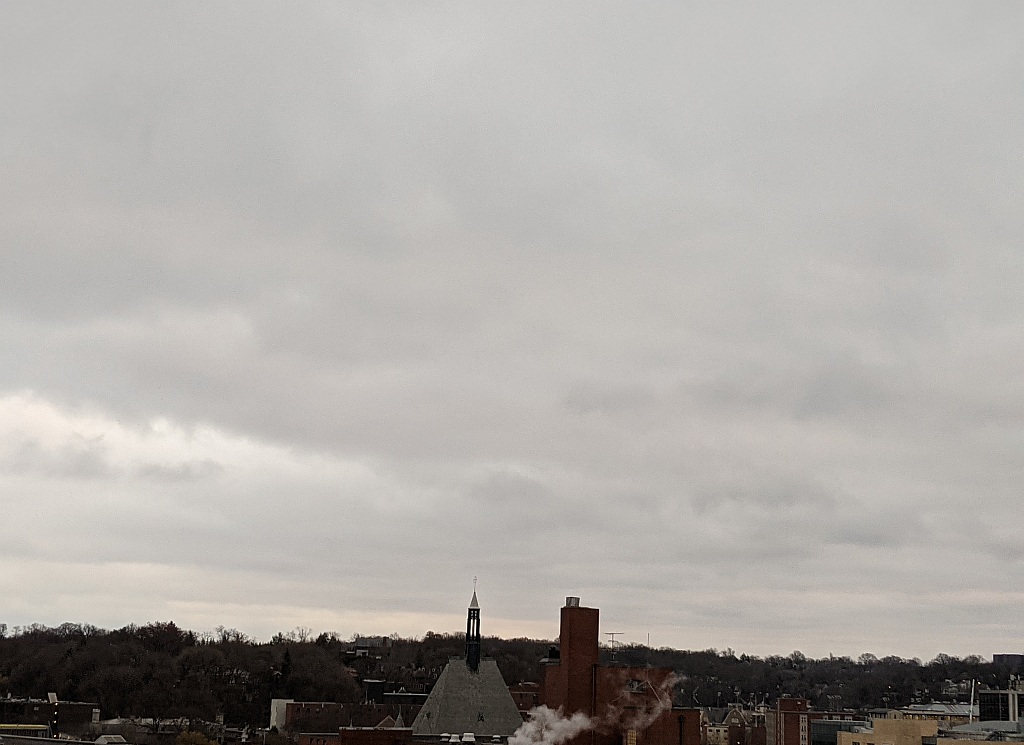
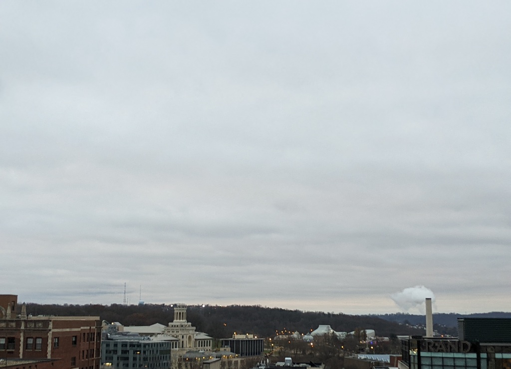
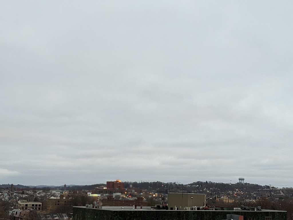
Cloudy? Nope. Overcast! Here’s what it looks like in my neighborhood at 7:30a.m.
Sky looking southeast, Pittsburgh, 6 December 2020, 7:33am (photo by Kate St. John)Looking south, Pittsburgh, 6 Dec 2020, 7:33am (photo by Kate St. John)Looking north, Pittsburgh, 6 Dec 2020, 7:32am (photo by Kate St. John)
We call this Pittsburgh Gray.
(photos by Kate St. John)
p.s. It is hard to keep a positive attitude when the sky looks like this and our hospitals are overwhelmed with COVID patients. Hang in there! Take a walk. Sit among the birds.
Here’s a visual portrait of the past week, from a warm day at Duck Hollow on 29 November, to snow on 1 December, and yesterday’s awesome sky at Moraine State Park.
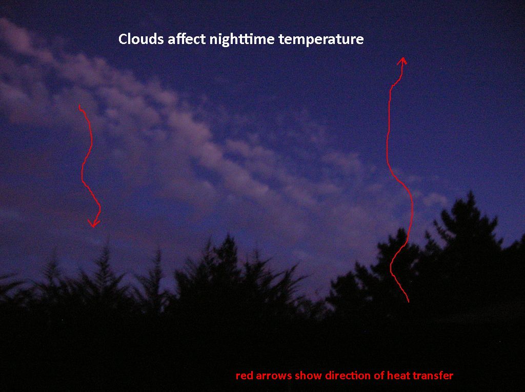
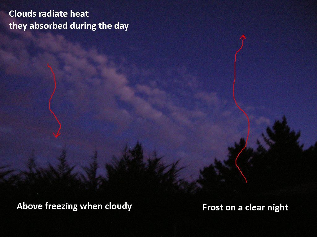
Clouds are not holding in heat. They are emitting it!
Clouds absorb heat during the day just as the earth does. When the temperature falls clouds emit heat in all directions including downward to us below. Their warmth can be just enough to keep us above freezing.
On a clear night there is nothing to warm us so we have frost in the morning.
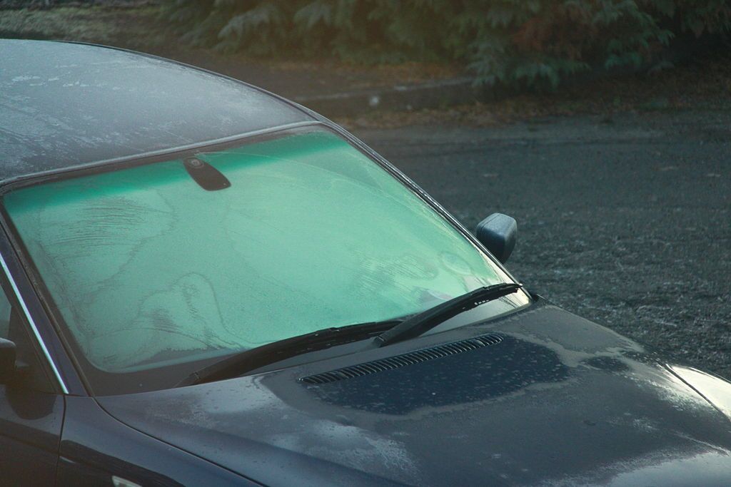
Did you know you can avoid frost on your windshield if you park beneath a tree on clear, near-freezing nights? The tree is emitting heat, too. No frost in the morning.
Either it is very cold in this picture or the car was not parked under a tree.
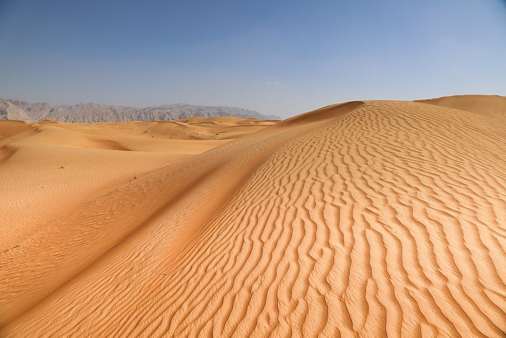
Quiz! Where is the largest desert on Earth? What continent is it on?
By “largest” I mean square miles. By “desert” I mean …
A desert is a barren area of landscape where little precipitation occurs and, consequently, living conditions are hostile for plant and animal life. The lack of vegetation exposes the unprotected surface of the ground to the processes of denudation. About one-third of the land surface of the world is arid or semi-arid.
Leave a comment with your answer. I’ll post the answer later today (see below).
Click here for a map (By the way, this map includes the answer but it doesn’t look that way!)
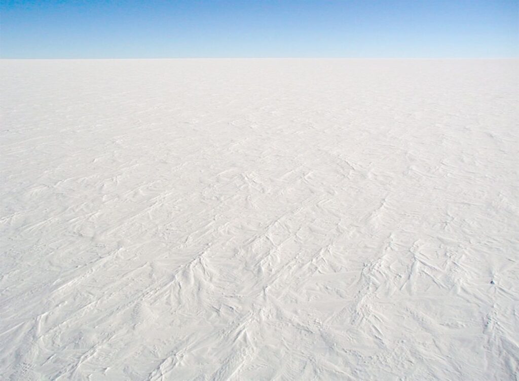
ANSWER: Antarctica! In fact both poles are deserts. The Antarctica Polar Desert is 5.5. million square miles, the Arctic Polar Desert is 5.4 million sq mi and the Sahara is 3.5 million sq mi. Read more about the largest deserts at geology.com.
Snow surface at Dome C Station, Antarctica (photo from Wikimedia Commons)
It cannot be too cold to snow some. It can be too cold to snow a lot. As air gets colder, it can hold less moisture. This is why the Antarctic is the greatest desert on Earth. It’s drier in many places than the Sahara! Climate change is expected to cause more snow in polar regions, not less. Now you know why. (warmer air means it can snow more)
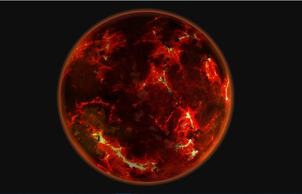
Back in 2018 astronomers discovered a planet 200 light-years away and five times the size of Earth. K2-141b is a lava planet so close to its sun that its rotation and orbit are in lock step; the same side always faces the sun. It also moves really fast completing an orbit in only 0.28 days. Earth’s orbit takes a year. On K2-141b a “year” lasts 6.7 hours!
All of this was so intriguing that astronomers from York University, McGill University, and the Indian Institute of Science Education and Research decided to model K2-141b’s atmosphere. Published in the Monthly Notices of the Royal Astronomical Society, their report attracted attention because K2-141b is so unbelievably hellish. For instance:
The planet rains rocks, has an enormous lava ocean over 60 miles deep, and winds whip across its surface at speeds more than four times the speed of sound. And, because of how the small planet moves around its sun, one part of it experiences permanent daylight and reaches temperatures up to 5,432 degrees Fahrenheit, while the other side exists in permanent darkness, and temperatures drop to negative-328 degrees.
Put all that together and you get a place hot enough to evaporate rock, windy enough to transport the evaporated minerals rapidly to the other side of the planet, and cold enough on the dark side for minerals to condense quickly and fall as a rain of rocks!
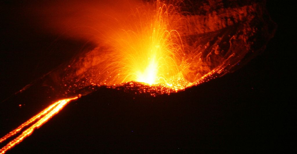
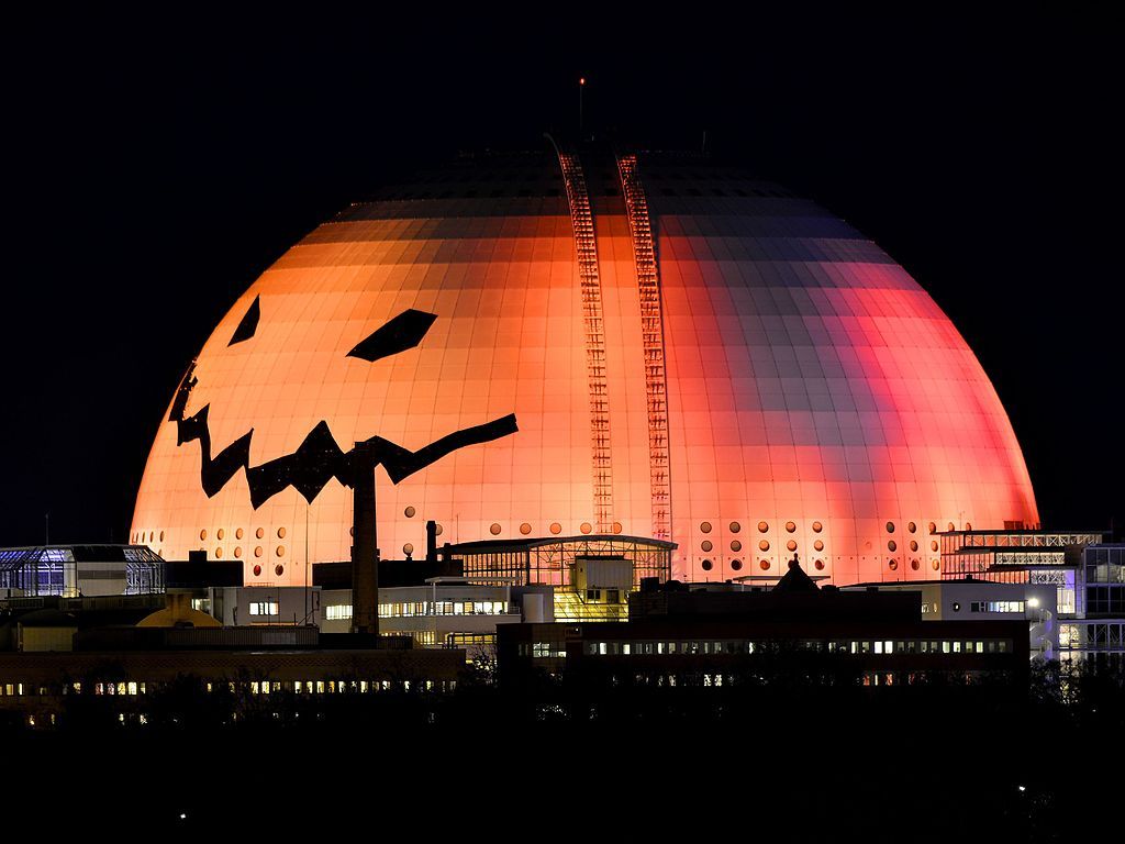
No squash can match the Ericsson Globe in Stockholm, Sweden when dressed for Halloween. At 360 feet in diameter it’s wider than a football field, the largest jack o’ lantern in the world.
However, the universe wins the prize for size. The Jack O’ Lantern nebula is a cosmic cloud of radiation and particles emitted by a huge star 15-20 times heavier than our sun. This 2019 animation from NASA/JPL-Caltech shows why it’s called The Jack O’ Lantern.
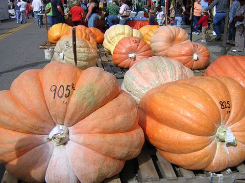
1,179 pound jack o’ lantern in Aspinwall, PA, 30 Oct 2020 (photo by Betty Rowland)1,179 pound jack o’ lantern in Aspinwall, PA, 30 Oct 2020 (photo by Betty Rowland)
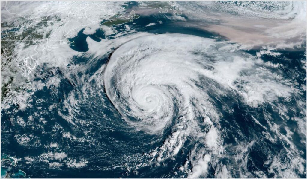
Smoke from Colorado’s second largest fire on record, the 170,000-acre East Troublesome Fire, was carried by the jet stream to the northeast of Hurricane Epsilon (upper right of image).
Rose hips, Frick Park, 3 October 2020 (photo by Kate St. John)
This October there are plentiful fruits and seeds for migrating birds in Pittsburgh. Virginia creeper, porcelain berry, and rose hips (above) provide food for cedar waxwings and robins.
Pine siskins invaded southwestern Pennsylvania this week! Many of you are reporting them at your backyard feeders while natural food sources, such as arborvitae, have created pine siskin hotspots. Siskins force open the cones with their sharp beaks and pick out the seeds.
These arborvitae cones were on the ground at a pine siskin hotspot. Three stages are pictured: Top = Spent cones as much as one year old, Middle = Opened cones that were emptied by pine siskins, Bottom = a mix of closed, opened and spent cones.
Arborvitae cones that fell on N Dithridge Street thanks to pine siskins, 9 Oct 2020 (photo by Kate St. John)
The huge acorn crop in Schenley Park is attracting many blue jays, squirrels and chipmunks. Here’s what the ground looks like below the oaks at Bartlett Shelter.
Many, many acorns, Bartlett Shelter Schenley Park, 7 Oct 2020 (photo by Kate St. John)
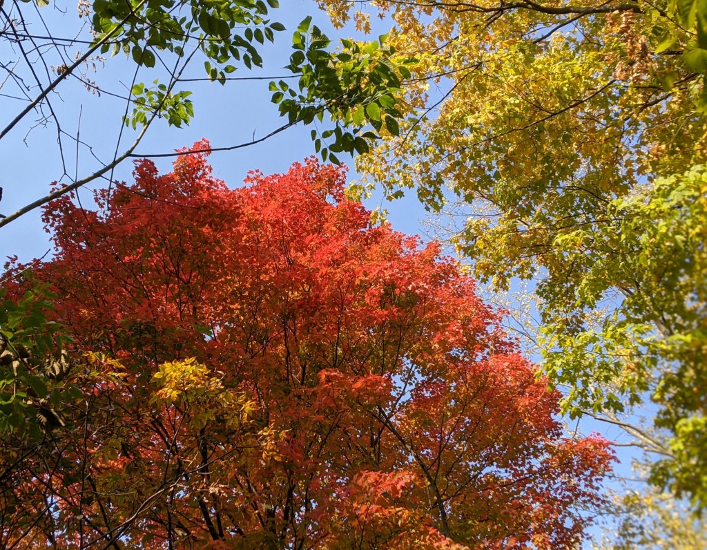
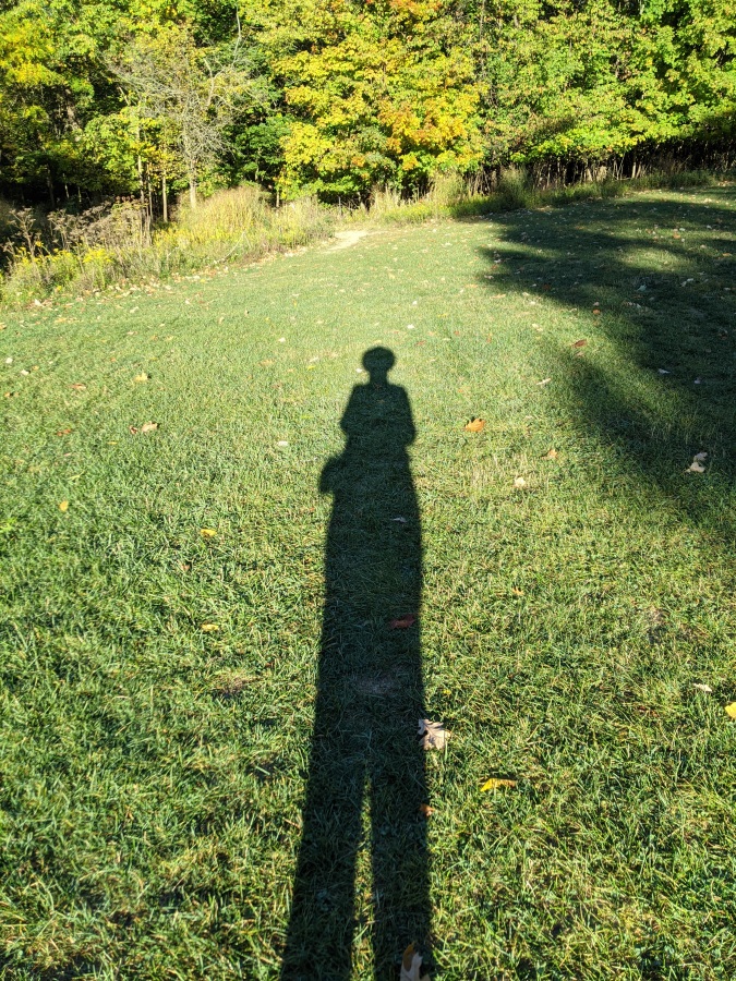
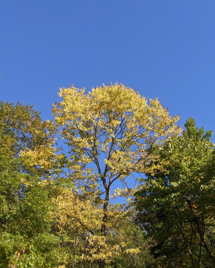
In other delights October trees, sky and shadows are spectacular.
Fall colors, Schenley Park, 7 Oct 2020 (photo by Kate St. John)
Long shadows, Schenley Park, 7 Oct 2020 (photo by Kate St. John)
Fall color in Frick Park, 6 Oct 2020 (photo by Kate St. John)
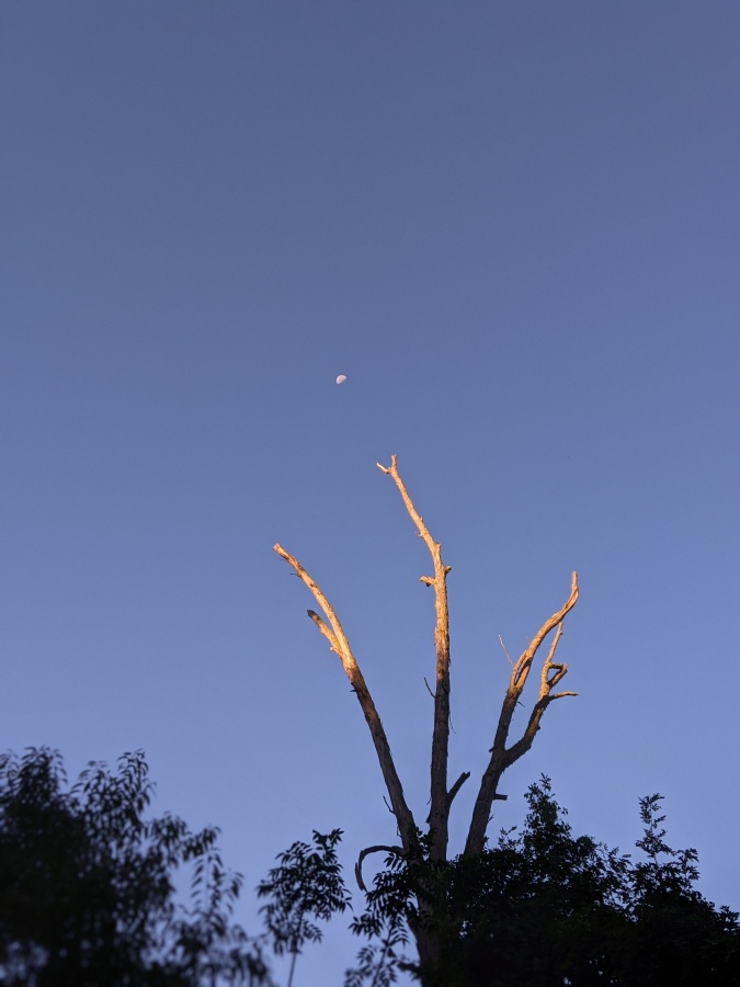
Dead hickory points to the moon, 8 Oct 2020 (photo by Kate St. John)
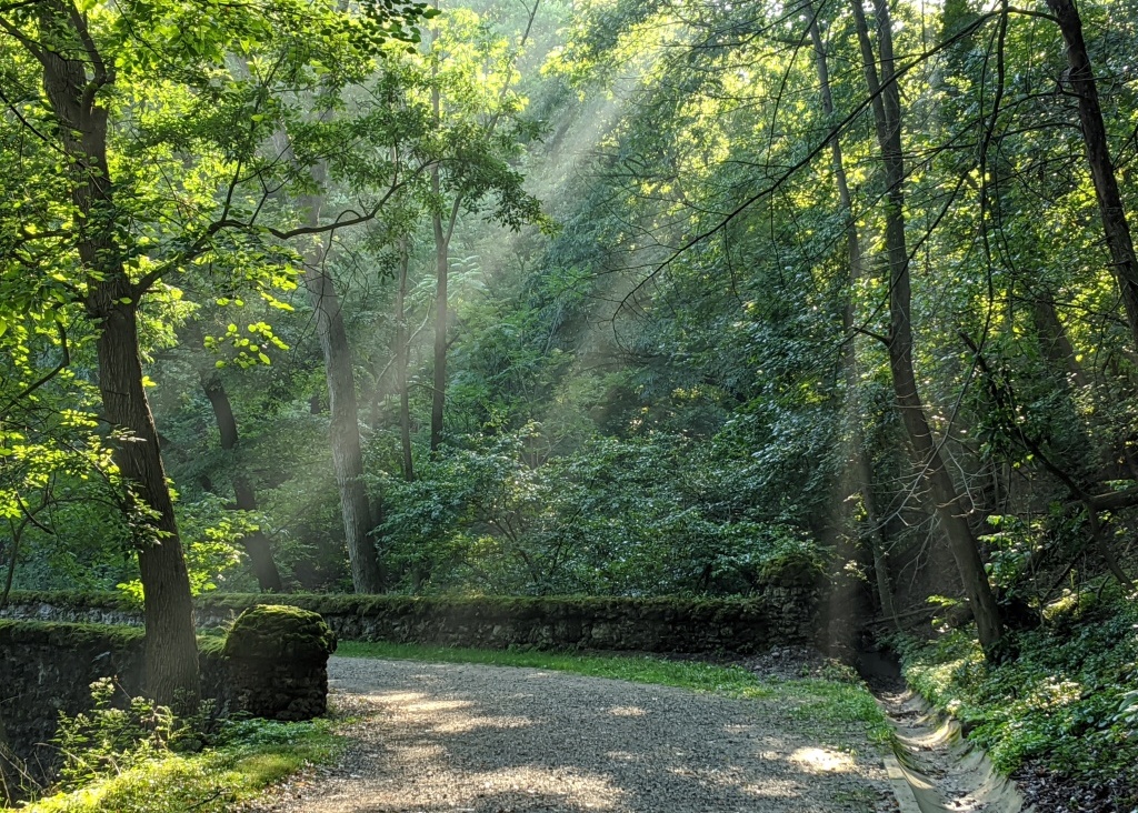
Sun rays on a misty morning in Schenley Park, 8 Sept 2020 (photo by Kate St. John)
20 September 2020
Fall is in the air in Pittsburgh as sun rays peek through autumn mist in Schenley Park.
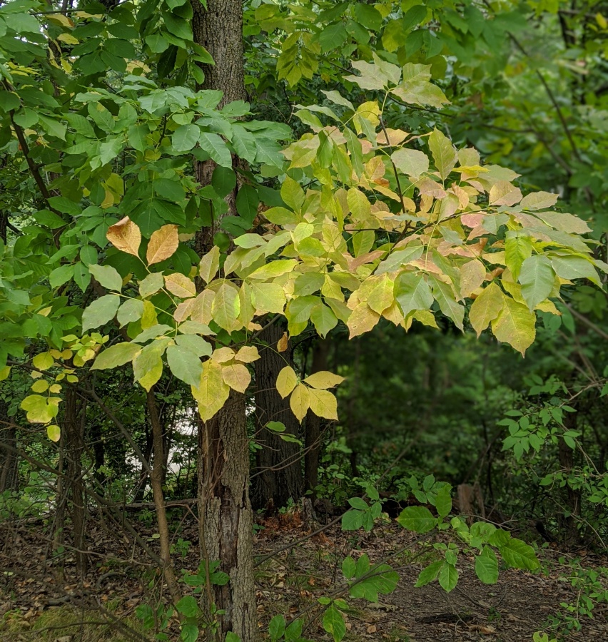
Below, though the large ash trees have died of emerald ash borer the small ones still put out leaves that turn unique colors. These are on their way from yellow to lavender.
White ash leaves turn a variety of colors in fall, Schenley Park, 18 Sept 2020 (photo by Kate St. John)
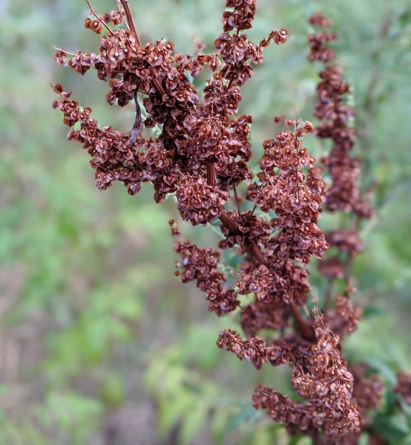
All summer we noticed curly dock (Rumex crispus) leaves and not the flowers. Now our attention is reversed because the seeds have turned a rich brown. The stalk is ugly, however the seeds are fascinating up close, each one surrounded by the calyx that produced them. The papery wings allow them to float on water and fly a bit in the wind.
Curly dock, gone to seed, Schenley Park, 17 Sept 2020 (photo by Kate St. John)
The most obvious sign of fall is the temperature. 43 degrees F at dawn today. Speaking of gloves, you’ll need them when you go birding in the morning.
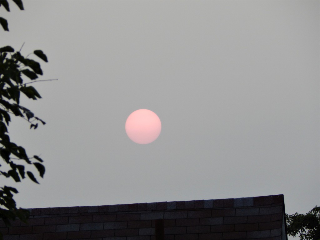
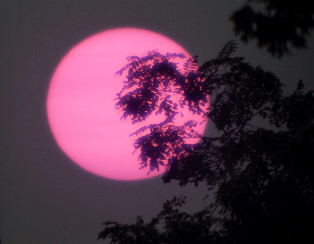
Late afternoon sun looks pink in Pittsburgh, 14 Sept 2020 (photo by Jonathan Nadle)
16 September 2020
This week’s spooky sunsets and hazy skies in eastern North America are due to smoke from the massive wildfires in Washington, Oregon and California. The smoke is so intense that it’s dispersing across the continent and across the Atlantic, causing haze in Europe.
Near sunset on Monday 14 September the sun was a strange shade of pink in Pittsburgh, captured above in true color by Jonathan Nadle.
We can’t see the smoke coming but the satellites do, blowing eastward in two paths on Tuesday 15 September: one over the Northern Plains and Great Lakes, the other over Nebraska to Kentucky and Virginia.
#SATELLITE SPOTLIGHT: #Smoke from the #WesternWildfires continued to blow eastward today, as seen here from @NOAA‘s #GOES16??. Although it wasn’t nearly as thick as in the West, the smoke caused #hazy skies in many cities along the East Coast–including Boston, New York, and D.C. pic.twitter.com/AhP4mlYgSX
— NOAA Satellites – Public Affairs (@NOAASatellitePA) September 16, 2020
It’s also blowing west over the Pacific, shown here on Friday 11 September.
— NOAA Satellites – Public Affairs (@NOAASatellitePA) September 12, 2020
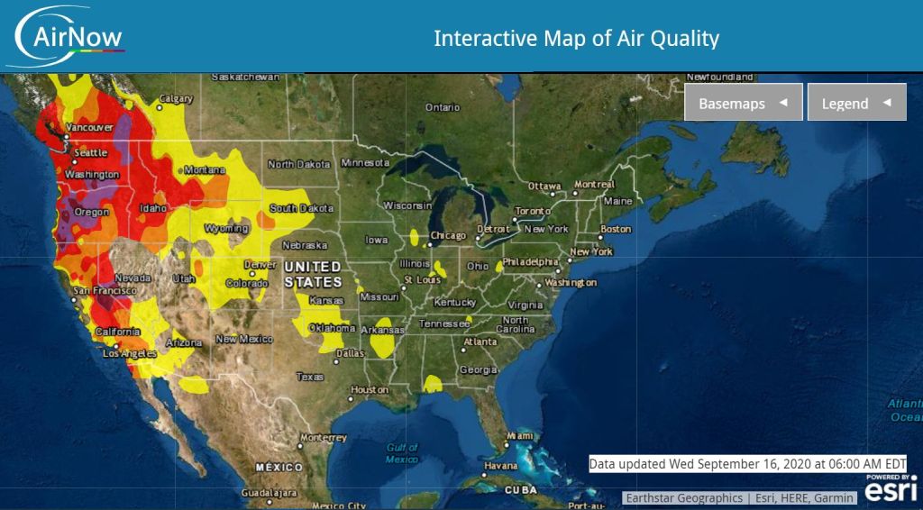
The haze is inconvenient for us but truly hazardous on the West Coast. The dark brown colors on the map below are the worst air quality in the world. The air is so bad that people are leaving the area. I know of at least one person who’s fleeing from San Francisco to Pittsburgh.
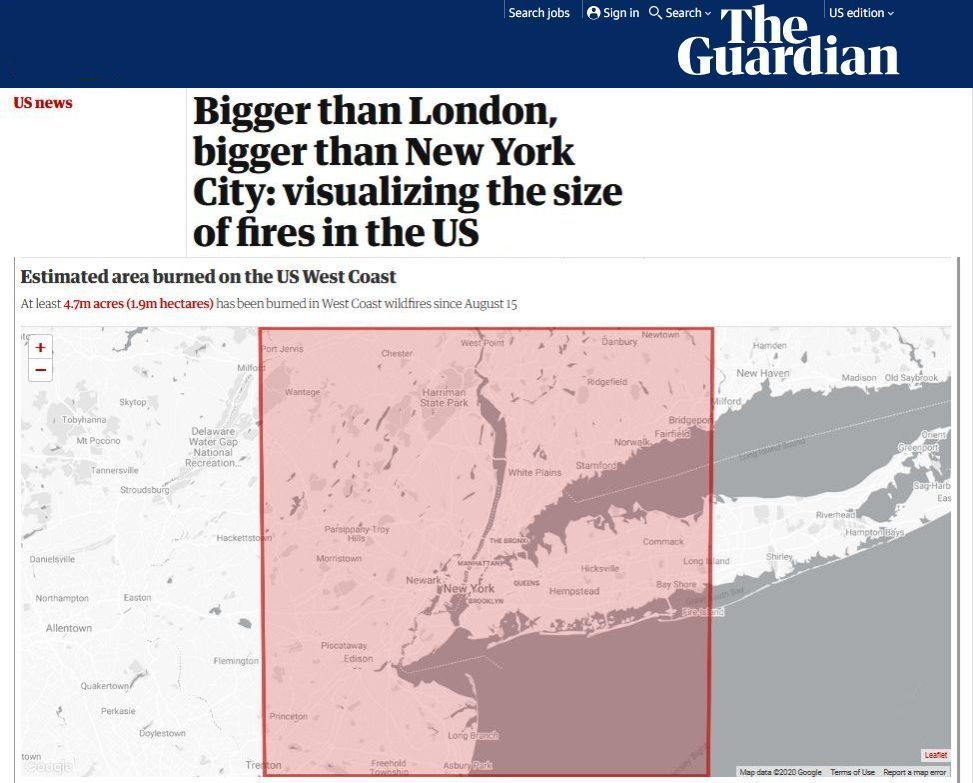
By now the fires cover 4.5 million acres, an area so large that it’s hard to imagine. To help you visualize it The Guardian has created an interactive map comparing the fire acreage to well known cities and your own hometown — click here or on the tiny screenshot below. NOTE: The comparison below is for New York City. I compared the fire acreage to Pittsburgh and found it would run from approximately I-80 to the PA-West Virginia line!
Strange sun at sunset in Pittsburgh (filtered), 15 September 2020 (photo by Jonathan Nadle)
None of us are immune to this huge effect of climate change. Smoke gets in our eyes.
UPDATE: Janet Campagna, who lives in California, remarked that the days are much cooler because the sun can’t get through the smoke. This reminded me of the volcanic winter which results from smoke in the atmosphere after giant volcanic eruptions such as Krakatoa in 1883 and Mount Pinatubo in 1991.
(photos by Jonathan Nadle, screenshot of AirNow map from airnow.gov, screenshot of article from The Guardian)