In this NASA video a robotic spacecraft called Juno makes its sixteenth fly-by (Perijove) since arriving in mid-2016. Its closest approach is almost dizzying. I feel better when the spacecraft zooms away and we see the swirling clouds.
Did you notice that Jupiter is on the sound track, too? The fourth movement of Gustav Holst’s The Planets is called Jupiter, The Bringer of Jollity. Listen to the entire majestic movement here.
An article about ice on a very icy day, 8oF and falling.
Considering how often the temperature has fluctuated in Pittsburgh this winter I’m surprised we haven’t seen more glaze ice.
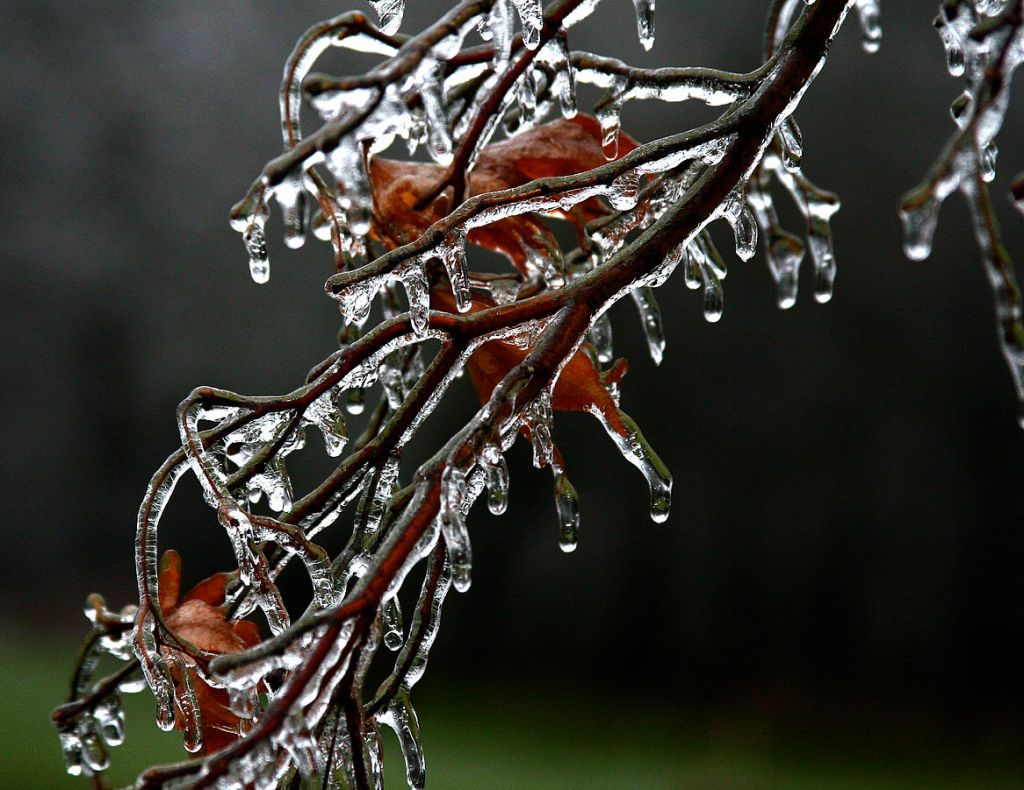
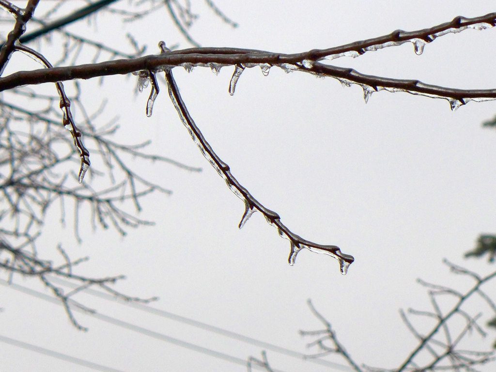
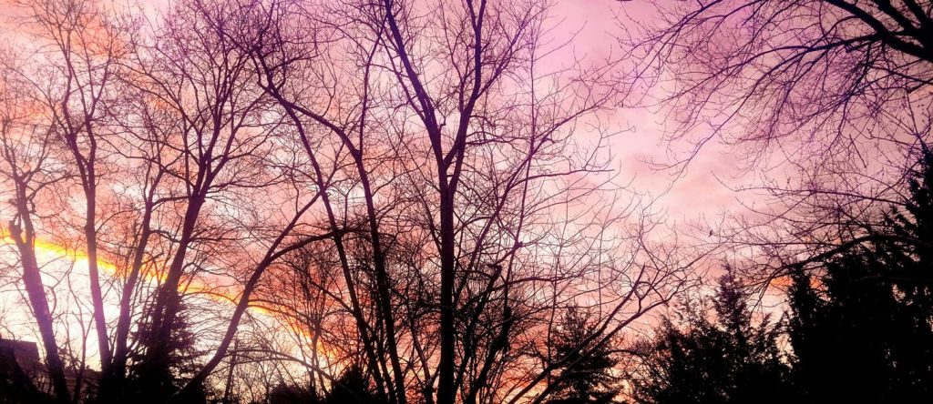
Glaze ice is the name for the icy coating caused by freezing rain or freezing drizzle. If the accumulation is small, the effect is beautiful and the electricity stays on. The photo above from Wikimedia Commons is more beautiful than my own below.
Glaze ice on a tree, overcast sky, Pittsburgh (photo by Kate St. John)
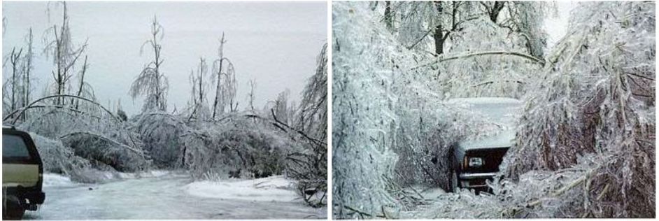
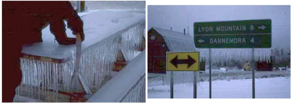
When glaze ice is 1/4 inch thick or more the Weather Service calls it an ice storm. A quarter of an inch doesn’t sound like much but it’s so heavy that it weighs down the trees and they fall on power lines, streets, parked cars and houses. Power lines and power towers can fall, too. According to Wikipedia, “just one quarter of an inch of ice accumulation can add about 500 pounds (230 kg) of weight per [power] line span.” No wonder things come crashing down.
In January 1998 I wasn’t in Maine for the Great Ice Storm but I remember its results quite vividly. We visited central Maine in September and there were still broken trees everywhere. Folks who lived through it said they were without power for weeks. Everyone was stuck near home — couldn’t drive anywhere — so the radio stations connected people by announcing supplies and requests for help. Everyone pulled together.
After a beautiful red sunrise the sky cleared enough to reveal thin, wavy clouds flowing overhead. The National Weather Service said these clouds were at 11,000 feet — “alto” height, not cirrus height — but they really looked like this cirrocumulus undulatus photo at the International Cloud Atlas. Notice the feathery details in the photos above. (The four slides show two in normal color and two enhanced for contrast).
Cirrus clouds indicate a change in the weather. So did the red sunrise, photographed by Dan Dasynich. “Red sky at morn, sailors forewarn.”
Remember how cold it was in January 2014? It’s been five years since we saw extremely cold weather but the jet stream is wobbling again and we’re going to see a smack of subzero temperatures this week. The maps show this week’s forecast lows described by the National Weather Service:
Bitter cold temperatures will give way to a potentially record breaking push of Arctic air this week. Wind chills as low as -40 or colder can be expected across the Northern Plains and Great Lakes. In addition, wide swaths of heavy snow can be expected across the area. This system will push east and south early this week with much below normal temperatures and wintry precipitation.
National Weather Service, 27 Jan 2019, 5am
Crazy as it seems, extreme cold is a sign of climate change. Here’s an explanation from my Polar Vortex article of January 2014:
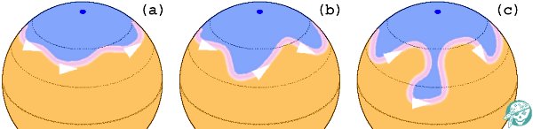
“In the good old days before climate change, the winter polar vortex in the northern hemisphere was generally well behaved. It was a persistent, strong, cold, low pressure zone surrounding the polar high at roughly the same latitude around the globe. The strong winds kept the jet stream in line. Nobody got too hot or too cold.
“But now as the Earth gets hotter hot air from the troposphere is forced into the stratosphere and disrupts the polar vortex. The vortex weakens, becomes disorganized, and can collapse into smaller pieces. Its winds weaken and the jet stream flaps like a flag in the breeze, as shown in (c) below.”
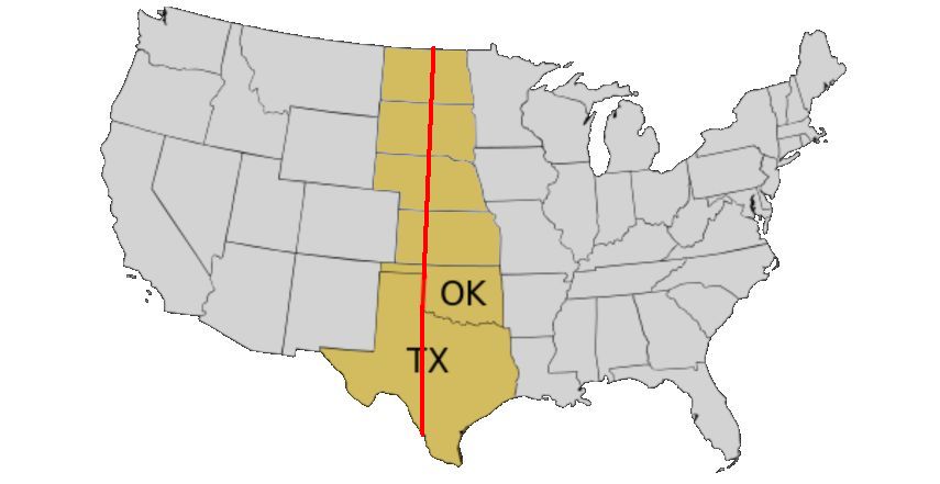
The 100th Meridian West is an imaginary line on the map that happens to mark the climate divide between the humid east and arid west in North America. Or rather, it used to. The rainfall divide is moving east.
Extending from the North to South Poles, the 100th runs longitudinally in the U.S. from North Dakota through Texas.
Its coincidence with the rainfall divide was first documented in 1877 by John Wesley Powell who found during his explorations in the Great Plains that the 100th was a visible boundary. Locations to the east of the 100th received 20+ inches of annual rainfall, the west received less.
20 inches is a key number for agriculture and human population. It determines what you can grow, whether you have to irrigate and, thus, how many people can live there. Powell saw the line and told Congress it had implications for settlement of the western plains. Congress didn’t heed him but …
This 2014 map of U.S. Population by County shows that it played out as Powell expected. You can see the rainfall divide in population density. People choose to live where there’s water.
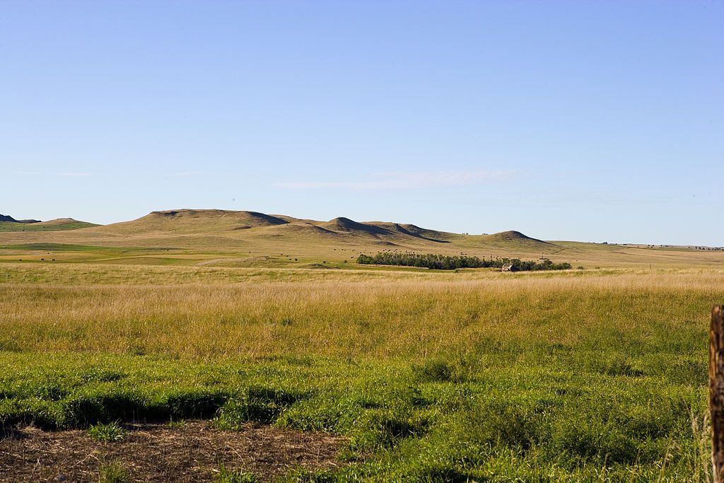
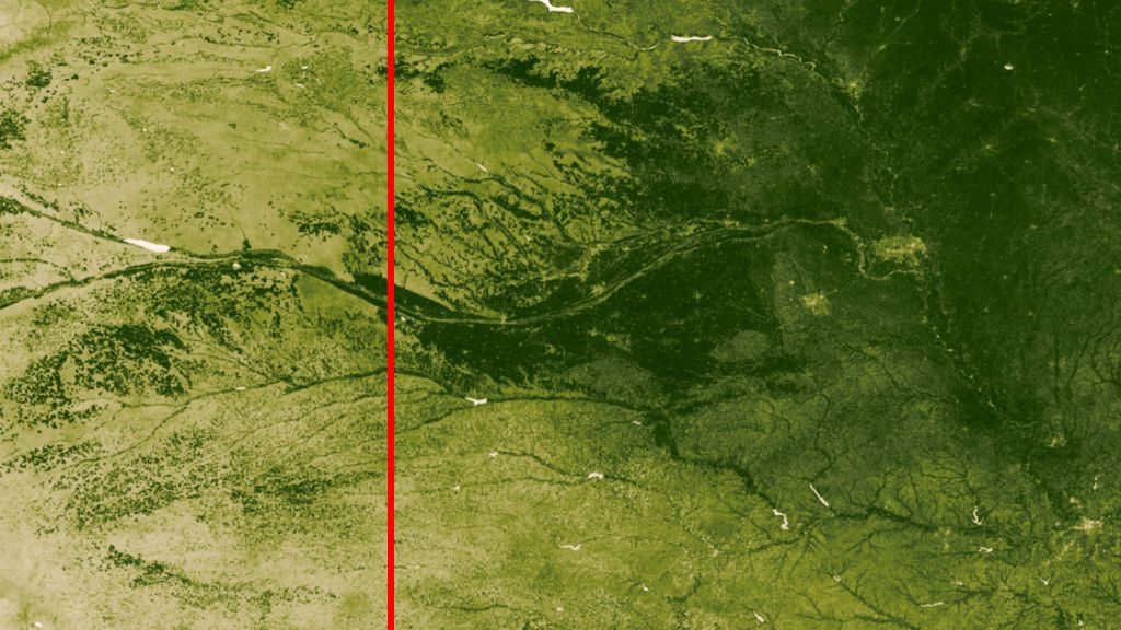
You can also see the line from outer space. I’ve marked the 100th (approximately) on this satellite photo of Nebraska. The landscape is deep green to the east though not uniform.
In a hundred years the aridity mark may be firmly inside Minnesota, Iowa and Missouri. Aridity decreases the amount of agriculture and will probably change the population. People choose to live where there’s water.
John Wesley Powell’s “100th meridian” is moving east.
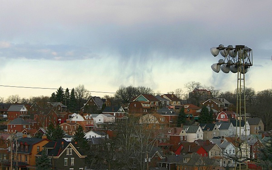
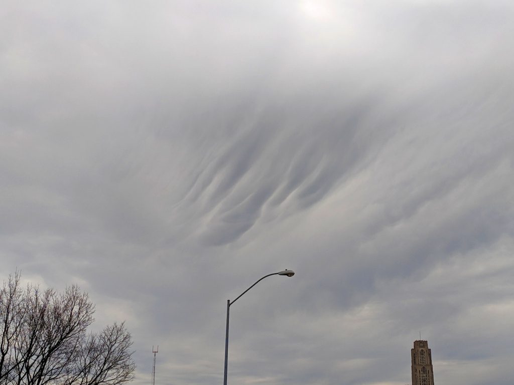
A week ago, 7 Jan 2019, the National Weather Service said the sky was clear at Pittsburgh International Airport but I have proof that at that moment it was overcast in the East End.
Not only was it overcast but the clouds were doing something special near the Cathedral of Learning. See that wrinkle? Is that undulation? Or is it the beginning of an asperitas formation?
Yes, we have overcast skies (tell me about it!) but there are cool things above us if we just take the time to look. Watch the video to get in the mood (exciting background music!).
C’mon, Pittsburgh, it’s time to appreciate clouds!
Here’s a form of ice we’re unlikely to see in Pittsburgh because our weather is rarely cold enough and it’s often overcast.
Diamond dust is clear-sky precipitation that looks like tiny diamonds in the air, falling through a ground-level cloud. The conditions for producing diamond dust are very specific:
The temperature has to be well below freezing — best at -13F or lower.
The cloud must be made of ice. It’s not a freezing fog that started wet and turned icy.
The cloud is in a clear sky and the sun is shining. That’s how you see the diamonds.
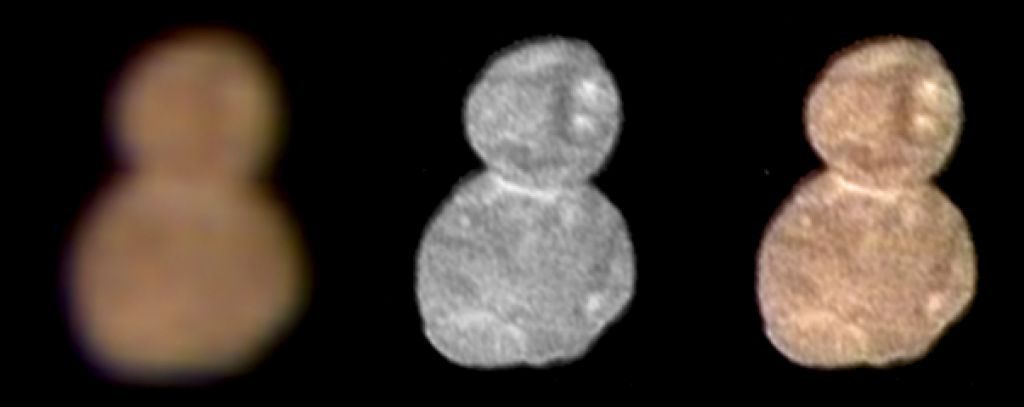
Last week the news broke that NASA’s New Horizons spacecraft had flown by and photographed what looks like the “snowman of the universe,” two icy chunks stuck together like a snowman and spinning out there in the Kuiper Belt beyond Neptune.
Yes, this object spins. Here’s a time lapse from NASA on New Years Day 2019.
The snowman is reddish and tiny, only 20 miles long, so he can’t be seen from Earth. We wouldn’t even know about him except that a few years ago the New Horizons team looked for something interesting for the spacecraft to explore after it passed Pluto. They saw him as a dot using the Hubble Space Telescope in 2014 and chose him because he’s a classical Kuiper Belt object with low inclination and low eccentricity.
How eccentric is a snowman in outer space? It depends on his orbit.
Ultima Thule’s real name is (486958) 2014 MU69. It’s just the right number of digits for a phone number, but don’t call it. The long distance charges are astronomical!
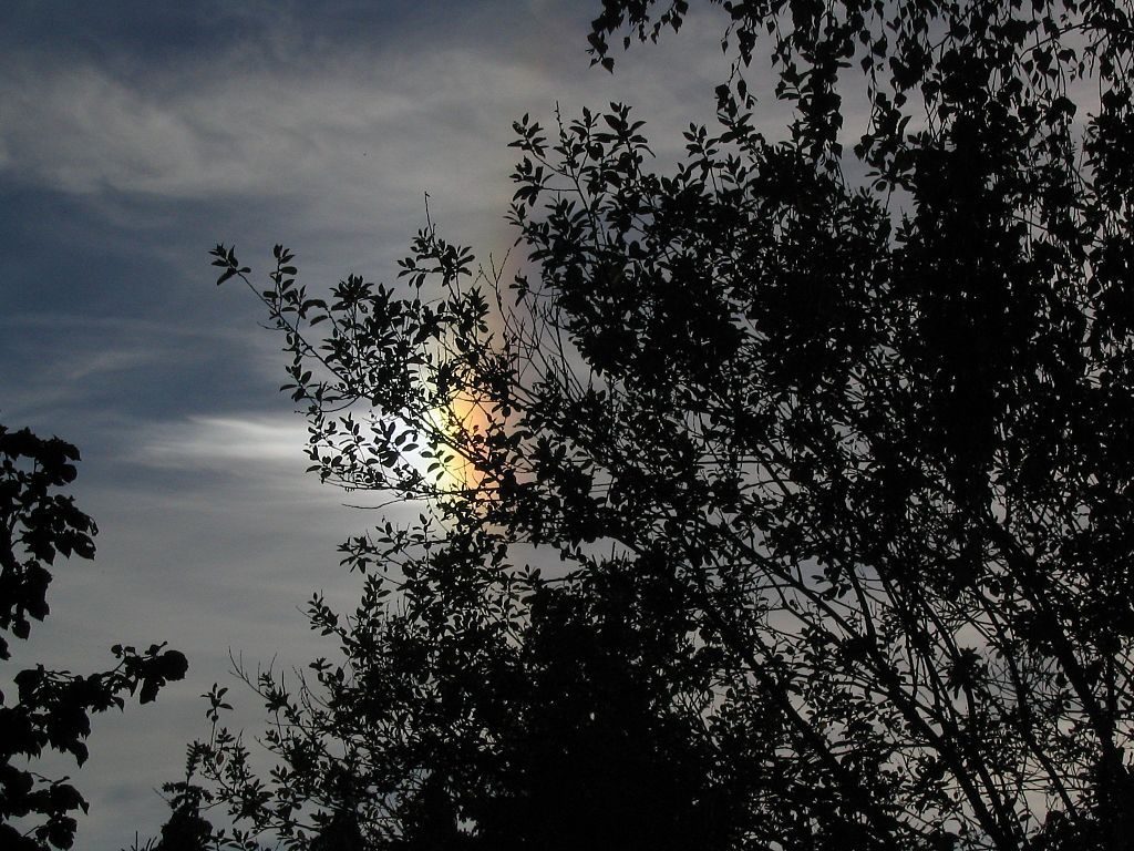
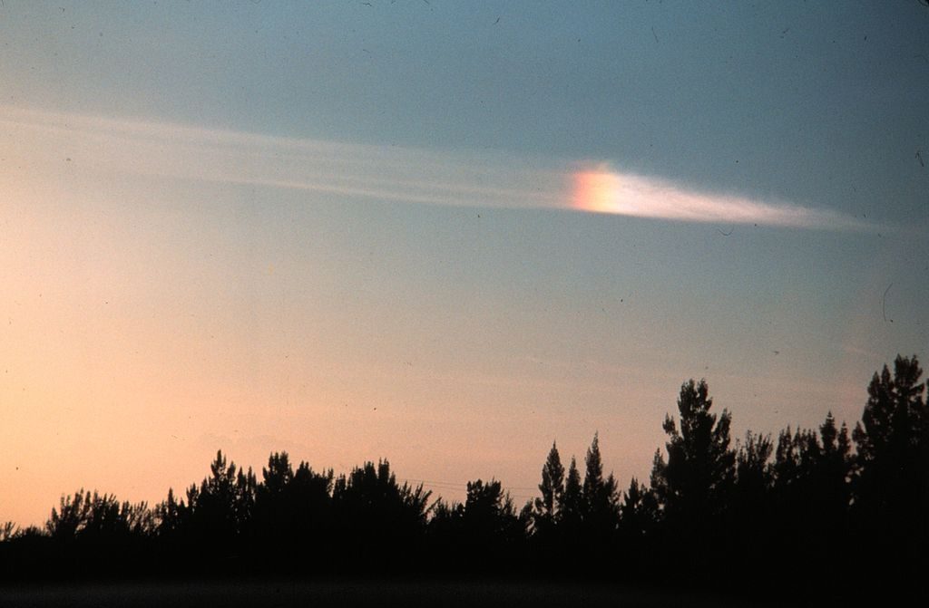
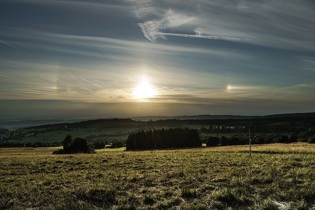
Winter is an excellent time to see sun dogs, one of the many atmospheric optical phenomena caused by ice crystals in the air.
Sun dogs, also called parhelia, are bright spots to the right and left of the sun on the same horizontal level. If you know how to measure angles in the sky you’ll find them at 22 degrees from the sun, sometimes with rainbow colors.
Sun dogs are best seen when the sun is near the horizon but in Pittsburgh clouds often obscure one sun dog or even the sun itself. Pictured above is a lefthand sun dog, pictured below is one on the right. You can tell, even without seeing the sun, because the red end of the rainbow is nearest the sun.
If you’re really lucky you’ll see the sun between two very bright sun dogs. The “three suns” effect shows the origin of their name in Greek mythology — Zeus (the sun) walking his two dogs.
In the old days, three suns were considered an omen and not a good one. During the Wars of the Roses (England’s civil wars in the late 1400’s), the future king had to convince his panicky troops that three suns meant good news.


.jpg)