Category Archives: Weather & Sky

Waves In The Sky

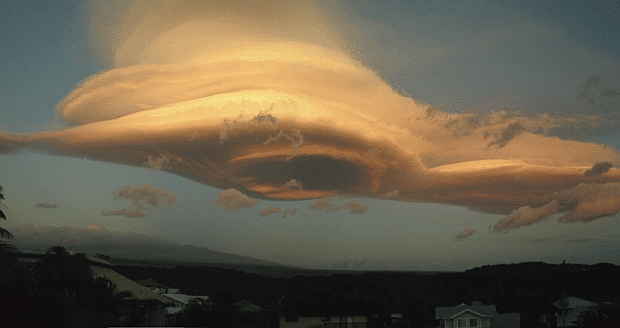
Cloud ripples 12 hours before the cold front (photo by Kate St. John)

10 September 2014

What does it mean when there are waves in the sky?

These altocumulus undulatus clouds form at mid height at the spot where moisture meets wind shear.  Straight above my camera the wind abruptly changed direction and speed.  The long lines are perpendicular to the strongest wind, just like waves on a lake.

Altocumulus undulatus are typically only 300 feet wide so the wind shear here is a narrow zone.  If you flew through these clouds you’d probably feel a bump.

The waves might mean something big is about to happen … or not.  If they thicken over time, they indicate that moisture is building ahead of an approaching front 100 to 200 miles away.  If they cover only a small part of the sky, they merely mean that something’s going on right there.

Keep looking up.

(photo by Kate St. John)

In Fog

Adrift from Simon Christen on Vimeo.


On chilly autumn mornings, the fog rises from Pittsburgh’s rivers and envelops the town.

Our fog is nothing to the thick fogs on northern coasts.

In San Francisco, Simon Christen took time lapse photos of moving fog and wove them into his beautiful video:  Adrift.

Play it above in small format or click here for the full screen version on Vimeo.


See more of his fascinating photos and videos at Simon Christen’s website.

(video by Simon Christen on Vimeo)

p.s. If the video plays haltingly on your computer, click on the HD letters at bottom right of the video window to turn off High Definition which requires lots of bandwidth.

Why Does Thunder Rumble?

Lightning over Switzerland; 4 strobe images of one bird (photo from Wikimedia Commons)

25 August 2014

After a week of daily thunder and heavy rain we’re finally getting a spate of clear weather.  Today’s interesting thunder facts can’t be applied immediately but we’ll get another chance before long.

We’re all familiar with the crack of lightning and thunder’s low rumbles.  Sometimes we hear another loud bang in the middle of the series.  Why does thunder rumble and what are those mid-bangs about?  I found an explanation at the UK’s Weatheronline website.

First, let’s review the basics about light and sound.  Lightning travels at the speed of light, thunder at the speed of sound.  There’s such a time lag between them that we can figure out how far away the lightning is by counting the seconds between the flash and the sound, 5 seconds per mile.

The initial thunderclap is the closest part of the lightning but (amazingly!) the bolt itself is several miles long. We see it flash in twists and turns, branches and offshoots.  Every piece makes a thunderclap but many of the parts are so distant they sound like rumbles instead of booms.

What’s the bang in the middle?  It might be a new lightning bolt but … it could be the same bolt zigzagging closer as it travels through the sky.  The closest part is that middle bang.  Click here for an illustration showing how sound lags within a single lightning bolt.

Thunder rumbles because lightning is not a short, contained flash.  If it was we would hear a single loud boom, like the boom of an electrical transformer blowing up on the pole outside your house.  (I’ve experienced this!)

And here’s a cool note about the photo:
Do you see the birds flying below the cloud?  It’s actually only one bird!  The lightning flashed four times while the shutter was open so the bird appears four times as it flies through the storm.  Brave bird!

p.s. To see all four bird images, click here for the annotated photo with a yellow box.

(photo of lightning in Switzerland by Hansueli Krapf via Wikimedia Commons)

Weather’s Wardrobe Challenge

What to wear. Weather's wardrobe challenge, May 2014 (photo by Kate St. John)

The weather has been so up-and-down lately that it’s hard to dress for birding. At home my winter clothes are piled in stacks, waiting to be washed after I pulled out summer shirts for last week’s 87 degrees.

Now the summer clothes are in stacks and I’ve yanked sweaters out of the winter pile.  It’s 42 degrees this morning and will be 37 at dawn tomorrow.

What to wear for outdoor activities this month?  It’s a wardrobe challenge.


p.s.  It’s more than a wardrobe challenge for swallows, purple martins, chimney swifts and nighthawks.  It can be life-threatening.  These species eat flying insects which don’t fly when it’s cold.  Fortunately the next two days will be sunny with highs of 62 and 71 so the insects will be flying later in the day.  If you missed it, read here about purple martin landlords providing supplemental feedings in cold weather.

(photo by Kate St. John)

Rain, Rain, Here To Stay

Rain in Ukraine (photo by Pridatko Oleksandr via Creative Commons license Wikimedia Commons)

17 May 2014

Thursday afternoon it rained like this for about an hour.  Additional rain fell all day giving us 1.10 inches, a new record for May 15 in Pittsburgh.

The rain messed up rush hour and now the Ohio River is close to flood stage, but this is minor compared to the April 29-30 rain event in Pensacola, Florida when they received an amazing 10-15 inches in 9 hours, a total of 22 to 26 inches for the period.

Precipitation in Pittsburgh feels abnormal this spring.  Aren’t we wetter than usual this year?  No.  The rain gauge is less than 1/2 inch above normal since January 1.  The real difference is that the rain falls all at once.

We’ll have to get used to frequent heavy downpours, a hallmark of climate change in the northeastern U.S.  Click here to read more.

(photo of rain in Ukraine by Pridatko Oleksandr via Creative Commons license Wikimedia Commons)

It Was Fun While It Lasted

Bloodroot blooming at Cedar Creek Park, 12 April 2014 (photo by Kate St. John)

15 April 2014

During the past three days we had a burst of blooms in Pittsburgh.  Between Saturday morning’s foggy low and Sunday’s high of 82F the landscape transformed from incipient buds to gorgeous flowers.  (Today will be different, but more on that later.)

On Saturday, 12 April 2014, I found bloodroot at its peak at Cedar Creek Park in Westmoreland County (above) as well as spring beauties…
Spring beauties (photo by Kate St. John)

trout lilies…
Trout Lily at Cedar Creek Park, 12 April 2014 (photo by Kate St. John)

and hepatica.
Hepatica blooming at Cedar Creek Park, 12 April 2014 (photo by Kate St. John)

This morning the temperature is dropping fast.  It was 65oF at 5:00am and has already fallen to 47oF as I write.

Tomorrow’s prediction: 21oF at dawn. This will surely ruin the flowers.

It was fun while it lasted.

(photos by Kate St. John)

Frequent Heavy Downpours

Map predicting change in downpour frequency, 2040-2070 (map from NOAA Climate.gov)
Predicted Change in days of extreme rainfall in 2041-2070 compared to 1971-2000, Greenhouse gas higher emissions (map from climate.gov)

19 March 2014

Here’s something to look forward to … or not!

If you’ve been keeping track of intense downpour events for the past 50 years, as NOAA has, you’ve noticed that they are more frequent in Pittsburgh than they used to be.  This will only get worse.

According to NOAA’s National Climate Assessment, by mid-century the frequency and intensity of heavy rain events will increase dramatically in some parts of the country, especially in Washington, Idaho and western Montana.  The bluest locations on the map will experience two or more additional days per year of record rainfall.

Pittsburgh is not exempt. We’ll see an increase in downpours and there will be an even higher frequency north and south of us.  Watch out, Cleveland and West Virginia!

For Allegheny County this map is particularly scary because of our old combined sewer infrastructure (sewage + storm water) that overflows into the rivers after as little as 1/10″ of rainfall.  If you visit our rivers you’ve seen the toilet paper.  The situation is so bad that Allegheny County is under a 2007 EPA consent decree to fix it.  We are not the only city with this problem!

Obviously, the time to fix our sewers is now and the solution has to handle more rain that we get today.

Click here to read more about downpours on NOAA’s website and here for information on Allegheny County’s wet weather problem.

(map from Climate.gov. Click on the image to see the original map and accompanying article)

p.s. 24 March 2014: Oh no! Rain is the culprit in the deadly mudslide in Washington State last weekend: http://m.motherjones.com/blue-marble/2014/03/climate-change-mudslide-washington-weather

Incredible Stormscapes

Stormscapes sky by Nicolaus Wegner)

This awesome video was featured by Russell McLendon on the Mother Nature Network last week.

It was created by Nicolaus Wegner who captured time-lapse photos of developing thunderstorms in Wyoming and South Dakota last summer, then wove them into a video named Stormscapes.  Click on the image to watch it on Vimeo.

After you see it you’ll wonder how he lived to tell the tale.  Learn more in this National Geographic interview.


(screenshot from Stormscapes by Nicolaus Wegner. Click on the image to watch the video)

Really Frozen

Great Lakes 88% frozen (Map by NOAA Climate.gov, based on data provided by the U.S. Naval Ice Center)

Having weathered another snowstorm and dipped back into the deep freeze we can take solace that winter will end this month.  At least we hope so.

Unfortunately if you live near one of the Great Lakes, winter will last longer than normal this year.

On February 24 Climate.gov reported that for the first time in 20 years the Great Lakes were more than 88% frozen with four lakes — Superior, Erie, Huron, and St. Clair — 90 to 100 percent ice covered.  As you can see, Lake Ontario’s and Michigan’s open water kept the percentage down, but some of their open water is due to Coast Guard ice-breakers.

When I flew to Duluth, Minnesota on February 13 (the date of this map) I saw the ice first hand.  As the map attests, the entire western end of Lake Erie was frozen solid from Sandusky to Point Pelee, so solid that there were snowmobile tracks from Port Clinton to Put-in-Bay and from Magee Marsh to Sister Island.

From the air I saw the southern patch of open water on Lake Michigan and the solid expanse of Lake Superior at Duluth where I later climbed the lake’s frozen heights.  I didn’t stay in Duluth long enough to make the popular cross-ice trek from Meyers Beach in Bayfield, Wisconsin to the beautiful ice caves at the Apostle Islands National Lakeshore.  Click here to see what I missed.

The very cold weather created the ice and ironically, the ice will delay the warmth of spring.  In an interview with AccuWeather, Associate Professor Jay Austin of the Large Lakes Observatory in Duluth said of Lake Superior, “With all of this ice, all the sunlight that hits the surface of the lake is going to get bounced back out into space, so it’s going to take longer to get warmer this spring and summer. The lake is going to just start warming this year when it will start cooling off for next year.”

Aaaarg!  A short summer?  That’s just what Minnesotans don’t want to hear!


(map by NOAA Climate.gov, based on data provided by the U.S. Naval Ice Center. Click on the image to see the original and read more about the frozen lakes.)

Wishing…

Aurora borealis over Bear Lake, Alaska (photo from Wikimedia Commons)

If only the sky would look like this …

… but it’s unlikely in Pittsburgh.  Not only are we too far south for most aurora borealis, but our skies are often overcast and city lights drown the spectacle.

This beautiful aurora was photographed over Bear Lake at Eielson Air Force Base, Alaska.

(photo from Wikimedia Commons, Creative Commons license. Click on the caption to see the original)