Category Archives: Weather & Sky

Bad Air Today, Fewer Warblers This Fall?

Sunset in Pittsburgh 3 June 2023. Pink sun due to Canada’s wildfire smoke (photo by Jonathan Nadle)

6 June 2023

On Saturday evening Jonathan Nadle took a photo of the setting sun glowing pink with threads of smoke across its face. The color was the result of wildfire smoke drifting in from western Canada.

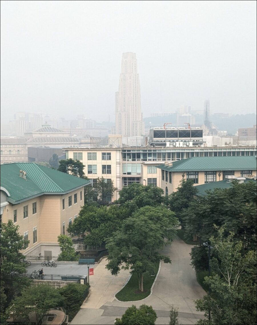
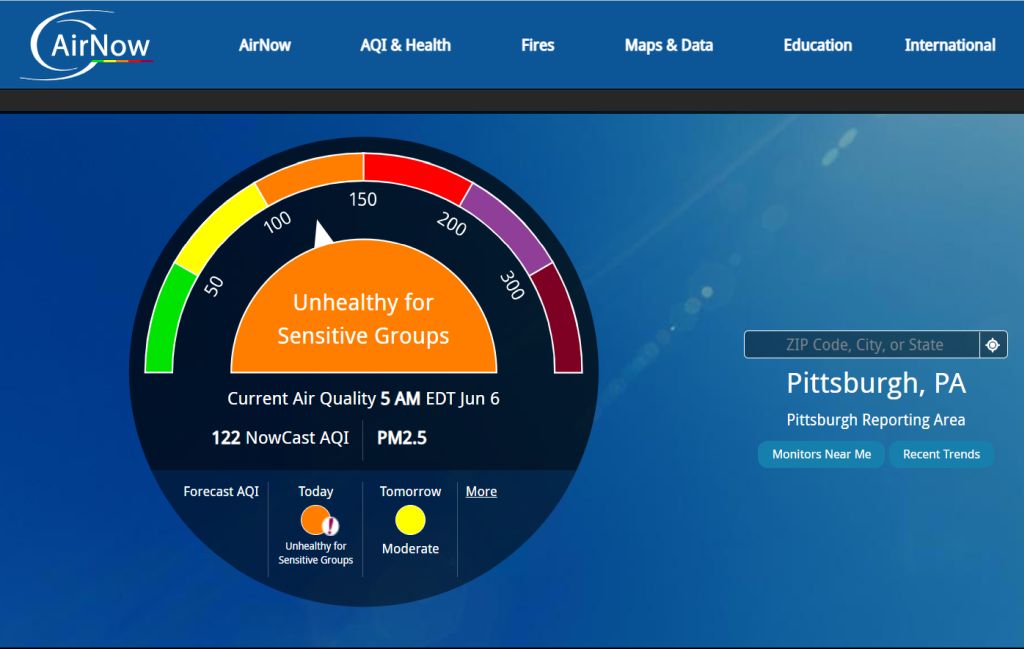
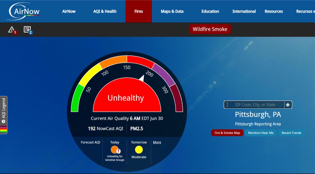
Today Pittsburgh and much of the northeastern U.S. are under an air quality alert because the smoke is now at ground level. We don’t see it as smoke — it looks like haze — but the particles have put our air quality forecast into Code Orange = “Unhealthy for Sensitive Groups.” Young children, seniors, and those with respiratory problems should limit outdoor activities.

AirNow forecast for Pittsburgh PA on 6 June 2023

NBC News explains:

Millions of people across the Midwest are under dangerous air quality conditions Monday, as smoke from wildfires in eastern Canada wafts over the region.

Hazy skies have blanketed a wide swath of the country from the Ohio Valley to as far south as the Carolinas. Air quality advisories are in effect Monday in southeastern Minnesota and parts of the Upper Peninsula of Michigan, as well as in more than 60 counties in Wisconsin.

The spike in air pollution comes from wildfires that have been raging in the Canadian provinces of Quebec and Nova Scotia.

… Canada is experiencing one of the worst starts to its wildfire season ever recorded.

NBC News: Air quality levels in parts of the U.S. plunge as Canada wildfires rage, 5 June 2023

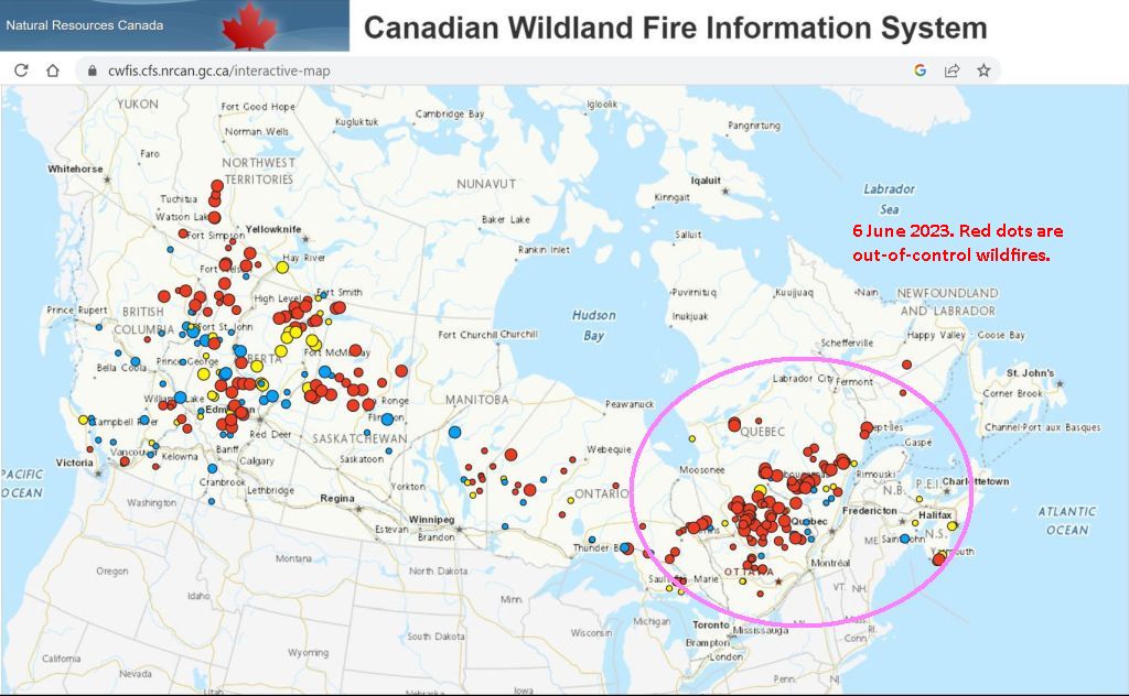
There are wildfires across much of Canada right now — west and east — but the fires affecting Pittsburgh today are mostly in Quebec and nearly all are out of control, displayed as red dots on Canada’s interactive wildfire map. Click here or on the screenshot below to see the interactive map.

Active wildfires in Canada, Quebec wildfires circled in pink, 6 June 2023 (map from Canadian Wildland Fire Information System)

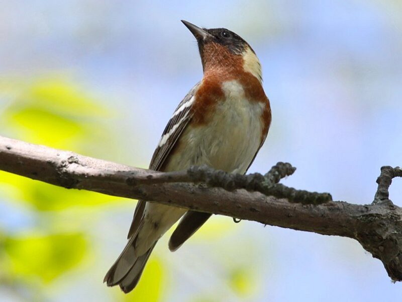
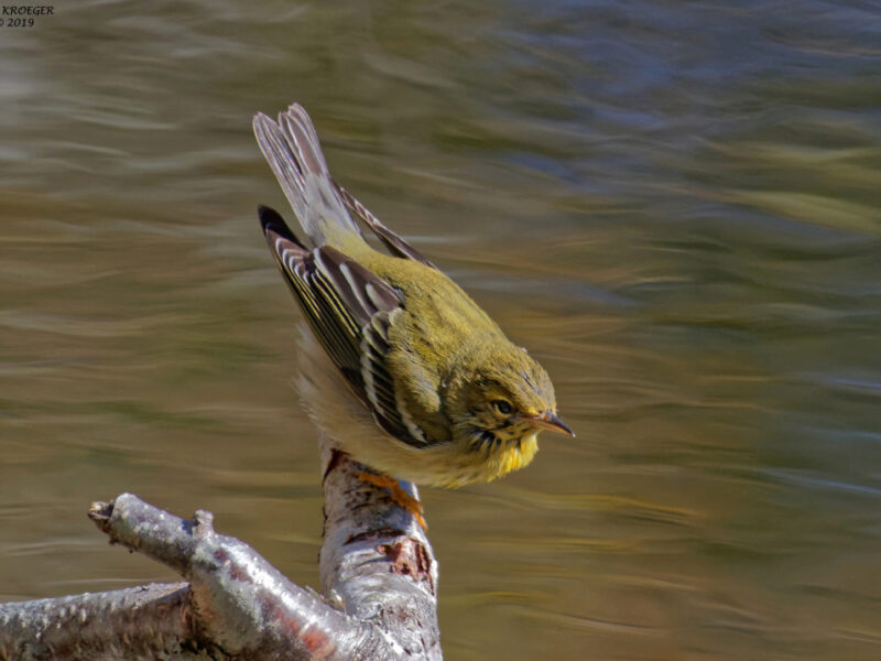
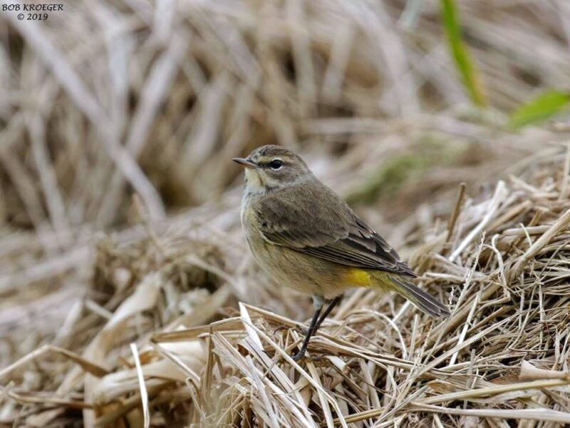
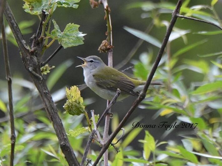
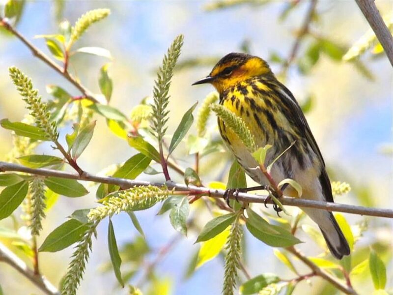
For Pittsburgh the smoke is mostly an inconvenience but for Canadians it is dangerous and for the birds that nest in these forests it is deadly. The fires are happening where northern warblers breed including bay-breasted, blackpoll, palm, Cape May and Tennessee.

When we see fewer of these migrating warblers in the fall, the fires will be partly to blame.

Tennessee warbler (photo by Donna Foyle)

Unfortunately as climate change heats up the Earth and reduces rainfall, we can also expect more fires in North America’s forests.

Click here to see AirNow’s interactive air quality map centered on Pittsburgh, PA

(see photo and map credits in the captions)


Air Quality UPDATES

28-30 June 2032:

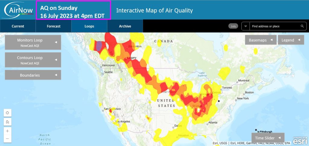
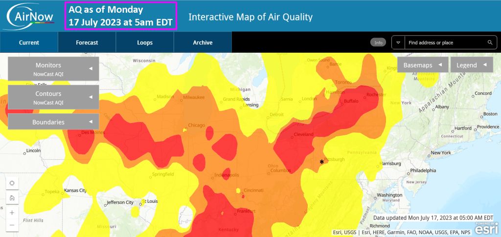
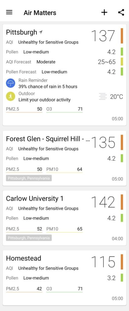
Wildfire smoke is back again, worse than before.

6-7 June 2023:

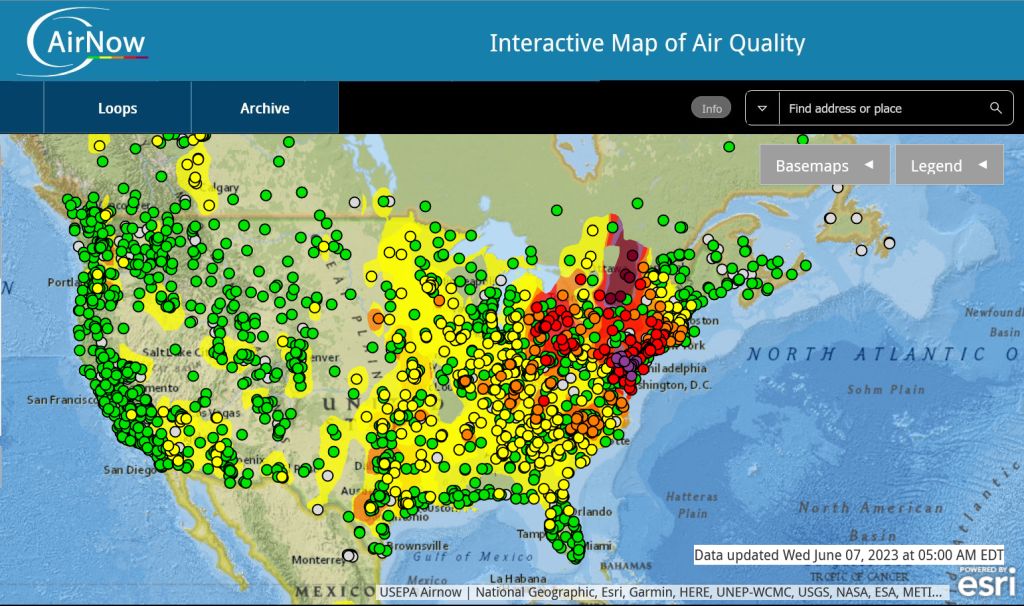
7 June 2023, 5:00am: The winds have changed. Pittsburgh air is still Unhealthy for Sensitive Groups this morning but it is much worse elsewhere. It is Very Unhealthy from Harrisburg to Philadelphia (purple), and Hazardous to breathe in a wide swath of Ontario including Ottawa (brown).

6 June satellite map:

AirNow interactive map as of 7 June 2023, 5:00am

Saturn and The Moon

Four of Saturn’s moons transit the planet (image from Hubble Space telescope via Wikimedia Commons)

12 May 2023

From Earth, Saturn is tiny and the Moon is large. You can see the huge size difference in Paul Byrne’s (@ThePlanetaryGuy) video of Saturn rising behind the Moon.

In reality Saturn is 95 times larger than our Moon and has 83 moons of its own plus thousands of moonlets. Only seven of Saturn’s moons can be seen through a telescope from Earth.

(photo from Wikimedia Commons, click on the caption to see the original)

Wildfire Weather in Pittsburgh

Fire at Ft. Indiantown Gap. Prescribed burn outside of fire season, Nov 2014 (photo from PA National Guard on Flickr via Creative Commons license)

12 April 2023

This morning’s weather forecast includes an unusual warning. There’s a Fire Weather Watch in Pittsburgh today from 11am to 8pm. The relative humidity is low (25-30%), the winds will be gusty (up to 25 mph) and it’ll be hot (almost 80ºF!).

Weather Forecast for Pittsburgh PA, 12 April 2023 (screenshot from National Weather Service)

Spring is fire season in Pennsylvania when 85% of our wildfires occur. As the growing season begins, forests and fields are covered in dry leaves and grasses. Under the right weather conditions a cigarette tossed from a car or a trash burn will catch and spread quickly.

That’s probably how this distant wildfire started in Fayette County in March 2011 (photo by Jon Dawson).

Smoke in the distance from a brush fire in eastern Fayette County, 26 March 2011 (photo by Jon Dawson via Flickr Creative Common license)

Pennsylvania DNCR publishes a daily county-by-county Fire Danger map which shows Allegheny County at elevated risk this morning. The highest risks are in north central PA. (Watch out DuBois and State College!) and in the drought areas in southeastern PA.

Observed Fire Danger in PA as of 11 April 2023 (map from PA DCNR)

So be careful today. Don’t burn trash, don’t drop a burning cigarette on the ground, and if you see a brush fire call the fire department!

Fire at Ft. Indiantown Gap. Prescribed burn outside of fire season, Nov 2014 (photo from PA National Guard on Flickr via Creative Commons license)

Be safe during Pennsylvania Fire Season.

(photos from PA National Guard and Jon Dawson on Flickr via Creative Commons license, weather forecast screenshot from NWS, Fire Danger Map from PA DCNR)

Seen This Week: Leaf Out and Frost

Star magnolia in bloom, Schenley Park, 27 March 2023 (photo by Kate St. John)

1 April 2023

Welcome to April! Last month brought flowering trees, frost damage, more flowers and early leaf out.

The star magnolia (Magnolia stellata) above was looking good on 27 March but the one below bloomed too early on Pitt’s campus and sustained frost damage.

Frost damage on a star magnolia, Univ of Pittsburgh campus, 22 March 2023 (photo by Kate St. John)

This honeybee didn’t care about the brown petals. She probably flew in from The Porch beehives across the street.

Honeybee at frost-damaged star magnolia, Univ of Pittsburgh, 22 March 2023 (photo by Kate St. John)

Non-native flowers are blooming. Eyebright (Euphrasia sp) popped up in the grass at Frick.

Eyebright in Frick Park, 22 March 2023 (photo by Kate St. John)

Purple dead-nettle (Lamium purpureum) bloomed before the frost and still looked good on the 29th, here with chickweed (Stellaria media) in a Shadyside front yard.

Purple dead-nettle and chickweed, 29 March 2023 (photo by Kate St. John)

Meanwhile leafout is already underway. Bush honeysuckle had leaves on 18 March.

Bush honeysuckle leafout in Schenley Park, 18 March 2023 (photo by Kate St. John)

And by the time I noticed this yellow buckeye (Aesculus flava) in Schenley Park, it was already well beyond first leaves. Two photos show the same branch two days apart, 28 and 30 March. Last year, yellow buckeyes were still in bud on this date.


Meanwhile our trees are in for too much excitement today with high winds gusting to 60 mph. We expect downed trees and power outages in our future.

Batten down the hatches, Pittsburgh!

(photos by Kate St. John, maps from @NWSPittsburgh)

Watching Sunrise on the Equinox

19 March 2023

Tomorrow the Spring Equinox will occur at 5:24pm EDT. Some will mark the day by visiting a celestial calendar, a structure where sunrise lines up with particular stones. At Angor Wat, below, the sun rises behind the middle tower.

Equinox sunrise over top of the middle tower of Angkor Temple, Angor Wat, Cambodia, March 2012 (photo from Wikimedia Commons)

In the U.S. there’s a granite celestial calendar behind the Len Foote Hike Inn at Amicalola Falls State Park in Georgia. Pictured at top, the Star Base includes a granite keyhole, a shelter (cave) and Adirondack chairs for viewing.

Tonight the Hike Inn is probably full to capacity with all 20 bunkrooms in use. Tomorrow everyone will be up and out before dawn to watch the sun rise.

The Hike Inn as seen from Star Base, March 2009 (photo by Kelly Stewart via Flickr Creative Commons license)

Newcomers usually visit the Star Base beforehand so they know what to expect.

Nashville Hiking Meetup members visit the Star Base, 2009 (photo by Kelly Stewart via Flickr Creative Commons license)

The next morning they watch from the cave.

Waiting for Spring Equinox sunrise, 2009 (photo by Kelly Stewart via Flickr Creative Common license)

The most famous aspect of the Hike Inn is not the Star Base but the fact that you have to hike 5 miles to get to it. No vehicle access. Check-in at the Amicalola Falls State Park Visitors Center, park your car at the trailhead and start your hike. The Appalachian Trail’s southern terminus at Springer Mountain is (relatively) nearby.

Trail sign for the Hike Inn (photo by Kelly Stewart via Flickr Creative Commons license)

Upon arrival put your phone in airplane mode. The Hike Inn is intentionally unplugged, though they do have electricity (mostly solar). No TV, no radio, no phone … just enjoy the quiet time.

Arriving at the Hike Inn, 2009 (photo by Kelly Stewart via Flickr Creative Commons license)

Because the equinox is late in the day on 20 March there may be two sunrises, March 20 & 21, that come close to perfect.

Sunrise at the Equinox 20 March 2004 from the Hike Inn, Georgia (photo from Wikimedia Commons)

For more information about lodging, check out the Hike Inn website.

(photos from Wikimedia Commons and by Kelly Stewart on Flickr via Creative Commons license; click on the captions to see the originals)

Action Maps of Wind, Waves and More

Screenshot of ocean currents from earth website

26 January 2023

More fun with maps!

Earlier this month when I wrote about wind speed maps (How Fast Is The Wind Blowing?) Steve Thomas sent a link to the earth mapping website. I remembered green swirling maps on my own blog, Winds On Water, but seven years ago I didn’t look further than the default surface winds.

The earth website is, in their own words, “a visualization of global weather conditions forecast by supercomputers updated every three hours.” Their action maps include high altitude winds, ocean currents, temperatures, fires and more.

Let’s start exploring with today’s map of surface winds, shown below (click here to open it on your own computer). I guarantee it will look different than this image I pulled yesterday.

Surface winds over the continental U.S. and mid latitudes of North Atlantic, 25 January 2023 (screenshot form earth)

To see the legend and change the map click on the [earth] icon at bottom left. The default setting is:

  • Mode=Air
  • Animate=Wind
  • Height=Sfc (surface)
  • Overlay=Wind
Screenshot of legend at earth website

To see winds at higher altitude I chose Height=250. [250 hPa = 250 hectopascals = lower pressure = higher altitude. The lower the hPa number, the higher the altitude above the surface.]

  • Mode=Air
  • Animate=Wind
  • Height=250
  • Overlay=Wind

The wind is screaming purple-white at 250 hPa. It looks like the jet stream.

Screenshot of winds at height 250hPa from earth website

To achieve the map of ocean currents shown at top I chose:

  • Mode=Ocean
  • Animate=Currents
  • Overlay=HTSGW (Significant Wave Height)
Screenshot of legend at earth website

Click here to see an action map of the Gulf Stream at the ocean’s surface (screenshot at top). Watch it rounding the tip of Florida, then pumping north and east into the Atlantic, leaving vortices in the Gulf of Mexico.

That strong current near the east coast of Florida is the water “highway” that many creatures use for migrating north. It’s the reason why you can see whales from shore in early spring.

Try out the other options on earth to have more fun with maps.

(all maps are screenshots from earth, base maps for these screenshots can be found at this link https://earth.nullschool.net/#current/wind/surface/level/orthographic=-65.93,34.58,803)

See The Green Comet … If You Can

Comet C/2022 E3 (ZTF) imaged using 300mm F/4 lens, 21 Jan 2023 (photo by Auvo Korpi via Wikimedia Commons)
23 January 2023

A green comet that last passed the sun 50,000 years ago set off a flurry of stargazing on the night of the new moon, 21-22 January. Even though Comet C/2022 E3 (ZTF) will pass closest to earth on 2 February it is best to see it now before the moon waxes to full on 5 February.

video from @MrSuperMole on YouTube

Comet C/2022 E3 (ZTF) is so faint that it must be viewed in a dark sky and is best seen via binoculars, telescope, or camera with telephoto lens — for instance, birding equipment. The photo above was taken with a 300mm F/4 lens. Click here for information on where to look.

With magnification and a star map all you need is a dark sky, but finding one is increasingly difficult.

A study published last week in the journal Science examined 12 years of citizen science reports of the constellations seen with the naked eye. The number of constellations seen from 2011-2022 went down as sky glow increased from lights on earth. As Smithsonian Magazine explains, the brightness of light pollution increased at a rate of 9.6 % per year. “That’s equivalent to the brightness doubling every eight years.”

Previous studies used satellites to measure earth lights reaching outer space but they missed the effect of ground lights inside our atmosphere. So the problem is worse than we thought. For a video illustration, see the 2016 article below.

Meanwhile in Pittsburgh, we definitely have light pollution but our impossible hurdle is cloud cover. We have lots of clouds in the forecast for the next 10 days.

Pittsburgh 10-day forecast from weather.com app on cellphone (screenshot from Kate St. John)

Read more about the light pollution study in Smithsonian Magazine: Light pollution is drowning the starry night sky faster than thought.

(photo from Wikimedia Commons, video from @MrSuperMole on YouTube, screenshot from weather.com on cellphone)

How Fast Is The Wind Blowing?

Oak leaf on an updraft in winter (photo by Marcy Cunkelman)

17 January 2023

We can’t see the wind but we can guess its speed by watching what it does to leaves and flags …

Wales national flag blowing in the wind (photo from Wikimedia Commons)

… and then using the wind speed chart from the National Weather Service (NWS) to make a guess. My guess for the above photos is a Gentle Breeze 8-12 mph or a Moderate Breeze 13-18 mph but it’s hard to tell.

Estimating Wind Speed (chart from the National Weather Service)

NOAA weather satellites don’t see the wind either but they can see the clouds moving in three layers.

  • High level clouds (cirrus) at 23,000 to 46,000 feet
  • Mid level clouds at a level of 10,000 to 23,000 feet
  • Low level clouds are below 10,000 feet

In their animations of satellite images we can almost see the wind but not its speed.

For instance, in this GOES East animation from last Thursday 12 January 2023 we can see the Atmospheric River pumping into California and a low pressure system moving up the Ohio Valley.

GOES EAST satellite, GeoColor timelapse images, 12 Jan 2023 6:56Z-10:51Z (animation from NOAA)

NOAA’s computers use the animated maps to calculate wind speed and direction. The result, called Derived Motion Winds, plots the wind height, direction and speed on a map.

Legend for Derived Motion Winds: Wind Height and Speed (NWS)

Here’s the same timelapse with Derived Motion Winds. Notice that the layers often don’t move in the same direction or at the same speed. You’ve felt this in an airplane as a “bump” when the plane rises or descends between conflicting layers.

GOES EAST CONUS, Derived Motion Winds 12 Jan 2023 (animation from NOAA)

You can “see” the wind anywhere in the Americas by choosing a satellite to view (list on the left) at the NOAA GOES Imagery Satellite Maps. Click on Derived Motion Winds if available.

To view the current GOES East satellite, pictured above, visit these links:

(photos from Marcy Cunkelman and Wikimedia, maps and animations from NOAA and the National Weather Service)

Lake Effect Clouds and the Classic Gleam at Sunset

The Gleam At Sunset, 14 Jan 2023 (photo by Kate St. John)

16 January 2023

Pittsburgh’s skies were oppressively gray on Saturday with thick Lake Effect Clouds but the forecast promised the clouds would break in early afternoon so I planned a walk in Schenley Park for 2:30pm. Hah!

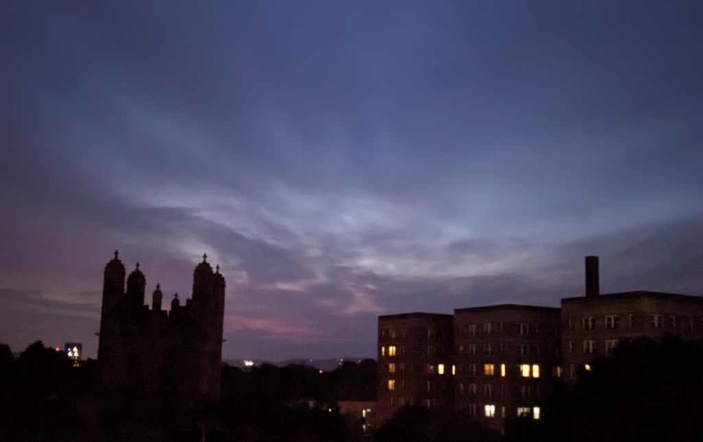
By 3pm the clouds were still thick and gray and the revised forecast predicted they would break up in the 4 o’clock hour. Of course! We were about to get 15-30 minutes of full sun immediately followed by sunset at 5:15pm, a classic Gleam At Sunset. I timed my walk to arrive at Schenley’s golf course by 4:45pm.

My photos show what happened: the classic gleam, an unexpected sun pillar, and a beautiful red sky at sunset.

If you’ve never heard of Lake Effect Clouds and the Gleam At Sunset, find out more in last month’s article:

(photos by Kate St. John)

Seen This Week: It’s Colder

Sunrise, 11 Jan 2023 (photo by Kate St. John)

14 January 2023

The sunrise was gorgeous and cold last Wednesday when a group of us decided to walk at Jennings in Butler County. We saw few birds but there were ice heaves, buttress roots on an elm, and the seeds of old man’s beard (Clematis drummondii).

Ice heave at Jennings, Butler County 11 Jan 2023 (photo by Kate St. John)
Elm tree with buttress roots, Jennings, Butler County, 11 Jan 2023 (photo by Kate St. John)

When old man’s beard is in bloom it’s called virgin’s bower, transforming it from a young woman to an old man in a matter of months.

Seeds of Virgin’s bower, a.k.a. Old man’s beard, Jennings, Butler County, 11 Jan 2023 (photo by Kate St. John)

My friends who live north of the city have not seen many dark-eyed juncos at their feeders this winter, but juncos are definitely present at the Frick Park Environmental Education Center. Charity Kheshgi posted photos of our recent trip to Frick.

(bird photos by Charity Kheshgi embedded from Instagram, all other photos by Kate St. John)